With COVID 19-related travel restrictions and lockdowns, everybody’s ability to travel has made hiking and biking in Europe difficult, and impossible for me in 2020. So this month, I have decided to focus on some of my favorite hiking adventures. I will explain why I favor these adventures over some of the others, and let the photographs speak for themselves. You will note that sometimes the photos are taken in different seasons, and that is because I so enjoyed these wine regions (and their wines), I revisited them more than once. And I fervently hope that hikers, including myself, can travel to these areas in 2021!
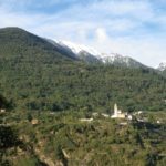
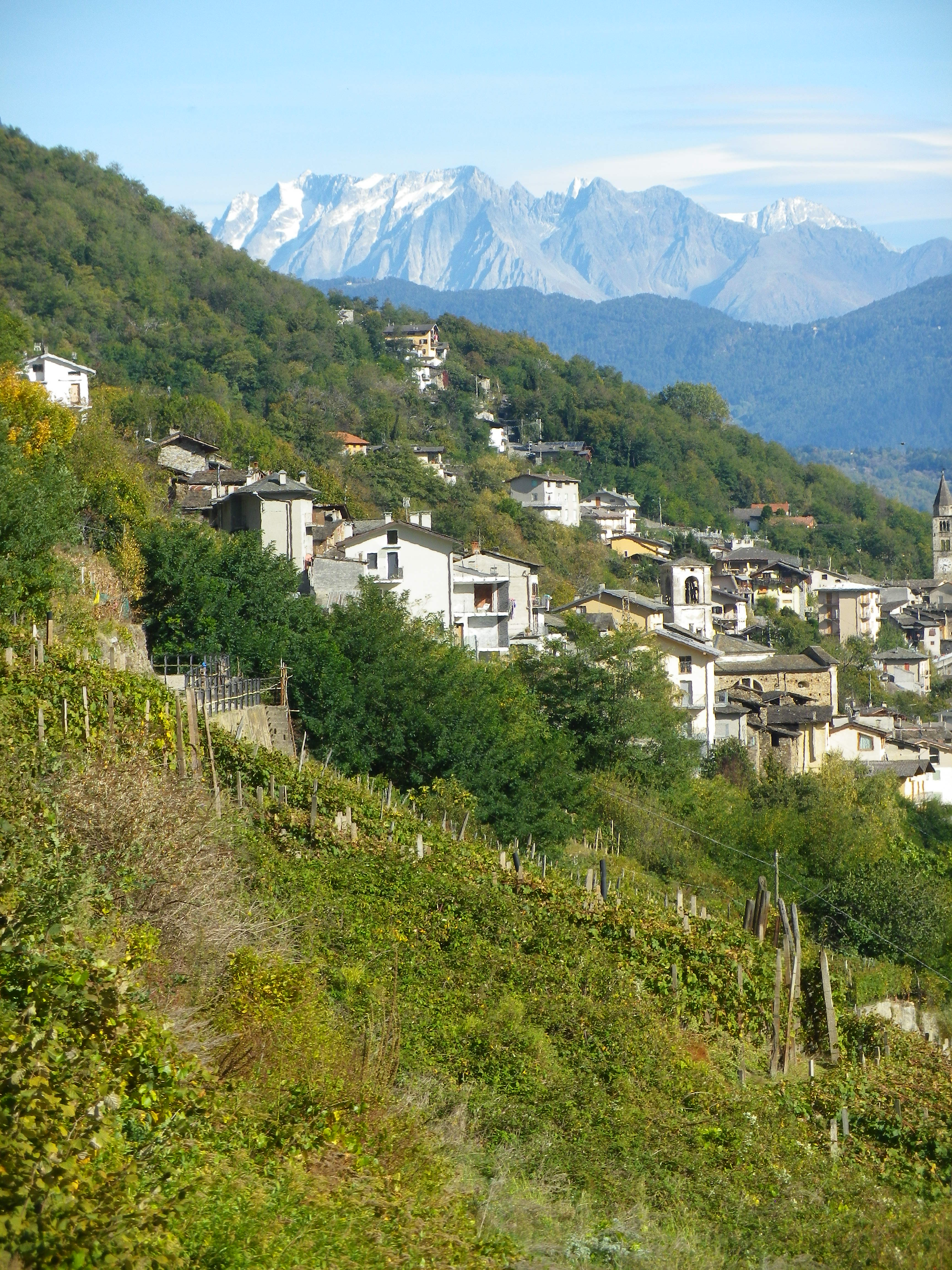
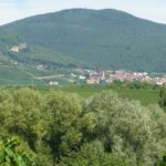
1. The Place: Italy: Valtellina
The Activity: Hiking (or mountain-biking!) the 70-kilometer-long Via dei Terrazzamenti
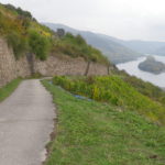
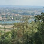
Why this one: This moderately challenging hike offers absolutely stunning Alpine scenery, with several villages or hamlets to explore along the way, and diverse agricultural landscapes just to provide variety. The trail was moderately challenging, as there were several steep and relatively long inclines, but they were punctuated by relatively flat stretches, and even some descents. The scenery can speak for itself, and the villages and hamlets were quiet, charming, unspoiled locations in which to take a break, and enjoy the atmosphere. Sondrio is about in the middle, and a good place to base from, and makes a good place to break the hike until the next day. While I loved the fantastic Sentiero Valtellina bicycle trail (see details here) which parallels this trail, albeit along the north-facing side of the river valley, the Via dei Terrazzamenti won out because it was higher up, and on the south-facing mountains, thus passing through more vineyards.
Caveats: The quiet location means you might be challenged to find accommodation to your liking. It’s not that they didn’t have several nice hotels in Sondrio, Tirano and Morbegno. It is just that if you are looking for a resort, or even a five-star hotel, there won’t be any (as of January 2021).
Winning Wine Discovery: In Valtellina, the Nebbiolo grape is known as Chiavennasca. While it is vinified in several different ways, my favorite wine is the Sforzato di Valtellina. Like the famous Amarone di Valpolicella, these grapes are air-dried for a period of time after harvest but before being pressed. This results in a rich, highly flavorful red wine of great intensity and power.
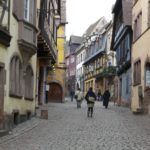
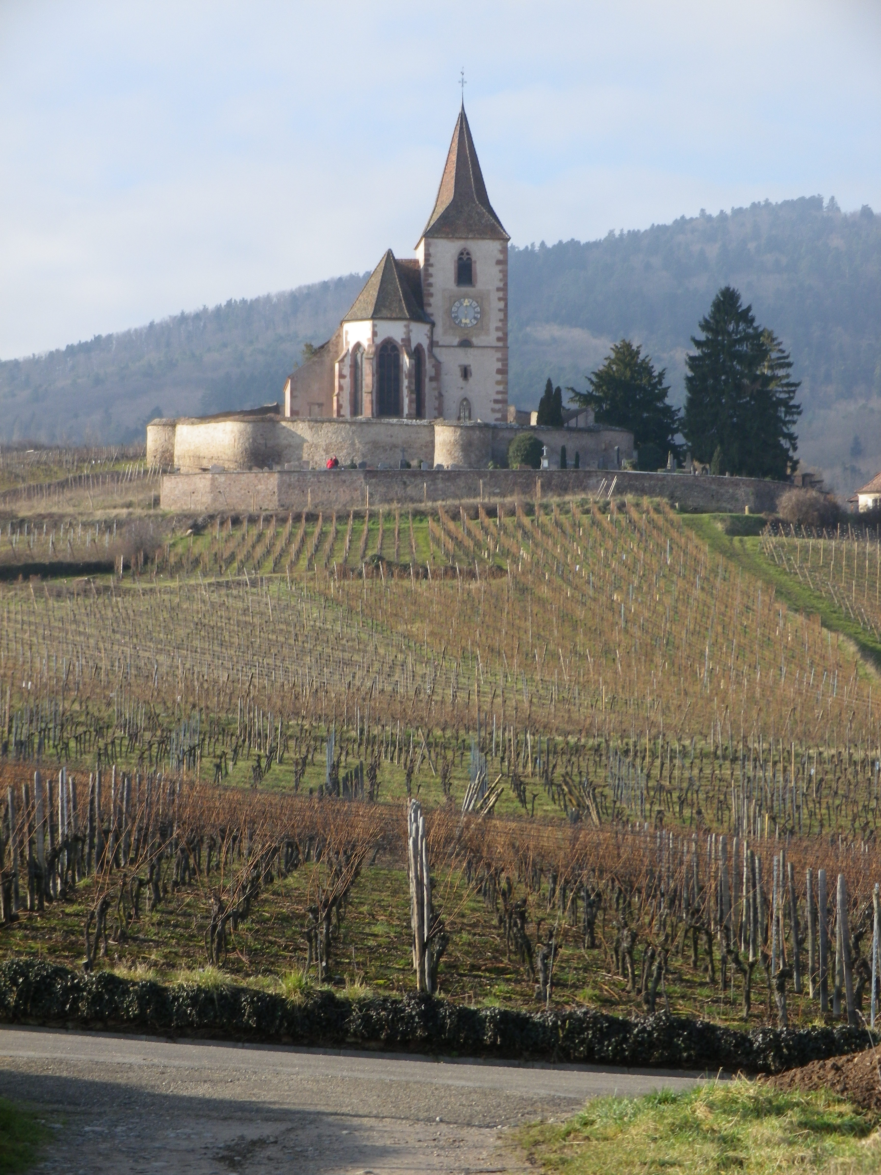
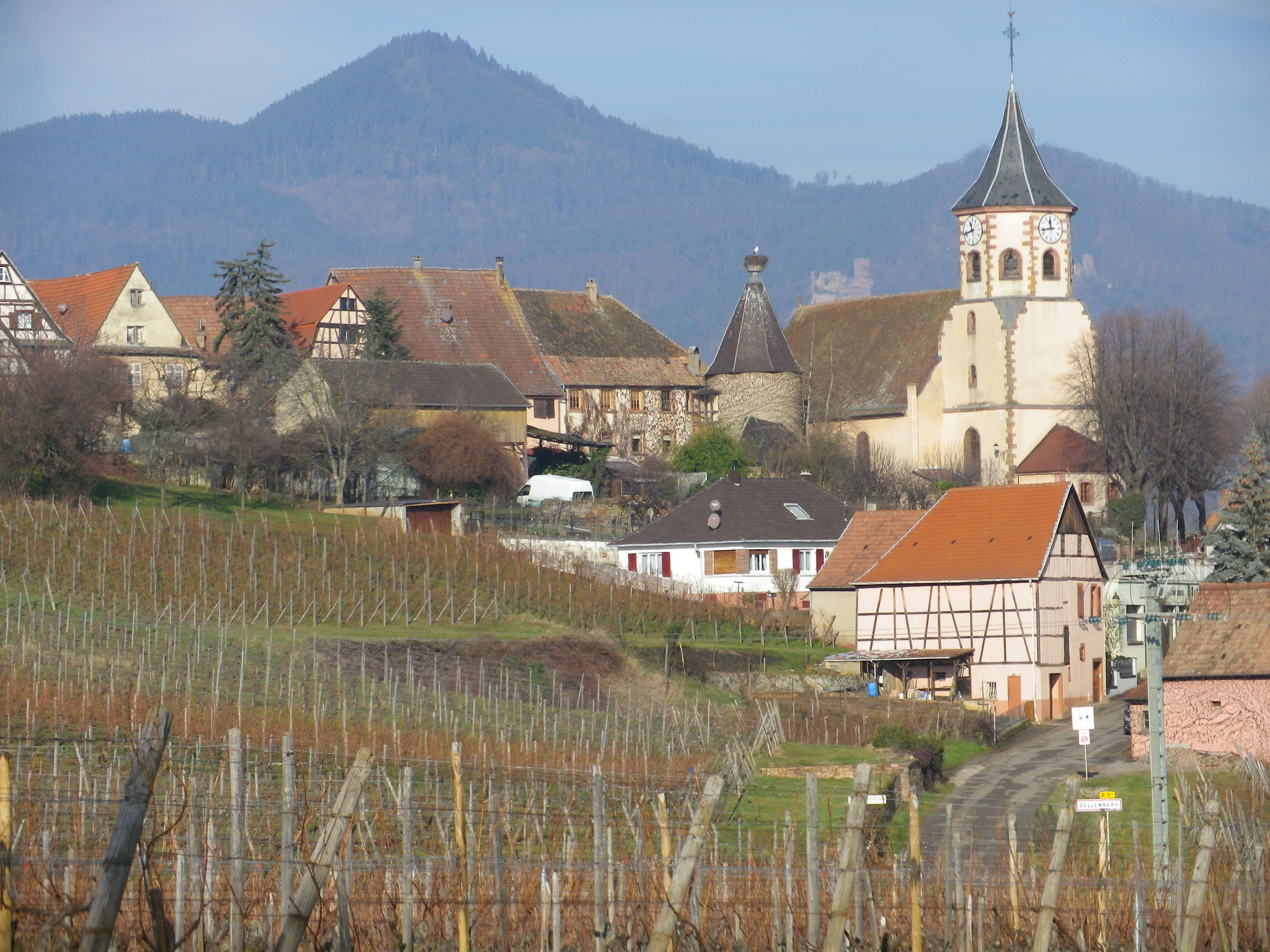
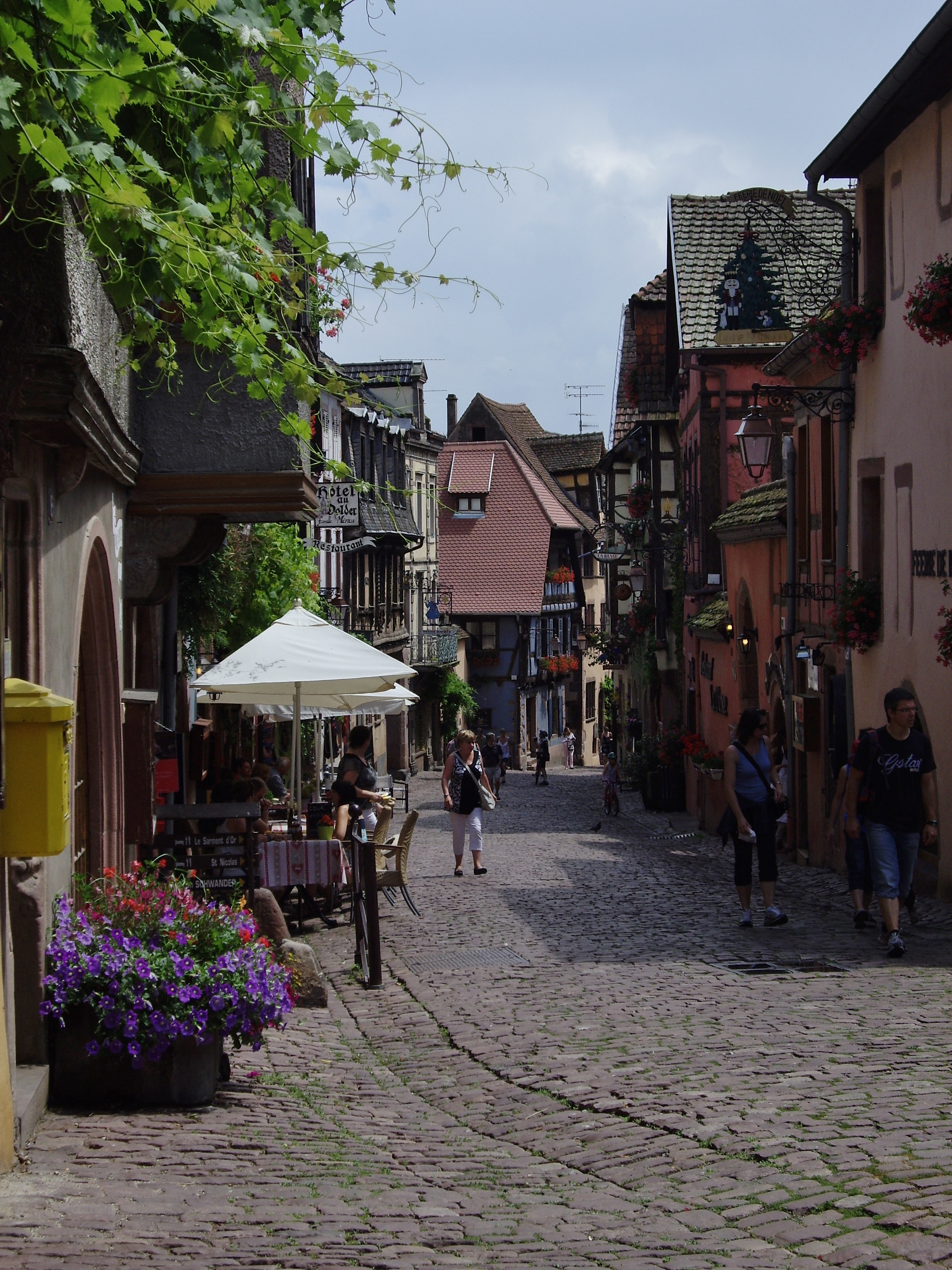
2. The Place: France, Alsace, Riquewihr
The Activity: Hiking the 17-kilometer long Sentier Viticole des Grands Crus (See details here.)
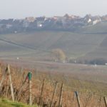
Why this one: What is not to like? The trail is relatively easy, and its ingenious design of interconnecting loops within a big loop allows hikers to decide which loop to hike and how much to hike in any one day, while still basing in a single town. Also, this is one of the most popular areas of Alsace, and rightly so. The scenery is a pleasant mix of villages, vineyards, fields and not-so-distant tree-covered mountain tops. The six villages (Hunawihr, Bennwihr, Mittelwihr, Zellenberg, Beblenheim and Riquewihr), are all picture postcard worthy, and charming, once you explore them. The food is excellent, the wines deliciously diverse, and the lodgings varied and (usually) available. Alsace represents excellent values for the money in all three of these areas.
Caveats: As the hike is along one of the most visited sectors on the French Route des Vins d’Alsace, a 150+ kilometer long car route, it can be crowded in restaurants, hotels and parking lots in July and August with local day-trippers and summer vacationers, so plan ahead!
Winning Wine Discovery: Cremant d’Alsace – a sparkling wine made in the Champagne Method. I found that Cremant d’Alsace could be just as effervescent as Champagne, and, due to higher grape ripening levels overall, a bit smoother and fruitier on the palate. (It is also a lot less expensive – another plus!)
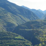
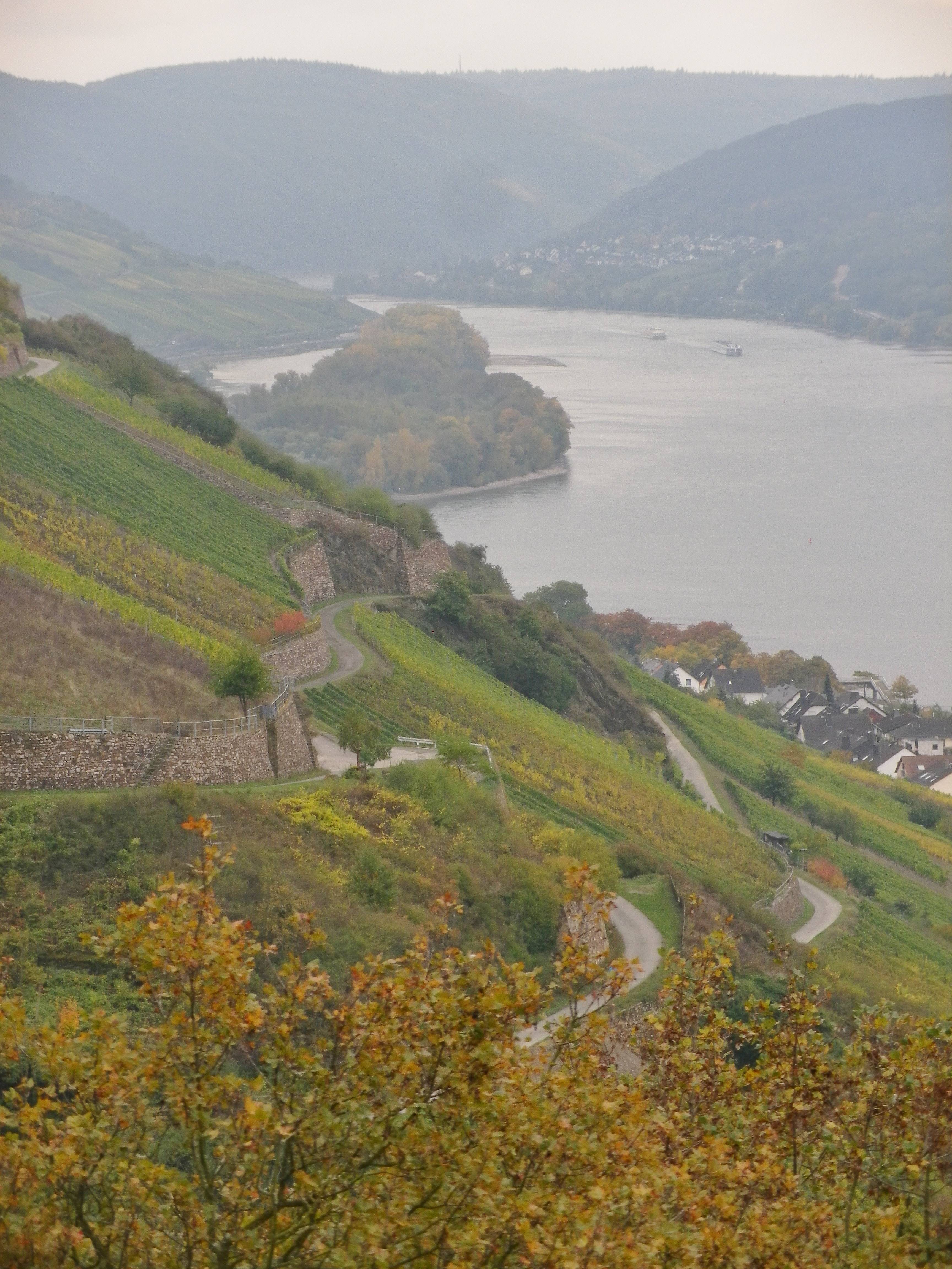
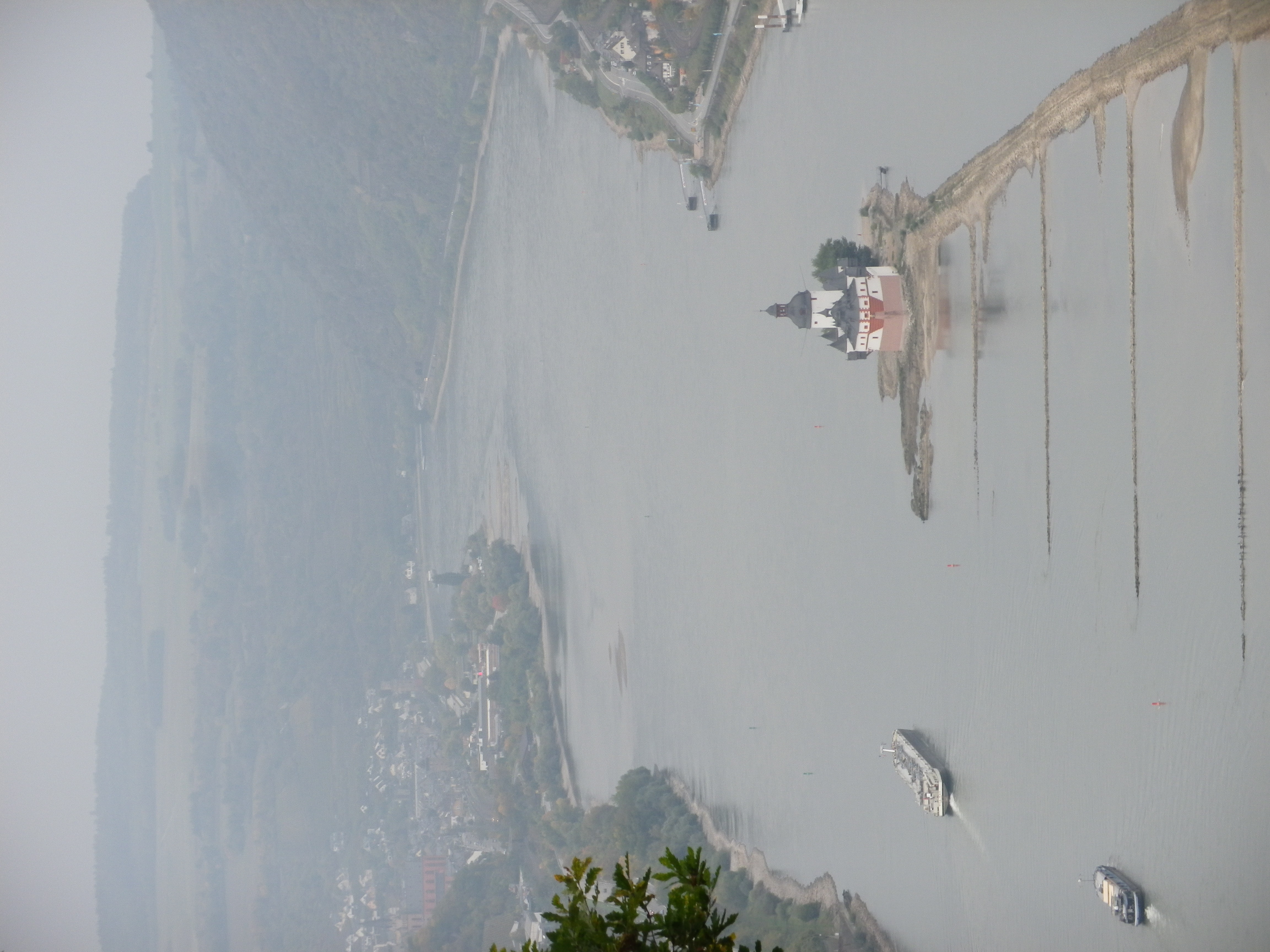
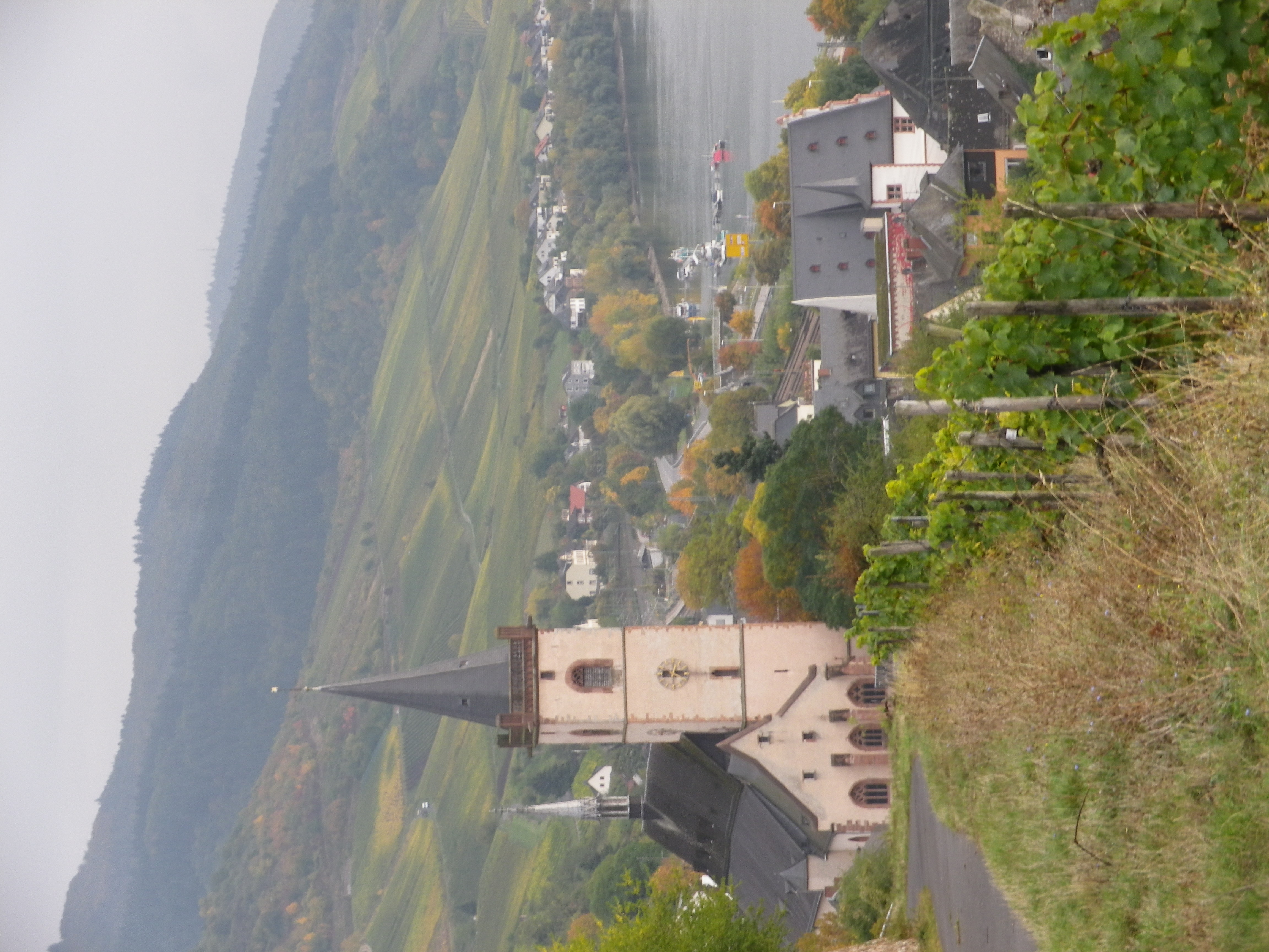
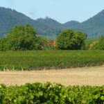
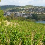
3. The Place: Germany, Middle Rhine (Mittelrhein)
The Activity: Hiking the 120-kilometer long Rheingauer Riesling Pfad (See details here.)
Why this one: The magic of the myths of the Middle Rhein come to life on this hike. Rising higher and higher along the hills lining the Rhine, the myth-making castles come into view. The perspective of a major river snaking its way through a canyon (from Kaub to Ruedesheim at least) is awe-inspiring, and every village is a fairy-tale unto itself. On northern half of the trail offers an especially diverse hiking experience as hikers pass through forests and glens, vineyards and fields. Another plus: While the hike itself is moderately challenging, the villages offer convenient public transportation, sometimes even via ferry, to your desired destination should need arise to break off – or take a break from – the hike.
Caveats: None, except to note that the while the winter temperatures remain mostly above freezing in the daytime, the weather can be rainy or overcast, especially from late fall to spring.
Winning Wine Discovery: Riesling! I had always found it thin and acidic. But here in its homeland, the area of the Moselle and Rheingau, it is rich, powerful, fruity and balanced. And that can be just the regular versions! Sweeter versions such as Spaetlese, and spectacular versions such as those coming from the Grosses Gewaechs (equivalent to Grand Cru status) can be mind-blowing for those who think they won’t like Riesling.
December again – the month of short, dark, often rainy or snowy days. The hikes in Germany and Alsace in December are necessarily short due to limited daylight hours, and unmitigated fog which rarely lifts before noon. I can look forward to winter hikes in Germany and Alsace though because of the abundance of cheerfully lit Christmas Markets – a wonderful way to dispel the cold and dark, and embrace the joy of the season.
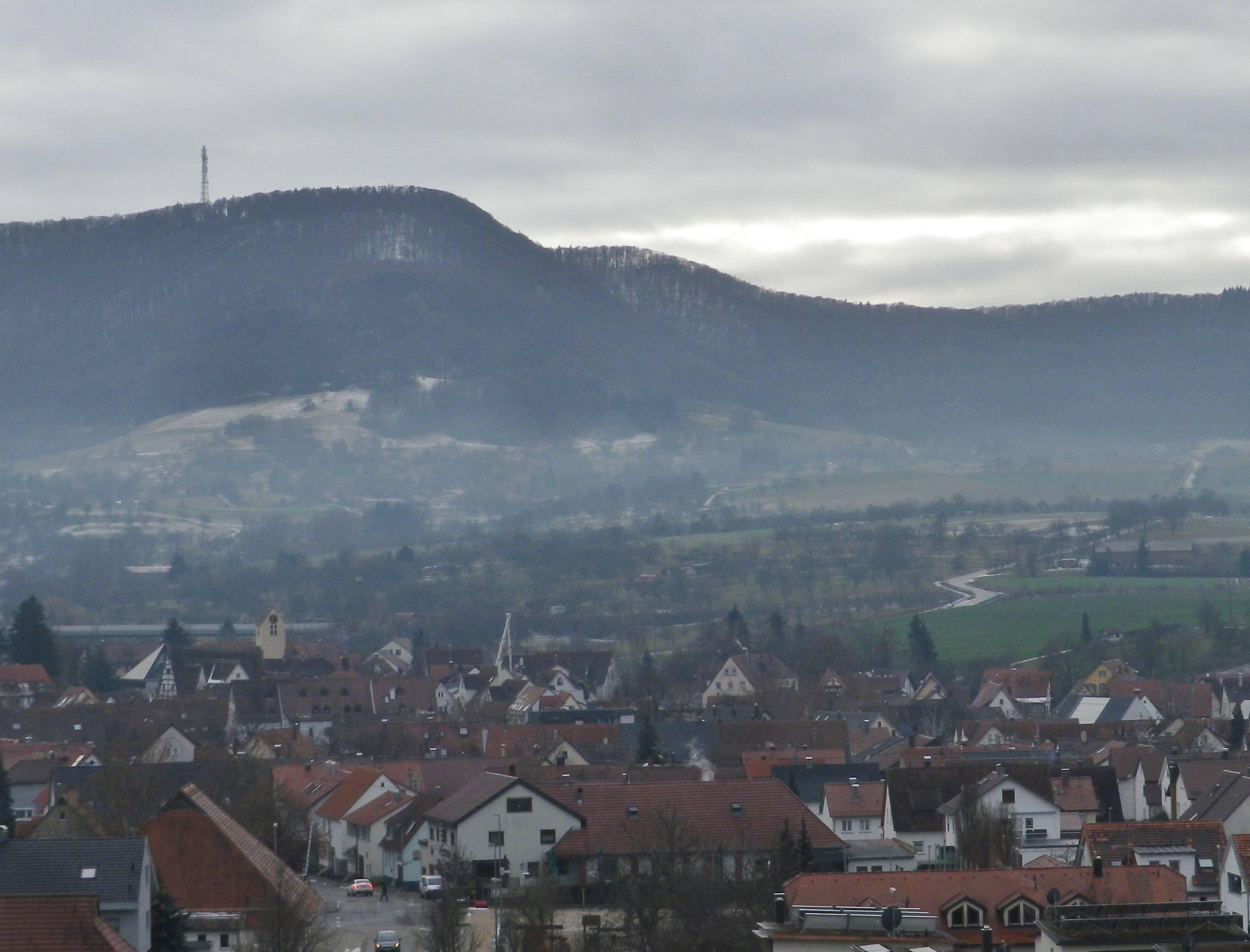
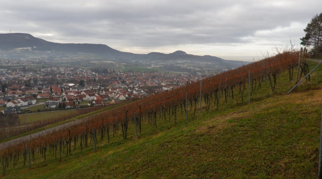
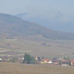
This hike, done at noon on the shortest day of the year, was not too far from the old university town of Tuebingen, which has its own Christmas Market. It was in the vineyard areas of Metzingen, in the hills above the town. This is not far from the Neckar Valley region, before the Neckar meanders through Stuttgart. Nonetheless, there is a very rural feel to this town, and the surrounding countryside forms part of the Schwaebische Alb, a hilly/mountainous region in southern Germany set between the upper Neckar, and the young Danube rivers.
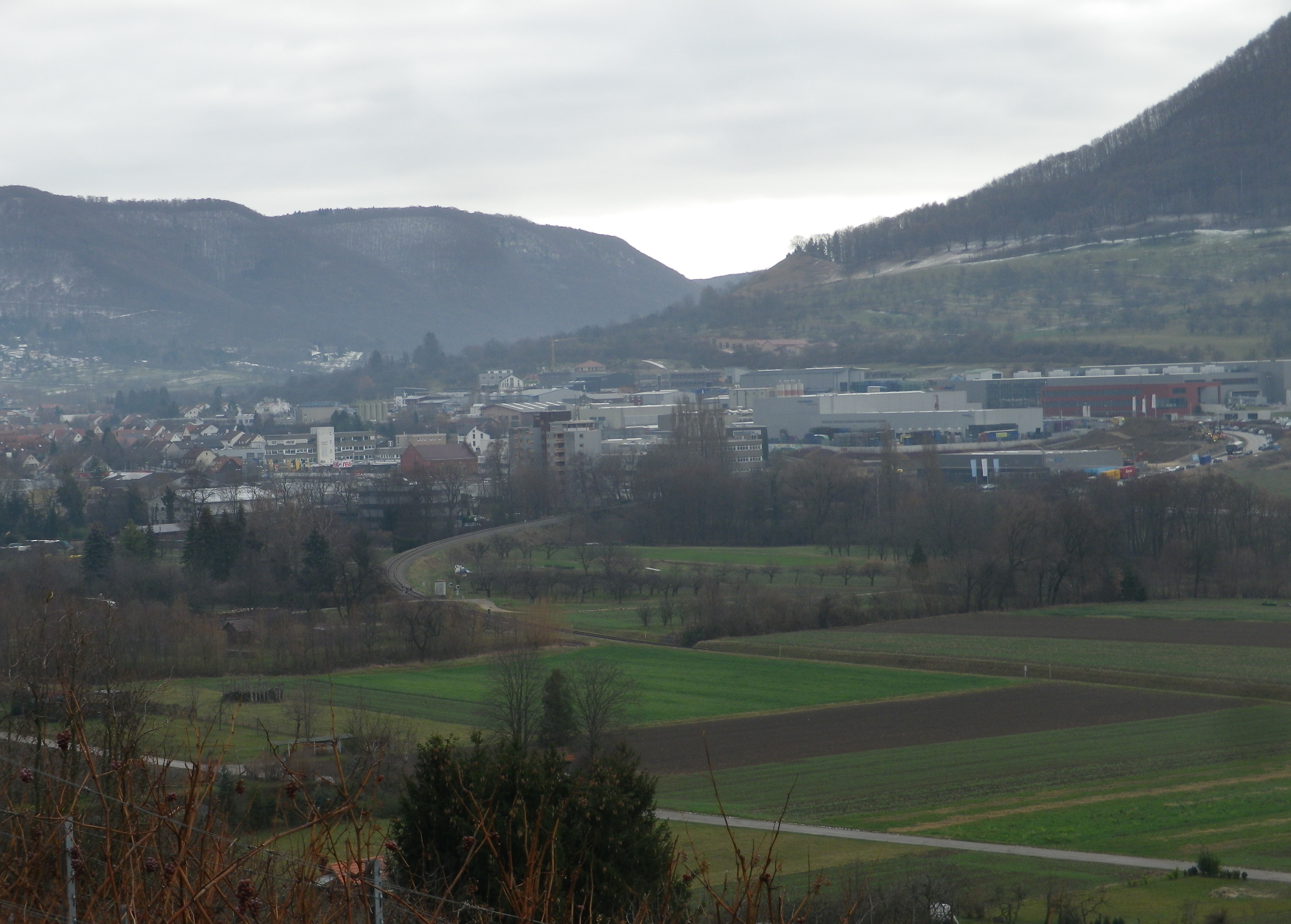
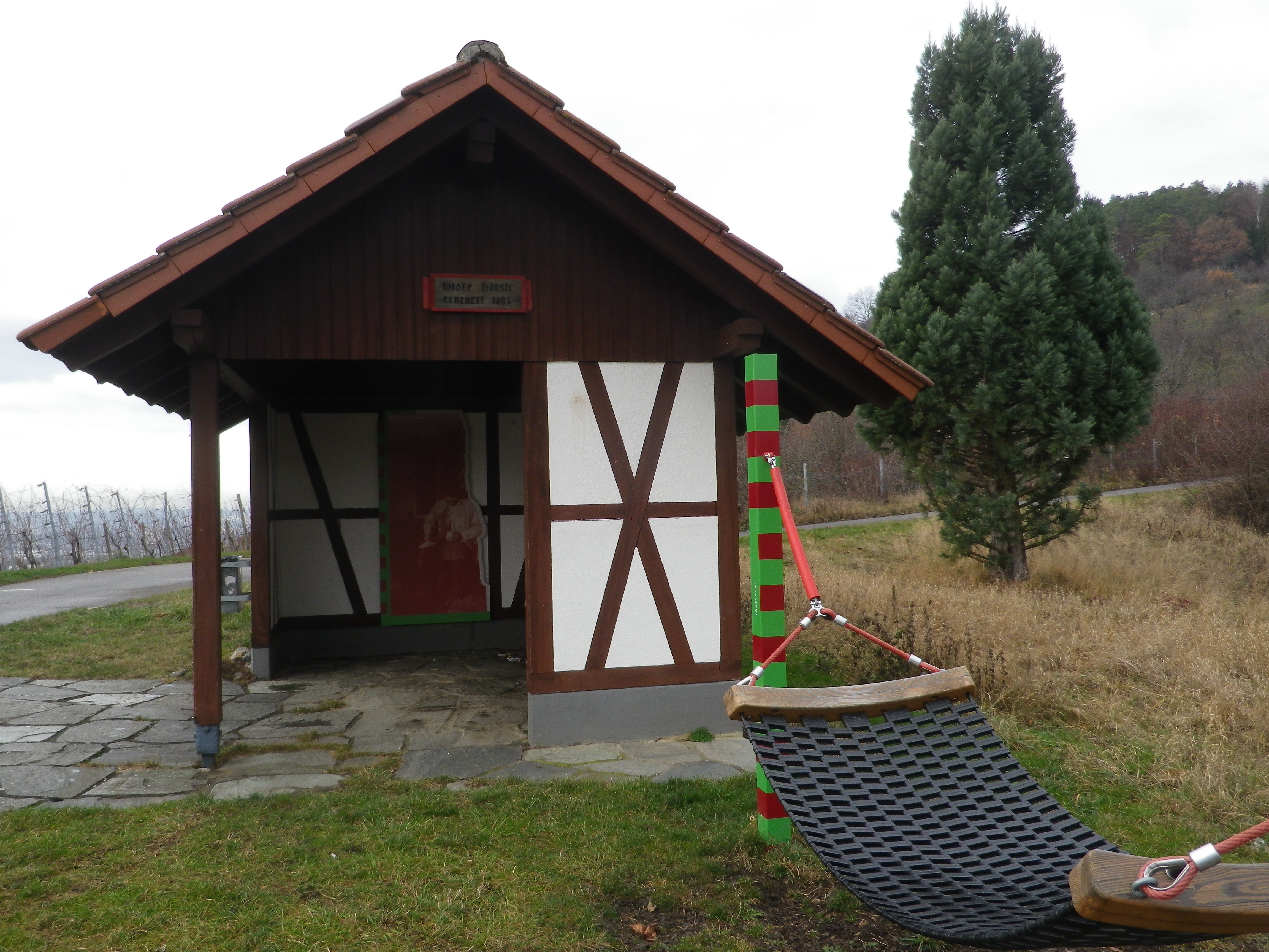
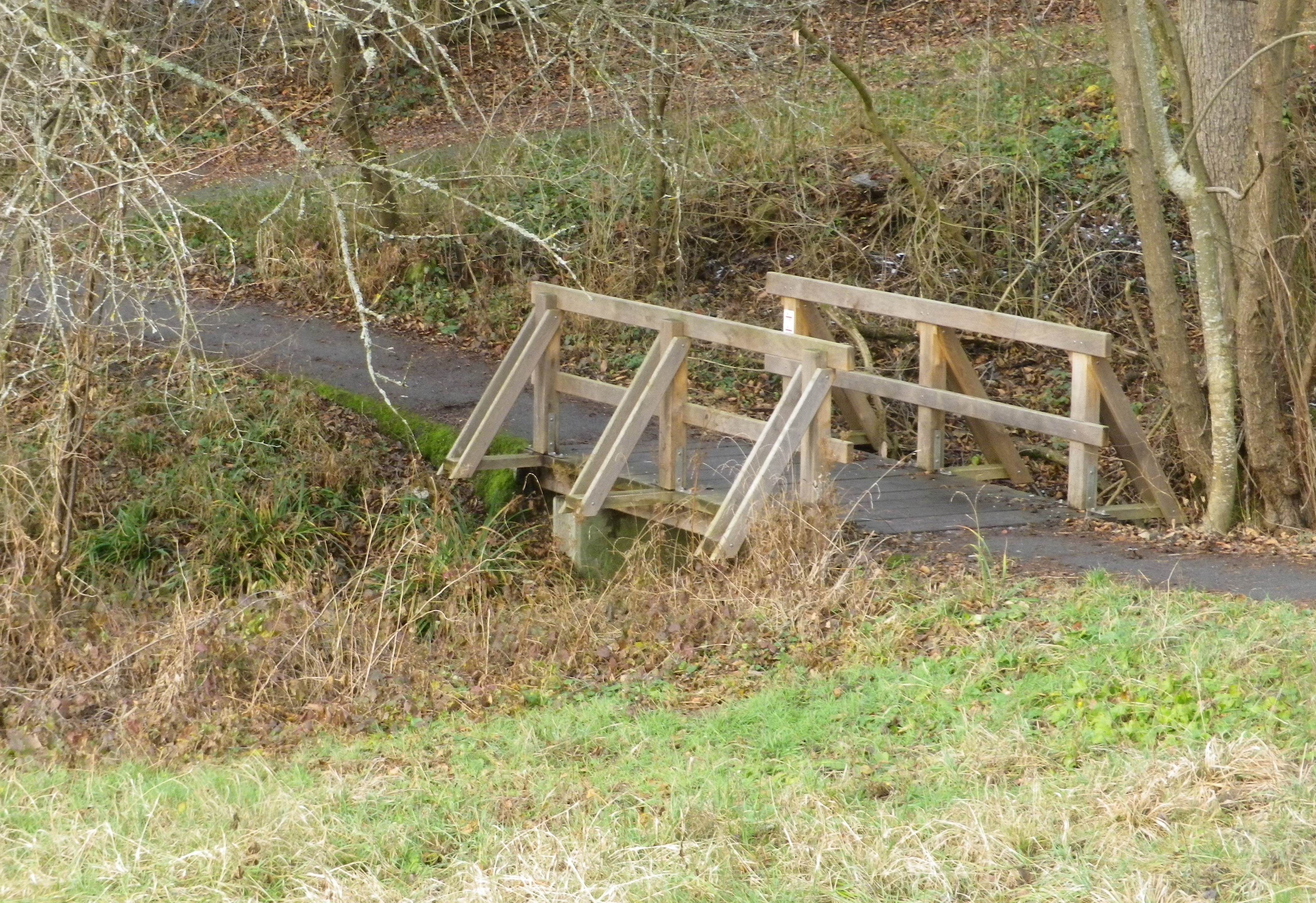
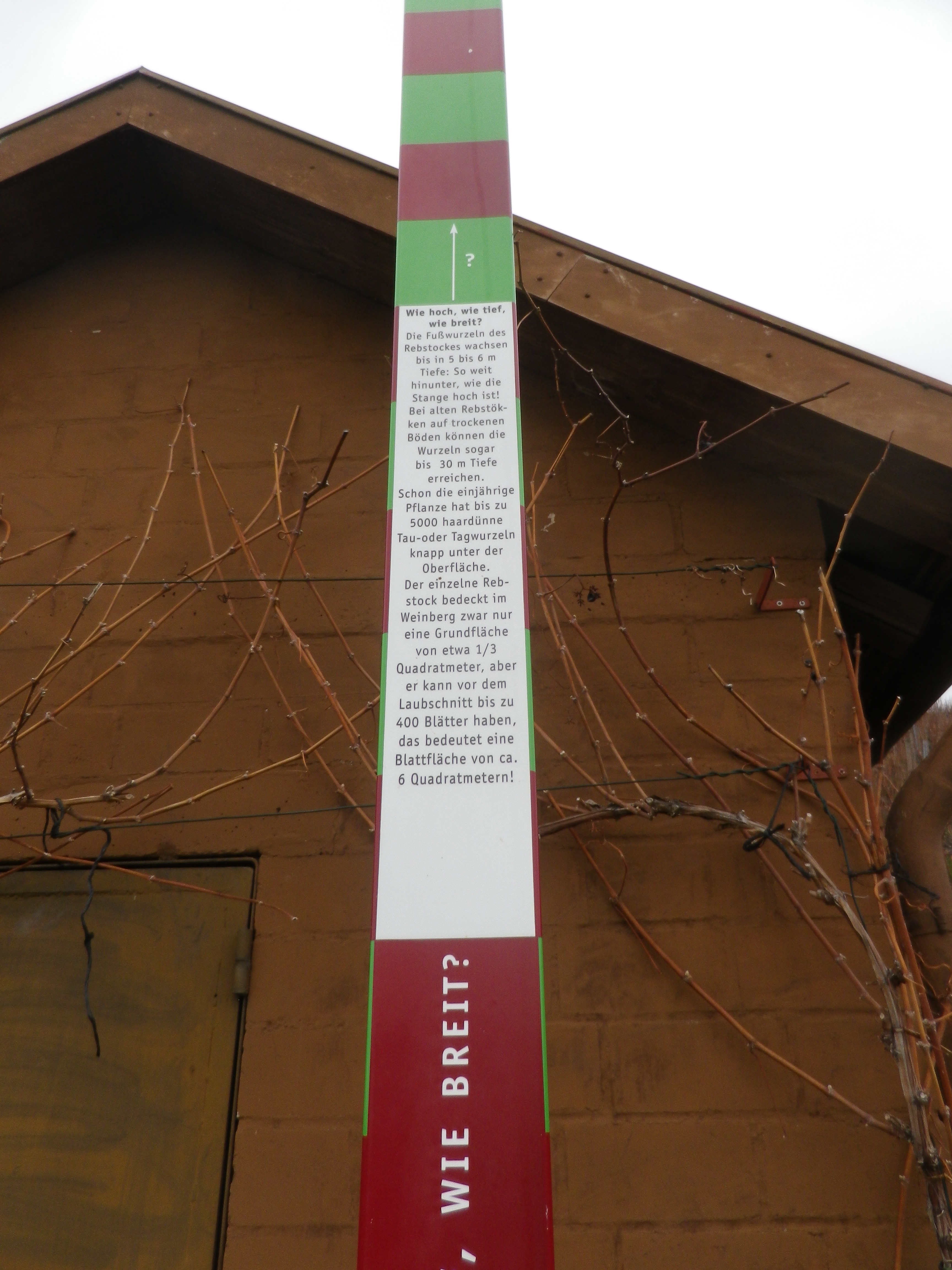
However, the vine-covered hills on the edge of Metzingen are not very high, and hard-packed surfaces traverse the wide slopes. This makes the itinerary to the top suitable for families with young and old alike, and those looking for an easy stretch of the legs. (Be sure to follow the itinerary, which is counterclockwise because the descent is more direct, hence a bit steeper.) The whole Weinerlebnisweg Metzingen-Neuhausen trail may be completed in an hour or so; a bit longer if you read the wine-education boards along the way, and take some time to enjoy the benches, and even a hammock, from which hikers have wide panoramic views of the area south and west.
Another nice feature of this trail is that it connects with a sister trail, the Weinerlebnisweg Metzingen, via a connecting loop. (The top half heads out from, the bottom half leads to, the trailhead in Metzingen-Neuhausen.) The two parts of the loop segment are a nice addition. They provide scenic variety, as much of this loop passes through a saddle between the vineyards of Metzingen and Metzingen-Neuhausen. Instead of vines, fruit trees, nut trees and fields predominate here. The trail passes over the little Spalerbach creek before it enters Metzingen.
The Weinerlebnis Metzingen is similar in design to the Weinerlebnisweg Metzingen-Neuhausen trail in that it traverses the vineyard slope outside Metzingen. There is an added attraction here though. While vintner huts were conspicuous by their absence on the earlier trail, here they are found in abundance. These little huts serve as storage and shelter in bad weather. Often decorated a bit, they are unique and individualized contributions to the scenery along the trail.
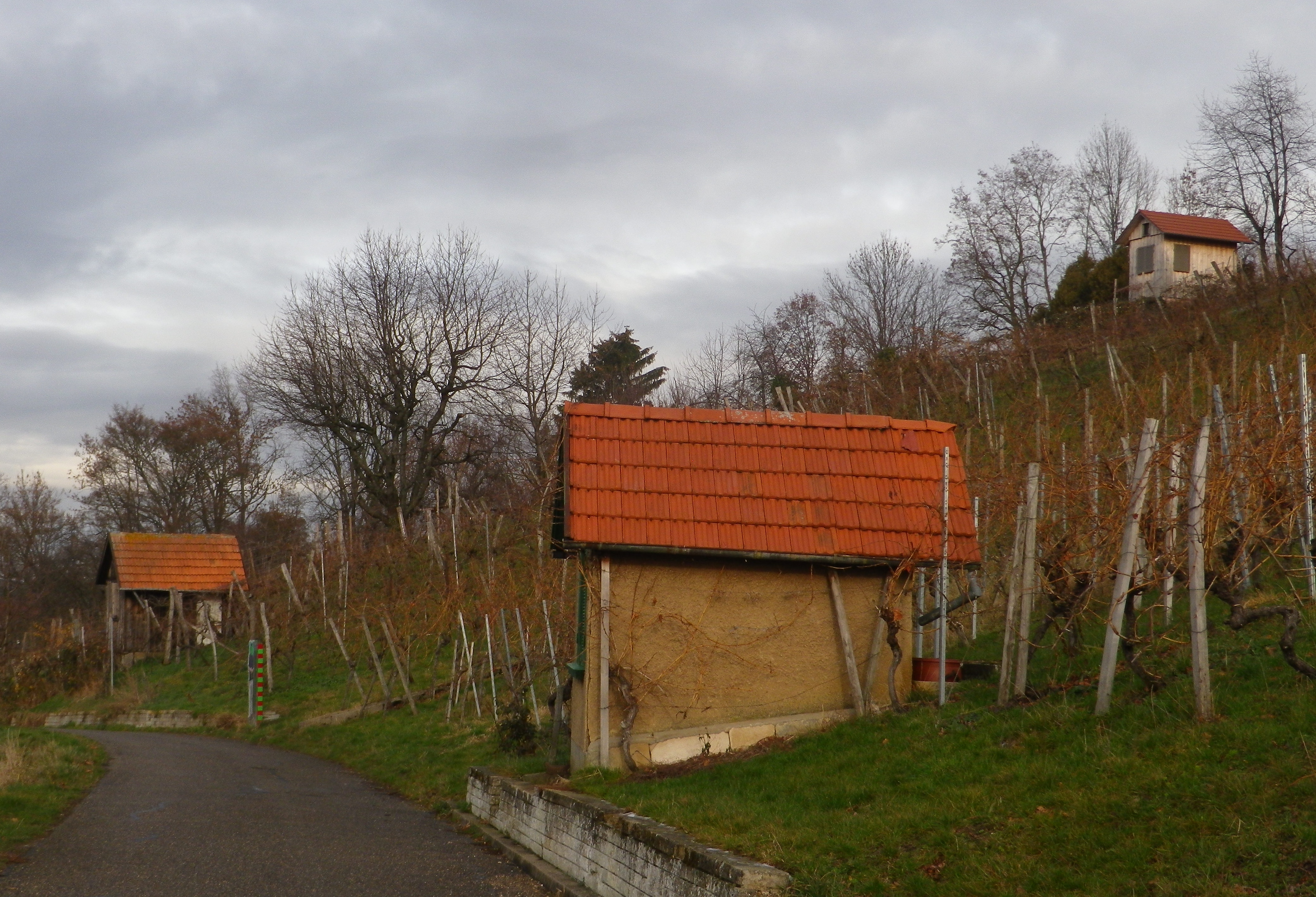
Although I didn’t do it, shortly after the Metzingen Weinerlebnisweg Parkplatz (parking area), once at the bottom of the vineyard, a quick dogleg right, then left onto Neuffener Strasse, continuing beneath the under pass to Nuertinger Strasse, will lead to the Stadthalle and the nearby Kelternplatz. The town has carefully maintained this square devoted to Metzingen’s wine-making history. It is filled with seven half-timbered structures that formerly contained huge wine presses. Now, these building contain, among other things, a vinothek, a wine-museum, a wine-makers house and opportunities to buy or taste the local wines. I visited this square on a previous visit and can say that it is worth a detour. (See the Nutshell here for more information.)
After passing through the Metzingen vineyards, the trail rejoins the connecting loop’s lower part. From there to my start point in Metzingen-Neuhausen, it was a pleasant, albeit very easy, walk, which I completed in the short time that spanned the lifting of morning fog, and the falling of evening’s darkness. While it may not have been a challenging trail in any sense, it was a great local itinerary that drew attention to the centuries old tradition of wine-making in Metzingen and Metzingen-Neuhausen.
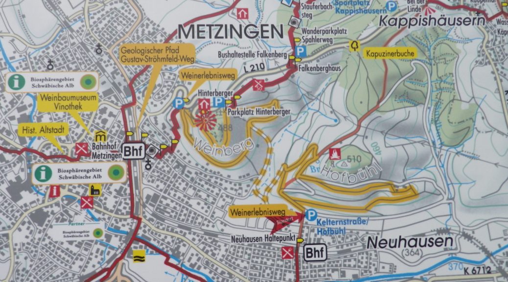
Trail Name: Weinerlebnisweg (Metzingen und Neuhausen)
Trail Type: Two short distance circuits conjoined by a third circuit between them; well-maintained and almost exclusively paved, a form of marking/signage is along parts of the trail
Length: 8.3 km/5 miles
Convenient to: Tuebingen or Stuttgart, Baden-Wuerttemberg, Germany
Marking:
Alternate red and green squares (often on tall posts) mark learning points along the trail, although these do not necessarily point the way to the next point.
Trail Description: A relatively easy itinerary up and down hills and dales, with learning boards, rest stops and scenic lookouts along the way, through agricultural and woodland settings, above a moderately urbanized area.
Trailheads:
Kelternstrasse, Neuhausen (for the Metzingen-Neuhausen circuit)
Am Gruenen Haeusle, Metzingen (for the Metzingen circuit)
Parking:
Kelternstrasse, Metzingen-Neuhausen (for the Metzingen-Neuhausen circuit)
Elsa-Braendstroem-Strasse (30), Metzingen (for the Metzingen circuit)
(Both are right on the trail)
Public Transportation Options:
Rail: DB ‘s (Deutsche Bahn) regional trains conveniently connect Metzingen with Tuebingen and Stuttgart
Suggested Stages:
Hikers can choose to complete one circuit, (such as the Neuhausen circuit for approximately 3.25 kilometers/2 miles), then return another day to complete the Metzingen circuit, which is just a bit shorter.
Trail Itinerary-Reference Points: (Counterclockwise)
Metzingen-Neuhausen: End of Kelternstrasse, follow the uphill path into the vineyards, take the path to the right, and follow along the vines (you will see education boards along the way), turn left, uphill, to a rest hut with a hammock, and follow back along the hillside, climb up to the Hofbuehl sign, follow a yellow circle over a foot bridge to the Hofbuehlbrunnen (a fountain), to Steinerweg; Metzingen: Through vineyards, to the parking spots on Elsa-Braendstroem-Strasse, turn left, downhill and curve around left to follow along the lower vineyards above Metzingen, back onto Steinerweg, and downhill, curving southeast to the start point in Metzingen-Neuhausen
Representative Trail Photos:
Restrooms: None observed!
Attractions on or near Trail:
Metzingen: On Kelternplatz there is a collection of half-timbered buildings formerly housing old wine presses, a museum dedicated to wine-making in the area, a Winemakers House, and a vinothek and wine bar.
Tasting along the Trail:
The local cooperative WGS (Winzergenossenschaft) Metzingen-Neuhausen is on Kelternplatz, Metzingen
The Wengerterhaeusle (“Winemakers House” listed above) offers regular public wine tasting events. Check the events schedule (“Veranstaltungen”) at https://weinbaumuseum-metzingen.de/
Alternative Options:
Biking: The 353 kilometers/219 miles-long Wuerttemberger Weinradweg passes through Metzingen. The southern portion often follows along the Neckar River, one of Germany’s wine rivers, before heading east and north at Heilbronn. See the Nutshell here.
Additional Information:
Regional: https://www.schwaebischealb.de/
Trail specific: https://www.metzingen.de/willkommen
Comments:
The connecting circuit between the two wine circuits adds a total of about 2 kilometers to whichever circuit is hiked.
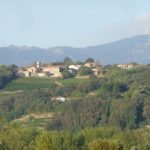
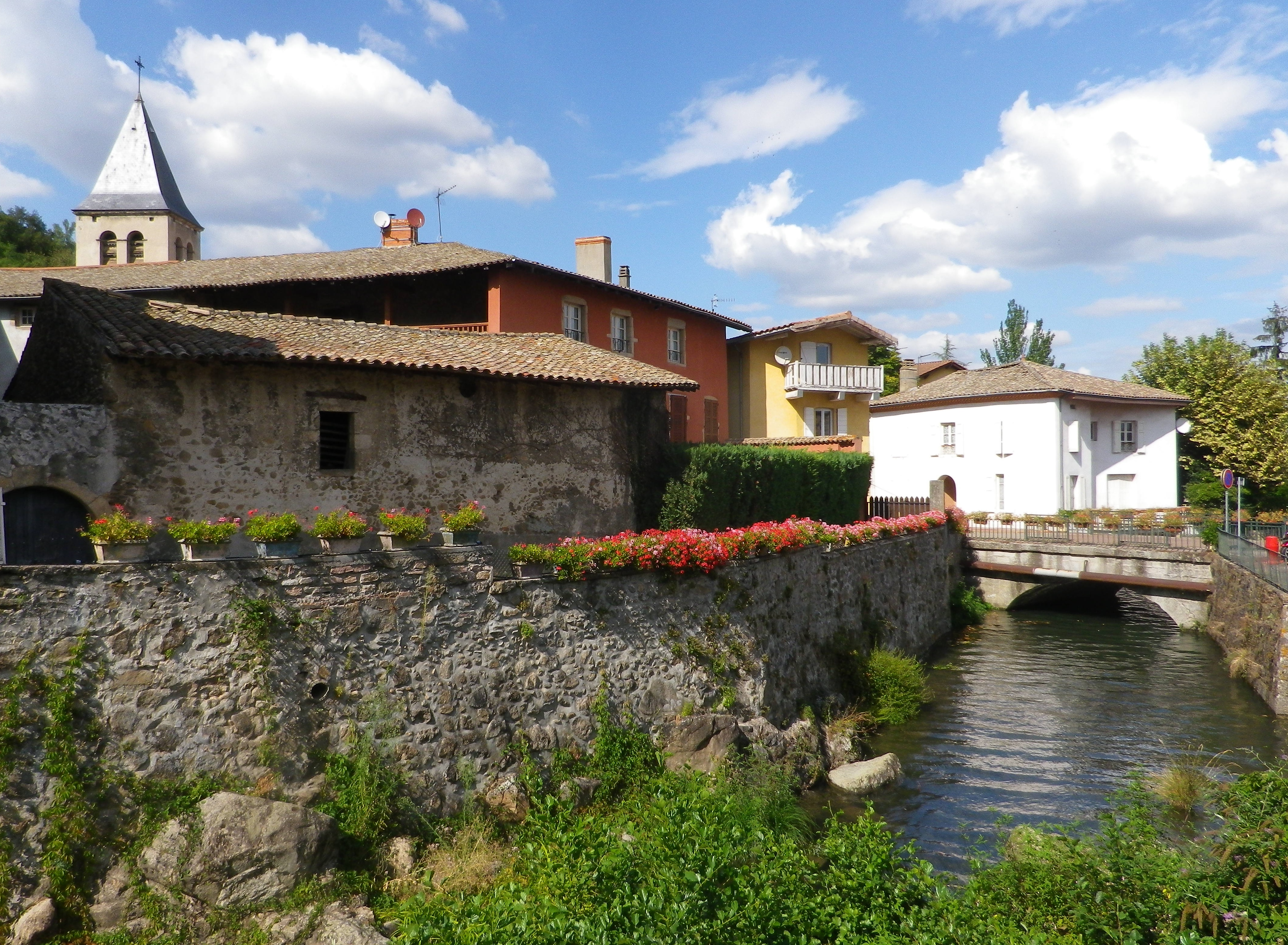
This may be the shortest post on record. Minutes away from Weimar, I gave a mighty tug on my luggage, stubbornly stuck under the train seat, only to have my knee, not my backpack, give way. Going down, using an old Anglo-Saxon cognate that caught the attention of the many modern-day German-speaking passengers, they graciously helped me off the train at the station. Months preparing for this two-day hike, hours of travel from Frankfurt, and in the end, no hike.
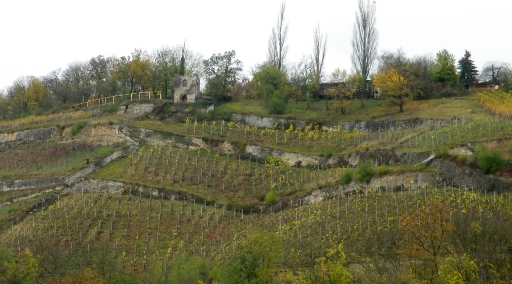
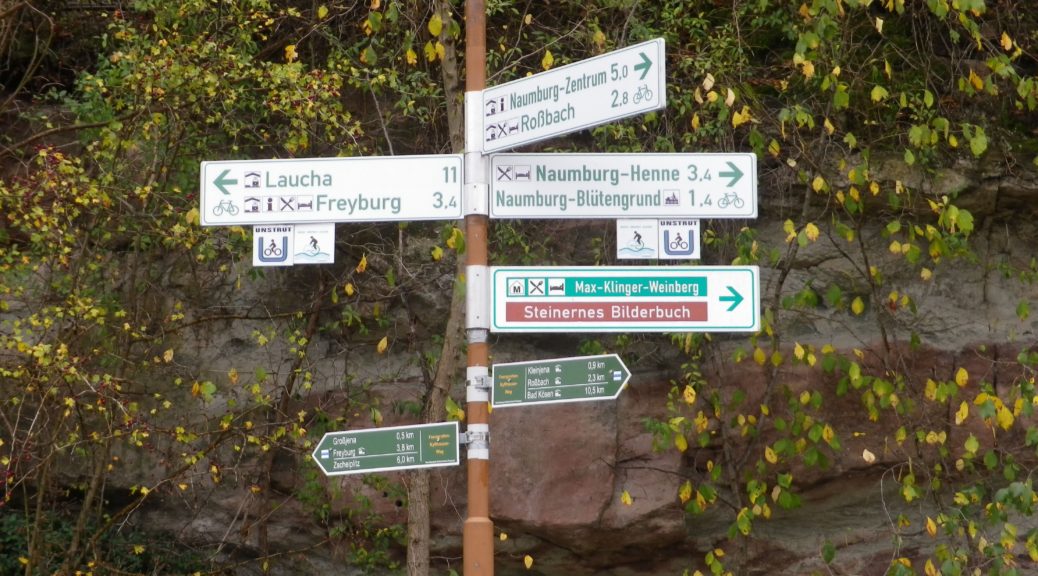
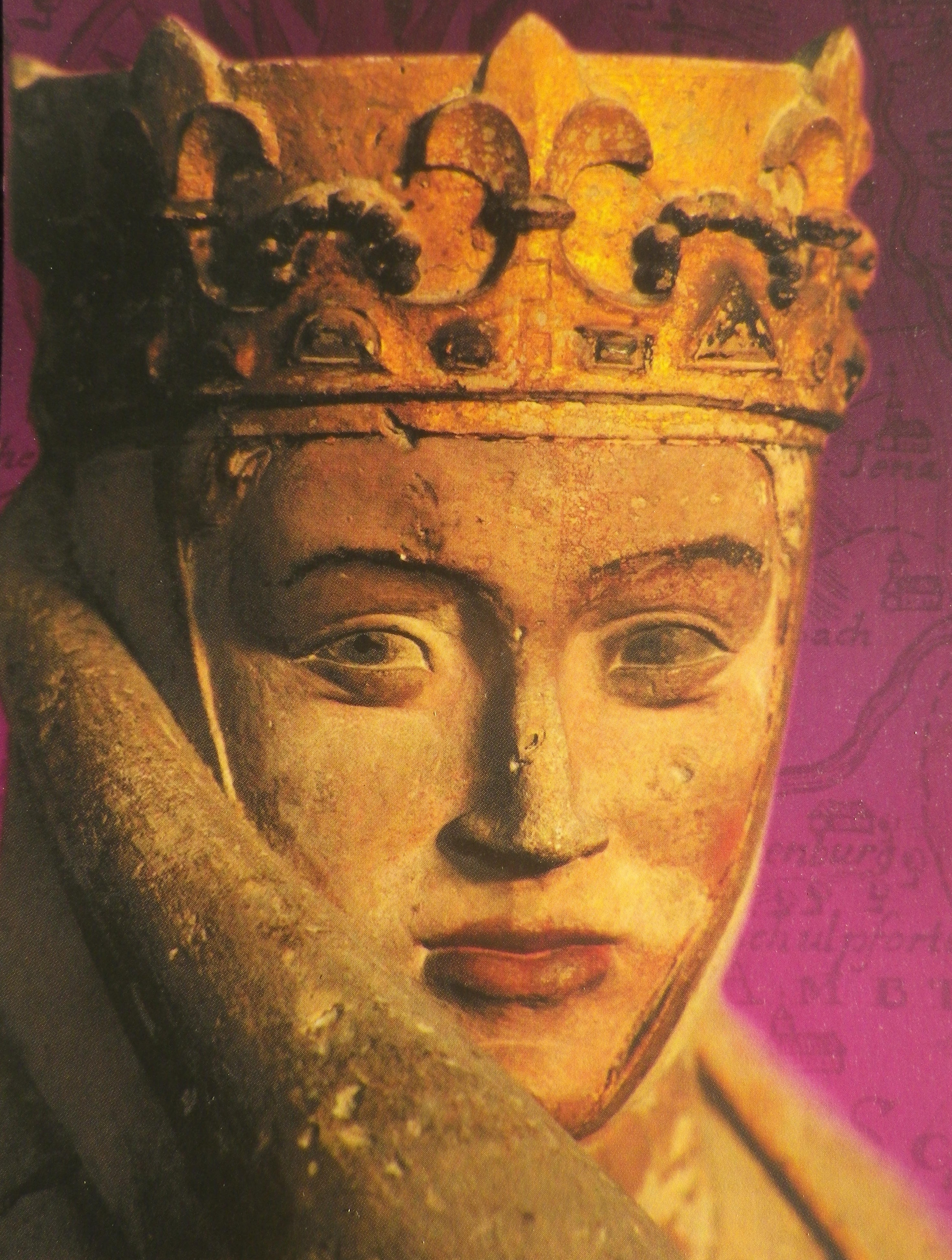
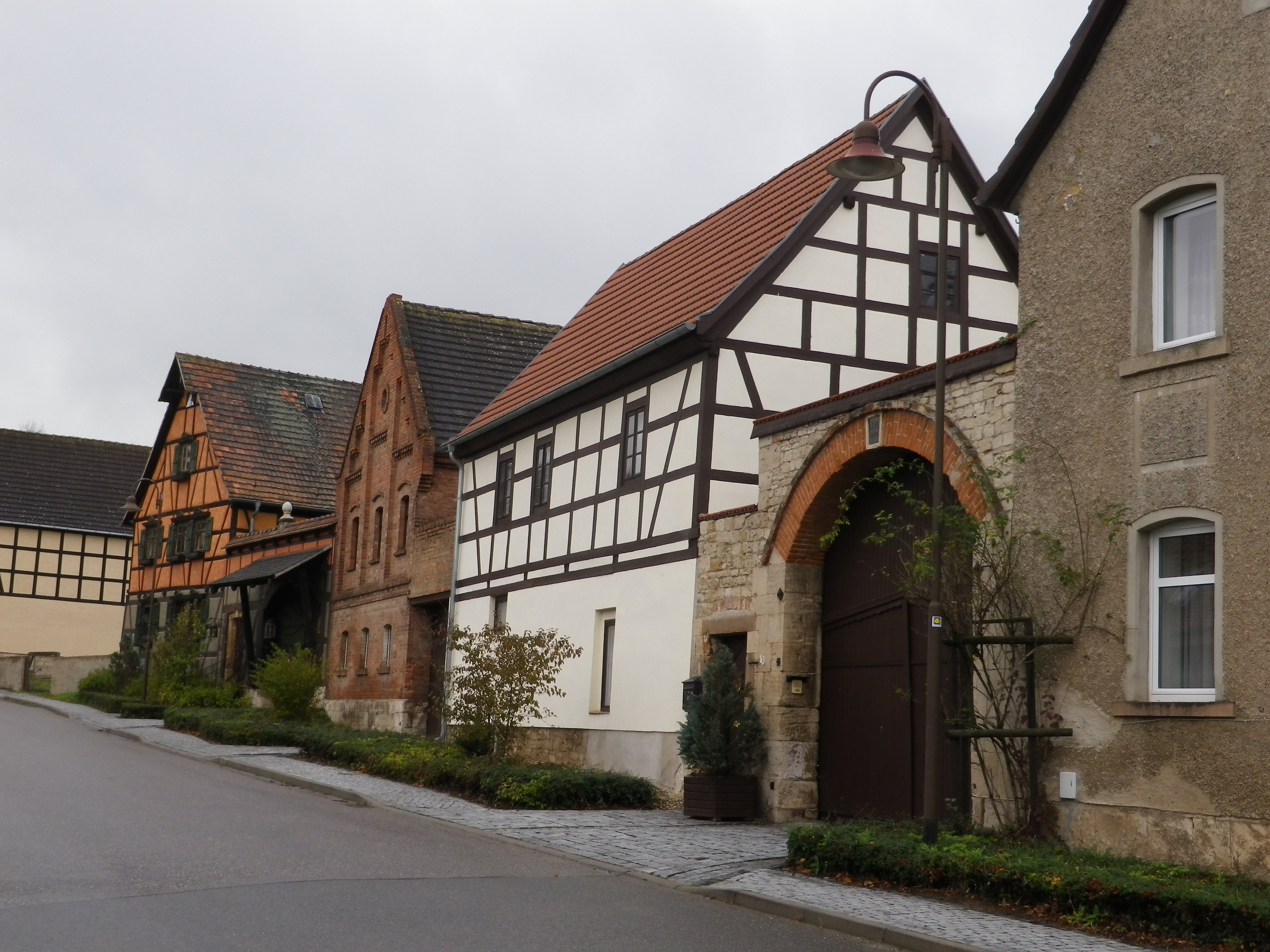
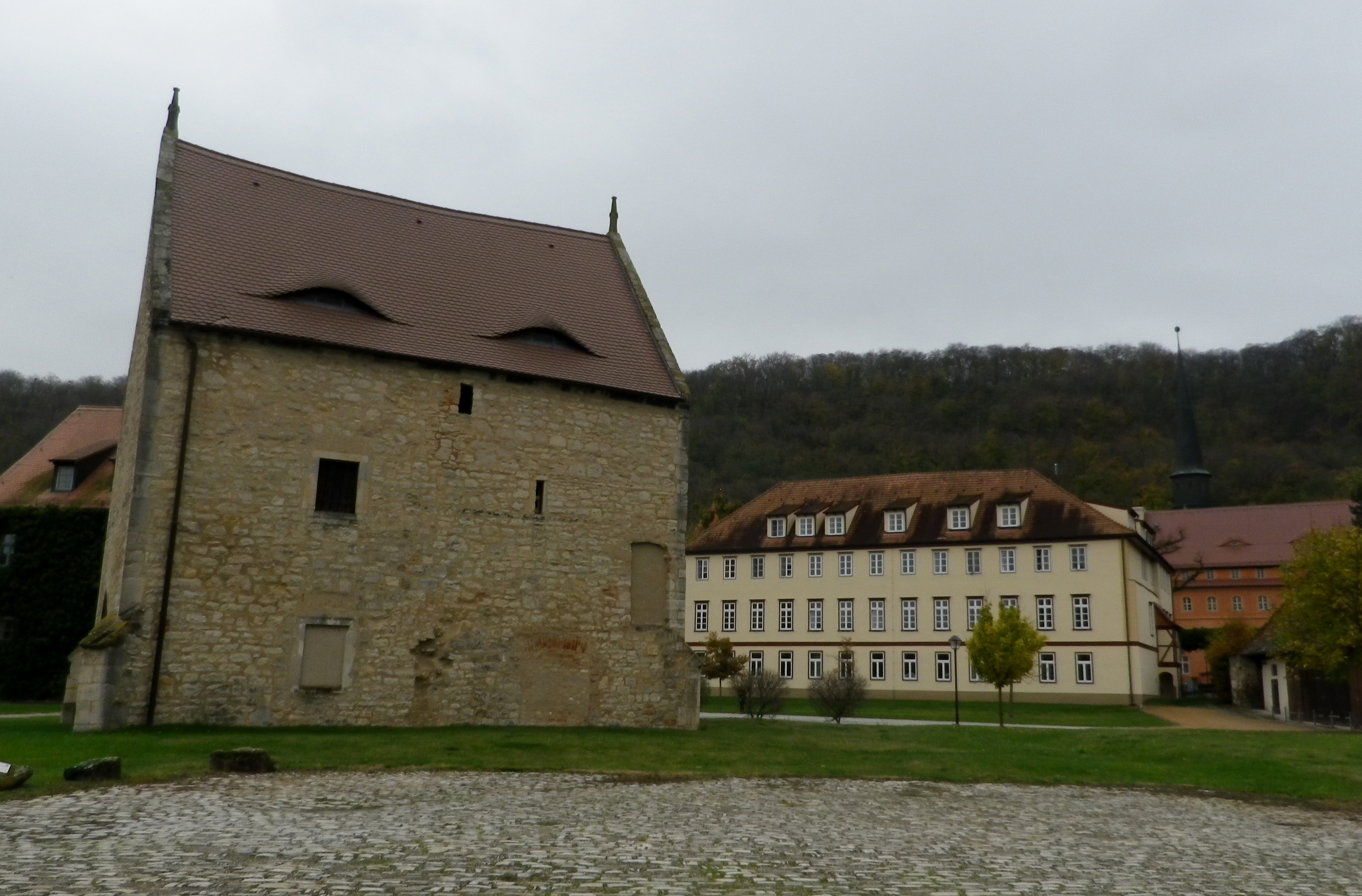
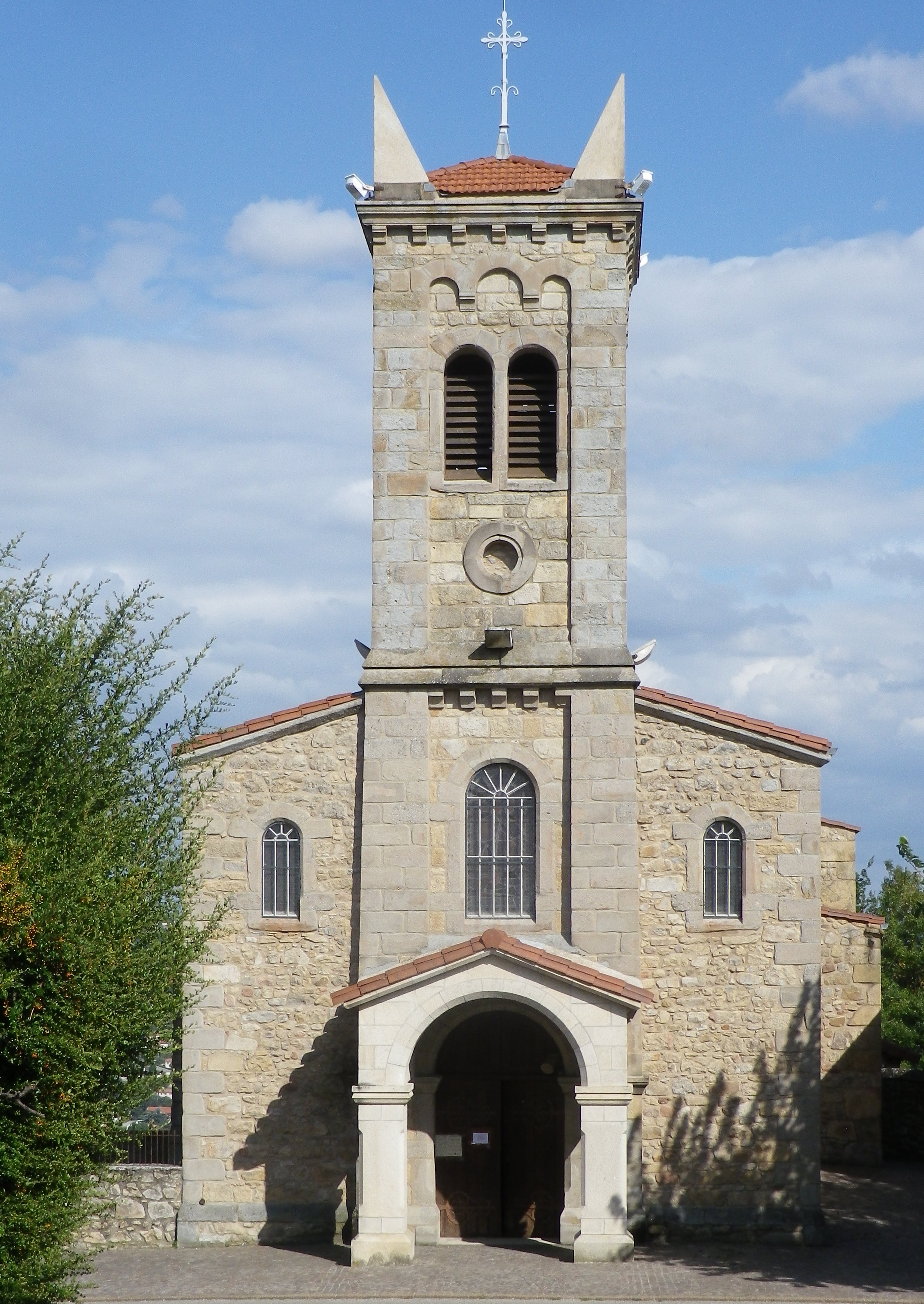
Fortunately, a friend and I had planned to meet at the station in Weimar, and he had a rental car. So off we went to Naumburg, just over the Thuringian border, in Saxony-Anhalt. Naumburg is a lovely old town with a spectacular medieval cathedral, (housing Disney’s Snow White evil stepmother look-alike – judge for yourself, below), and site of the trailhead for the Saale Weinwanderweg.
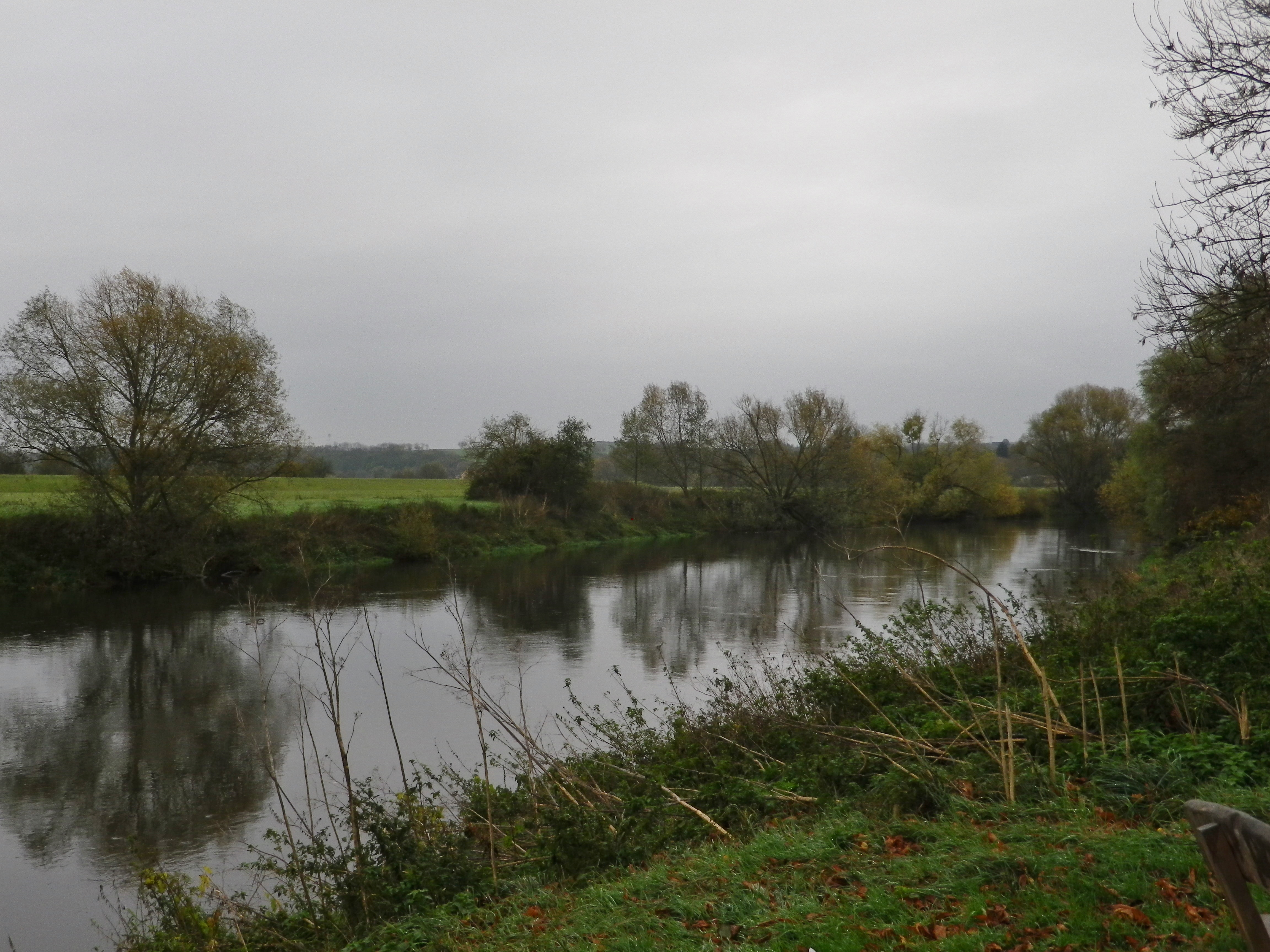
The trail commemorates the Saale-Unstrut wine region in Germany. It is one of two wine regions in eastern Germany, and the one with the northern most vineyards in Germany. These vineyards lie mostly on the south-facing hills and river banks lining the Unstrut and the Saale rivers (not to be confused with the Fraenkische Saale river, further south). Hence this trail partly follows along these two rivers. And the trailhead is located not far from where the two rivers meet, just outside Naumburg.
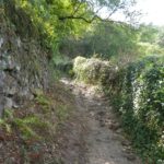
My friend, there to tour historical sites and peruse antique porcelain, graciously agreed to shuttle me to a series of points on the trail, accessible by car, where I could hop out, literally, to take photos. First stop, the trailhead. As evident by the photo below, this part of the trail is also a bicycle path, as were the subsequent sections I saw. It appeared that much of this trail could be biked, with a hybrid or mountain bike, from the looks of the sections I could reach. One caveat though, there are two sections higher up the hillsides, and through woods, that are probably a bit rougher, possibly suitable only for hiking. (There are cycling path alternatives though.)
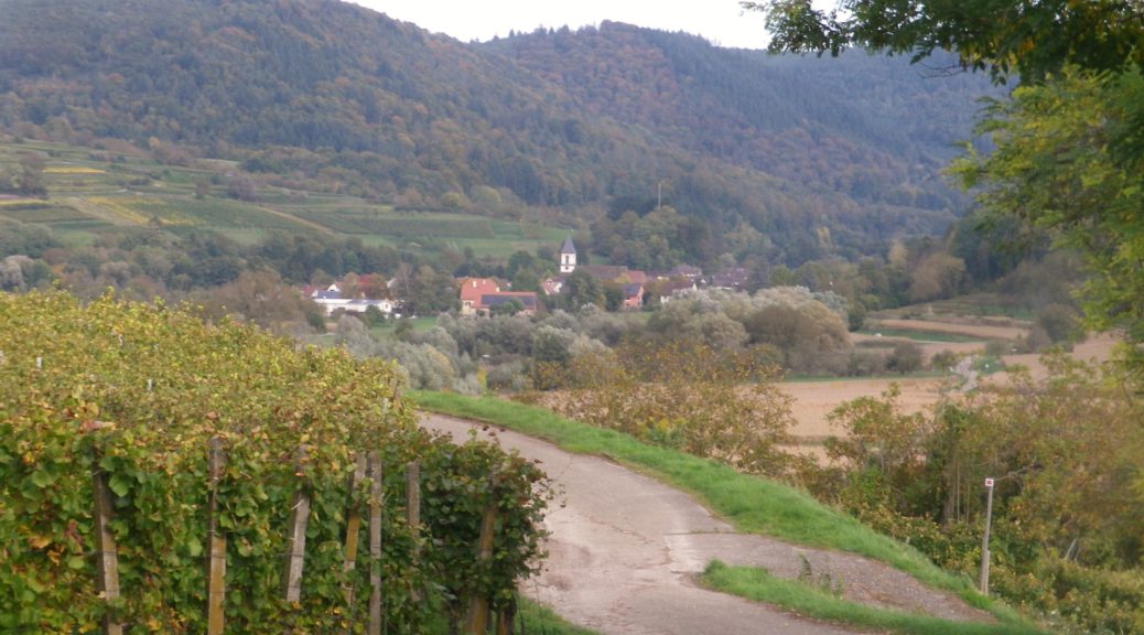
Another nice feature of this trail is the fact that it passes through some of the wine villages and towns in this region. The largest town in the area, Naumburg, has a nicely maintained historic district. It, and the cathedral, are worth a visit. Then there were a couple of villages. Kleinjena, opposite Grossjena on the Unstrut, comes next on the itinerary. Rossbach is a bit beyond Kleinjena. A settlement appropriately named Weinberge “vineyards”, follows, with its collections of vines suspended on the banks facing the Saale. Wine loving hikers will find several small, family run wineries along this sector of the trail.
Before reaching Bad Koesen, Kloster Pforta appears on the trail. This old monastery building is now one of the largest local wineries. Its Saalhaeuser vineyard rise above it, and the river passes in front of it. The winery has a cozy a wine tavern collocated with it. Its little terrace looks out over the river, and on a nice day, would be ideal for sipping a glass or two of its wines. (The other large winery, the Naumburger Wein und Sekt Manufaktur, is in fact a still and sparkling wine firm located on the trail a bit further upriver in Henne-Naumburg.)
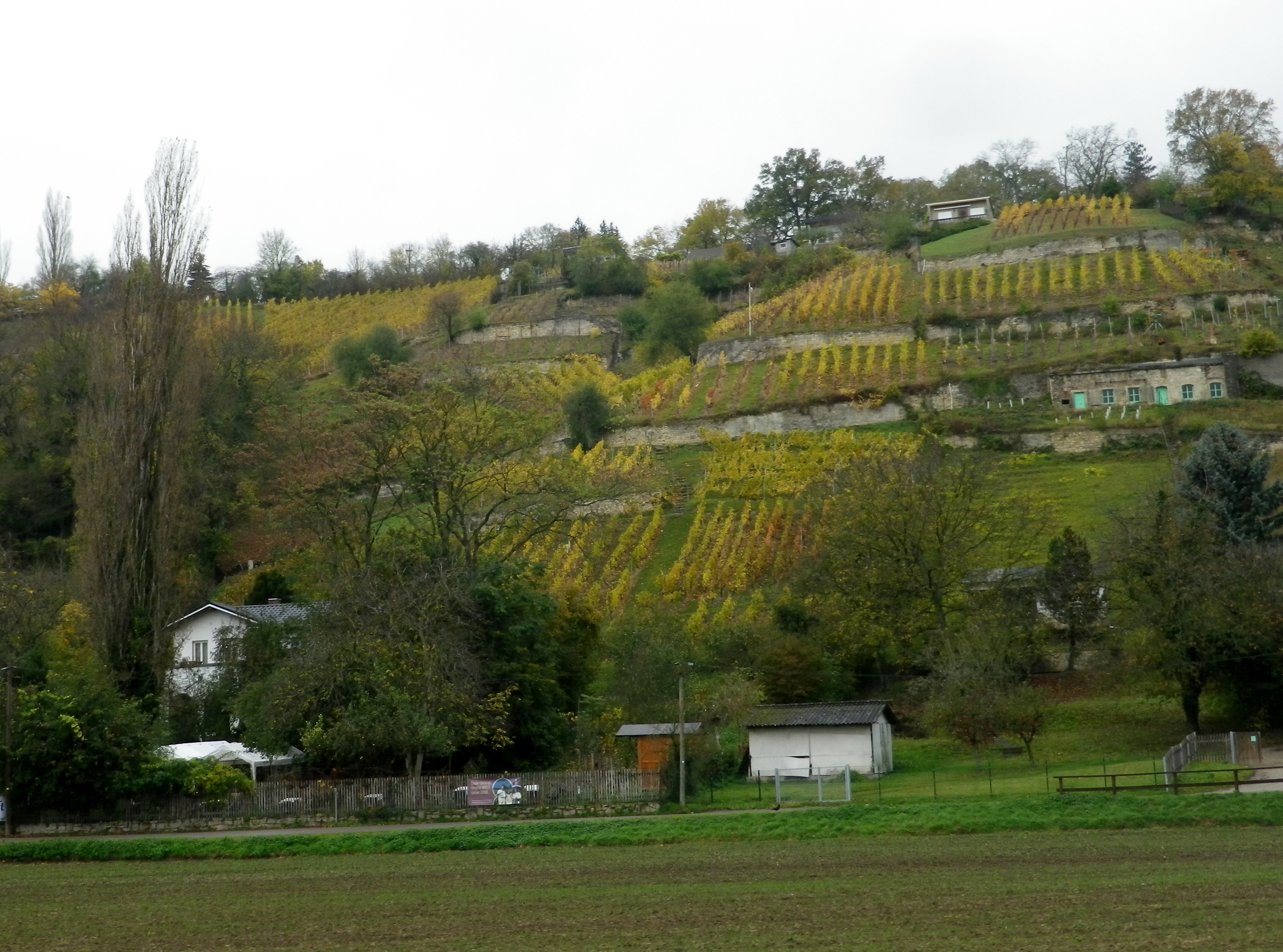
The trail returns to Naumburg via the bridge crossing at Bad Koesen. It is a small spa town on the Saale, to the west of Naumburg. In addition to being a spa town, with all the amenities found in any German spa town, there are several hiking trails in that district, and a least a couple of these focus on the vineyards. At the edge of Bad Koesen lies Schulpforte, formerly a Cistercian monastery dating to the twelfth century. (These were the monks who founded the original winery now found at the Kloster Pforta mentioned above.) After the abbey’s dissolution, the Duke of Saxony founded a school on the property. The impressive complex backs onto the side of a forested hill. The trail continues up that hill and through a forest for about two kilometers, back to Naumburg. (This was the part I could not hobble to, so I can’t write about the trail conditions.)
I completed my photo reconnaissance of this trail in less than an hour, vice two days. Thus, I had time to visit Colditz, and get lunch in a wine tavern. Over the rest of the day, and the next, I had opportunities to sample some Saale-Unstrut wines, and finalize plans to return some day to hike in the area, and taste more wines.
Trail Name: Saale Weinwanderweg
Trail Type: Mid-distance circuit hiking trail; well-maintained and mostly smooth surfaces, much of it paved, but no trail-specific marking on the trail
Length:
Total – 25 kilometers/15.5 miles
Convenient to: Leipzig, Germany
Marking:
No trail-specific marking
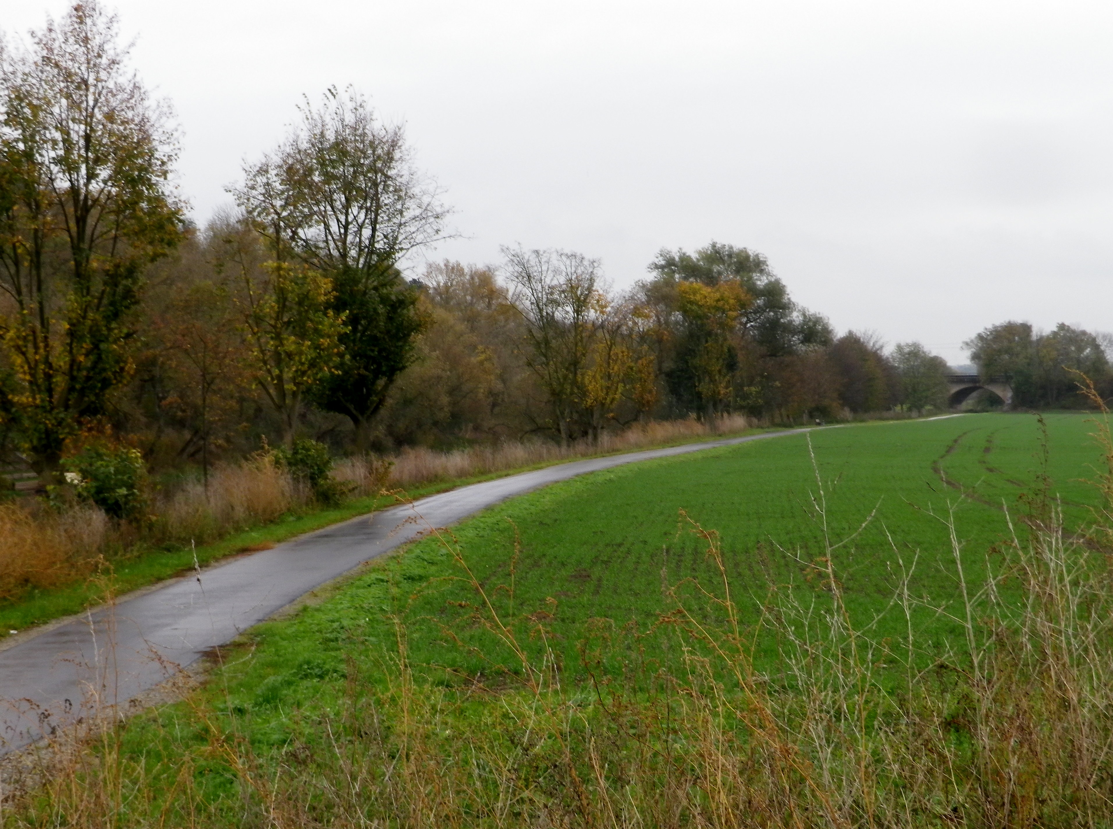
Trail Description: A very easy, if not a bit long trail, with only one ascent of any challenge, through the largely isolated vineyard areas between Naumburg and Bad Koesen, and those two urban centers. While the scenery is less spectacular than other trails, the attraction here is found in the quiet and very laid-back countryside of this little-known wine region of northern Germany.
Trailhead: Marienring x Hallesche Str, Naumburg, Saxony-Anhalt, Germany
Parking:
Naumburg (just before the river crossing to Henne): a medium sized unimproved lot
Grossjena: K233x Wasserstr, just after the bridge, a small unimproved lot
Bad Koesen: by the sports field at the trailhead, at the end of Hallesche Strasse
Public Transportation Options:
Rail: DB (DeutscheBahn) regional trains serve this area, and the nearest, and undoubtedly largest, hub for services in the county is Leipzig.
Bus: PVG Burgenlandkreis serves the area with a combination of tram and bus lines. Check the website for details.
Suggested Stages: Not applicable
Trail Itinerary-Reference Points: (Counterclockwise)
Naumburg:, Hallesche Str-Hallesche Anger, along the Saale, over river on Hallesche Str; Henne: past the Naumburg Wein und Sekt Manufaktur, road turns to path; Along Bluetengrund toward Grossjena; Cross Unstrut after 500 meters passing the Max Klinger Museum entrance; Kleinjena: Friedrich-Schulze Strasse, Unter den Reussen, path; Rossbach: Pass St Elizabeth church, Am Leihdenberg, Am Meisel, Trift, Weinberge; Pass the Steinmeister vineyards, Pass the Besenwirtschaft Dierking, Along Saale on Weinberge-Saaleberge, Pass Klosterpforta; Bad Koesen: Saalstr, cross the bridge, Naumbergerstr/B87, An der Kleinen Saale; Schulpforte; woods, Panoramaweg, Koesener Str, Michaelisstr, Lindenring, Herrenstr, pass the town hall on the main square, Marienstr.
Representative Trail Photos:
Restrooms:
No public ones observed
Attractions on or near Trail:
Max Klinger Museum, just outside Grossjena, dedicated to a well-known local artist, who also had his own vineyards on the grounds.
The local wine museum is located between Grossjena and Freyburg, in Schloss Neuenburg, a mile or so off the trail.
Tasting along the Trail:
Trail boasts numerous vintner establishments along the way, but the Wein und Sekt Manufaktur in Naumburg-Henne, Kloster Pforta, Schulpforte, and the wineries between Rossbach and Bad Koesen, are your best opportunities to purchase bottles.
Alternative Options:
Hiking:
-Weinlehrpfad Saale-Unstrut, a 12-kilometer (7.4 mile) trail along the vineyards on the Unstrut, starts in Laucha, and finishes by the bridge in Freyburg.
-Weinbergsweg, an 11-kilometer (6.8 mile) circuit around Bad Koesen, some of which is on the Saale Weinwanderweg.
Biking: The long-distance Saale Radweg, while not wine-themed, passes many of the wineries mentioned above, and is used by this hiking trail in part.
Additional Information:
Regional:
http://www.weinregion-saale-unstrut.de/ for wine tourism information concerning this wine region
https://www.saale-unstrut-tourismus.de/ for tourism in general in the Burgenland Kreis county
Trail specific: https://www.outdooractive.com/de/route/wanderung/saale-unstrut/saale-weinwanderweg-ab-naumburg/1405756/#dm=1
Comments:
Due to a knee injury, I did not hike this trail itinerary, so I cannot comment on the ascent or the wooded section of this trail between Bad Koesen and Naumburg.
Mankind is often hard pressed to improve upon nature. Humans leave an indelible mark on the natural world, and sometimes their efforts can enhance our experiences. In these cases, not just the natural landscape, but also the manmade landscape can appeal equally.
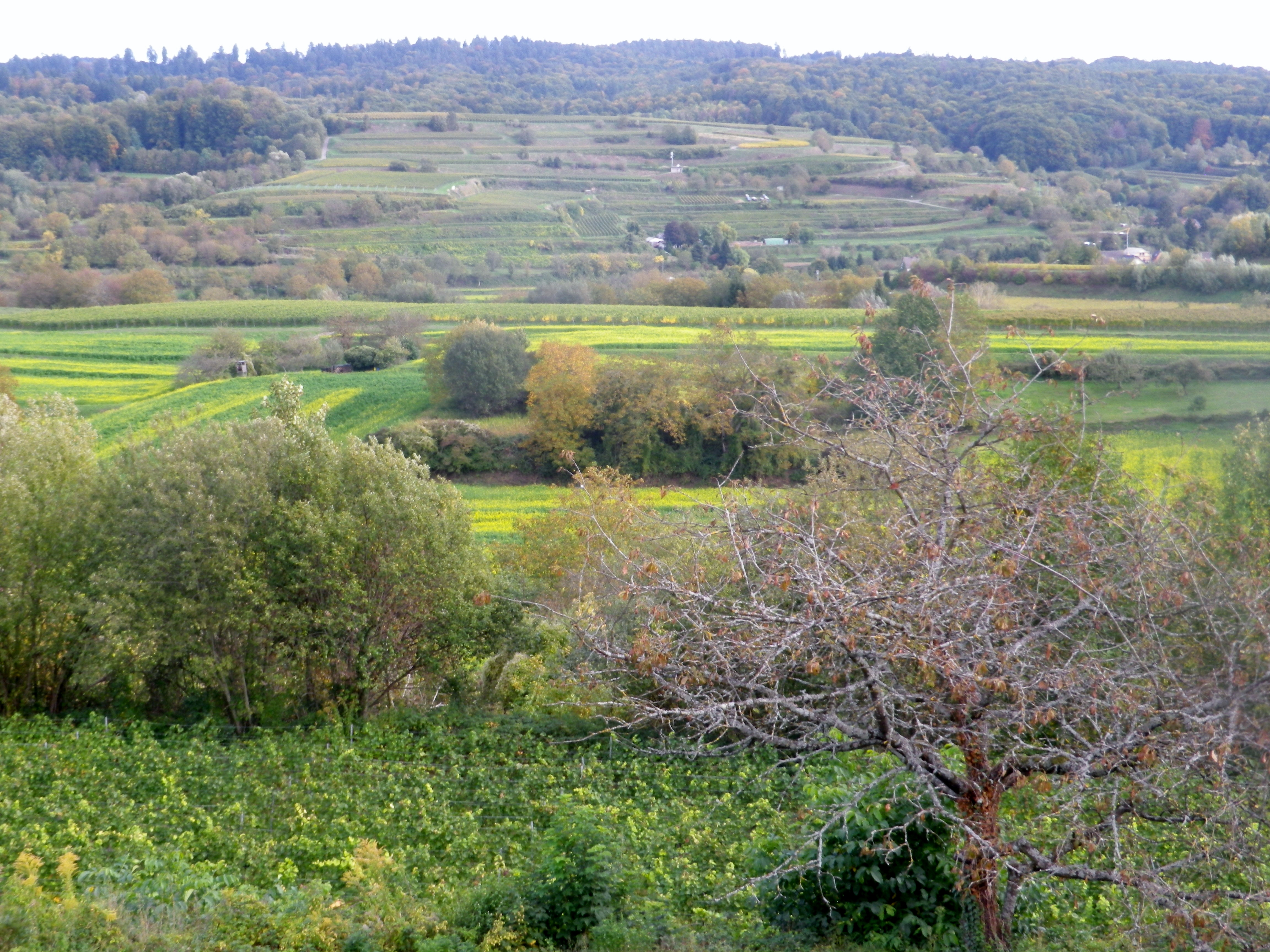
The Rebhisliweg itinerary focuses on manmade huts found in a beautiful, lush landscape. The circuit lies by Wagenstadt, in the Breisgau, a district of Baden. Topographically, layers of hills, some terraced, and ridgelines to the north, south and east devolve into the Black Forest, which appears as a mountain wall, capped by mixed forest vegetation. The dark greens of the fir trees, and the brilliant autumnal leaf colors add to the background. In the distant west, the majestic Vosges, turn from blue to purple as the evening approaches.
The nearby villages are compact gems, which harmonize, not distract, from nature. Set amongst vineyards, forests and fields, most buildings are only three stories at most. The red roofs set off nicely against nature’s greenery. The eye is drawn to, and then beyond, each village’s church steeple, or municipal bell tower. Each one distinct from the other, a sort of talisman for the inhabitants. The ridgelines ultimately dwarf them, but only because man’s construction draws the eye up, then away, onto that backdrop, thence to the mountain tops. They serve to unite middle and distant vistas.
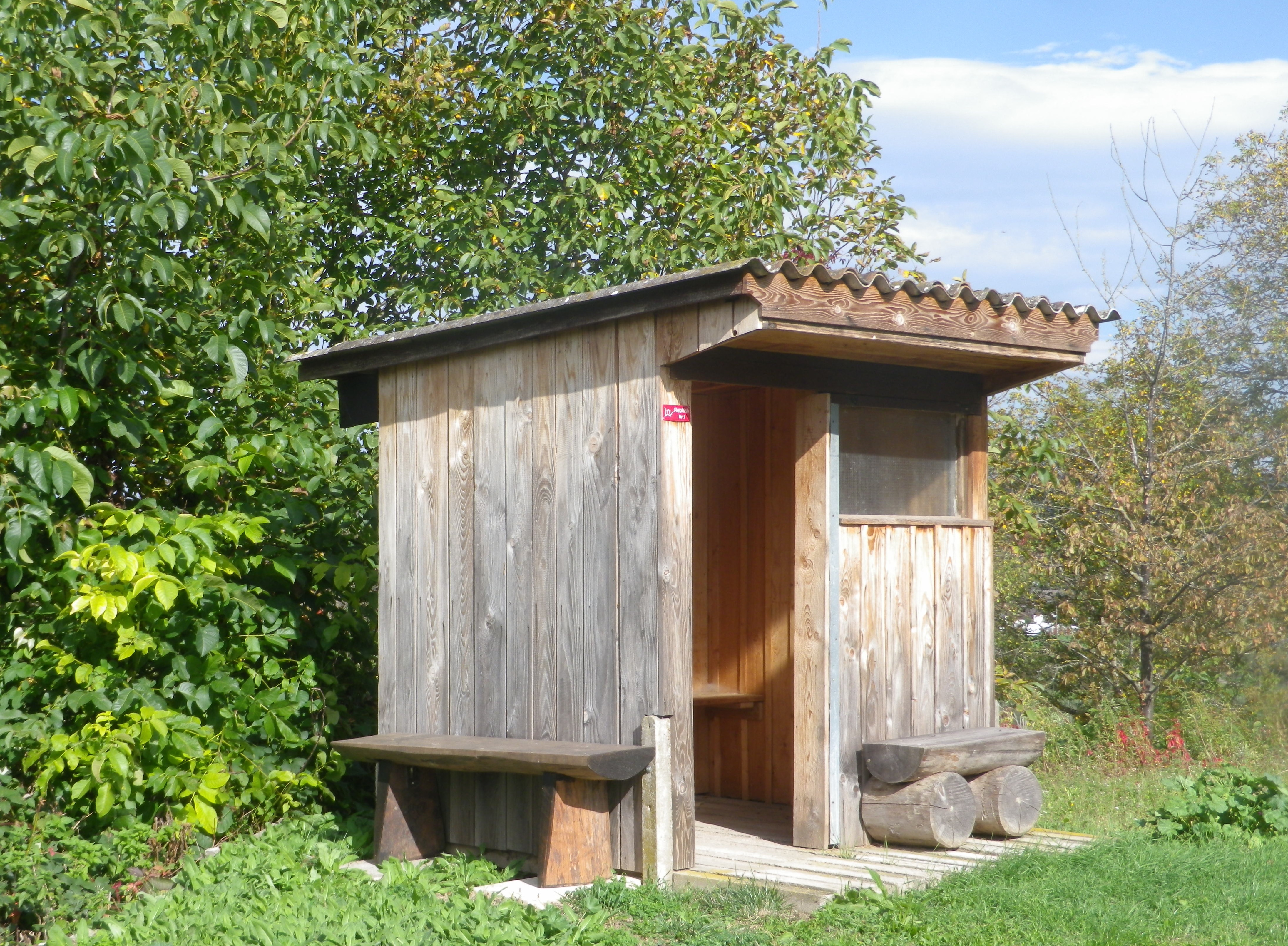
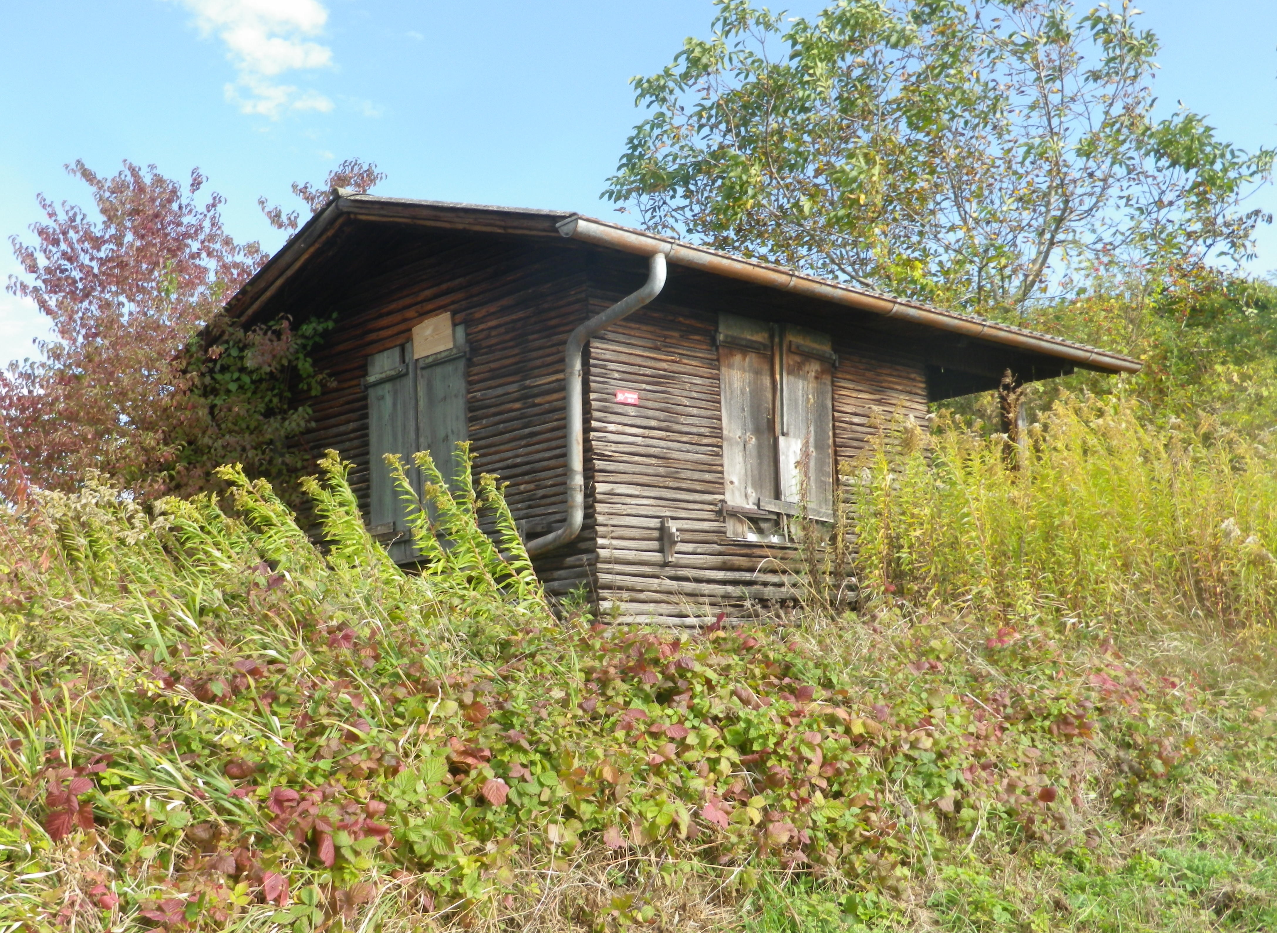
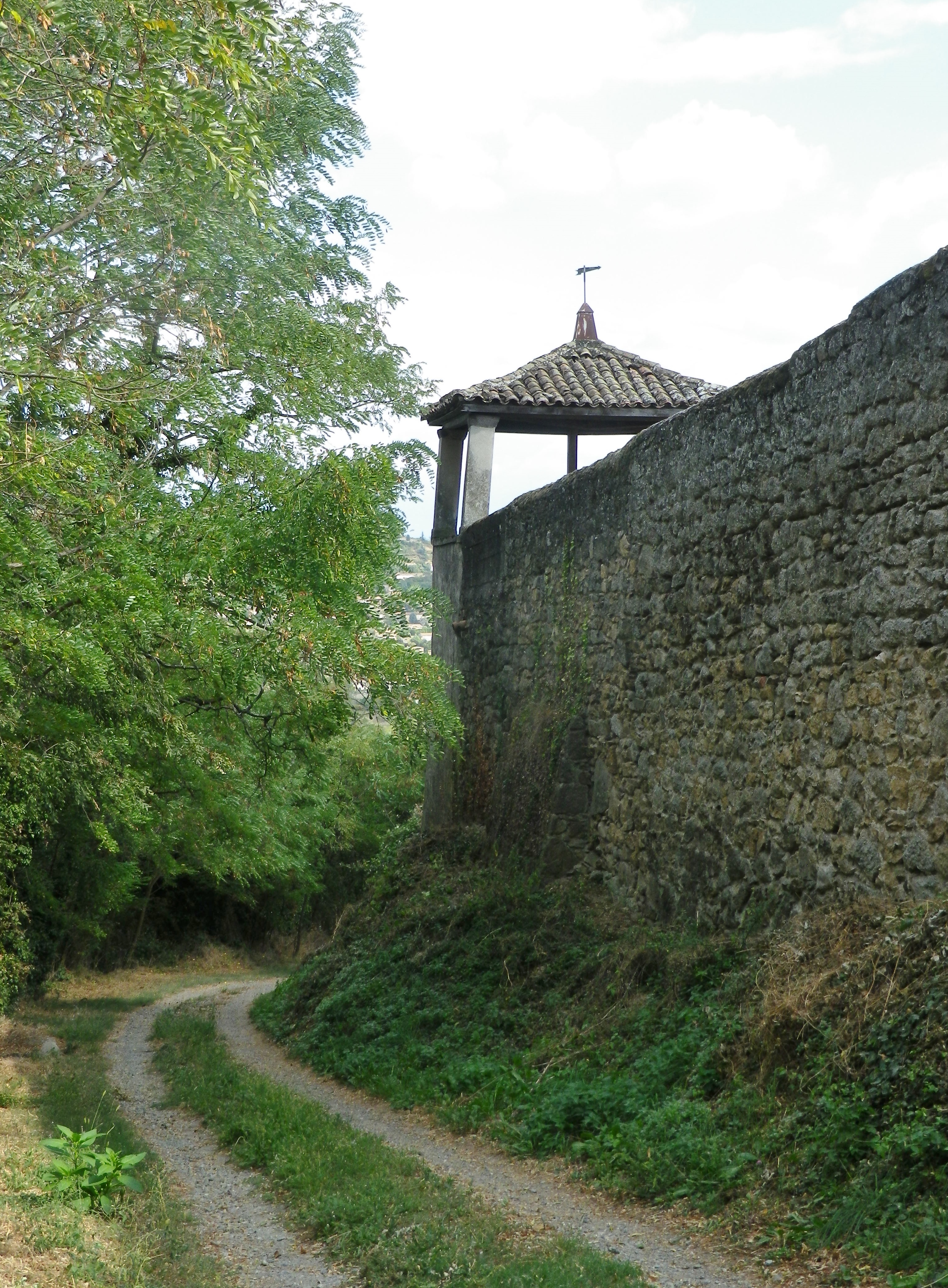
At eye level, the manicured vineyards, punctuated with fields, some farmed, others fallow or reclaimed by nature, and small huts. Known as Rebhisli in the old German Alemannic dialect, they are huts for those who work the vineyards. Whether sheltering the workers, or their tools, these vintner huts still exist in Germany. They provided the inspiration for this trail’s name and itinerary. The huts dot the landscape all along the trail. Some vintners still maintain certain huts, whereas nature is slowly reclaiming others. All are picturesque in their own ways, and are often offset against the magnificent landscape.
As this hike left the village of Wagenstadt, it passed through fields before proceeding upward. As the vineyard terraces began, the air filled with the scent of crushed grapes, and fallen leaves. The harvest was mostly over, only the spaetlese or beerenauslese grapes remained, the grape leaves turning yellow.
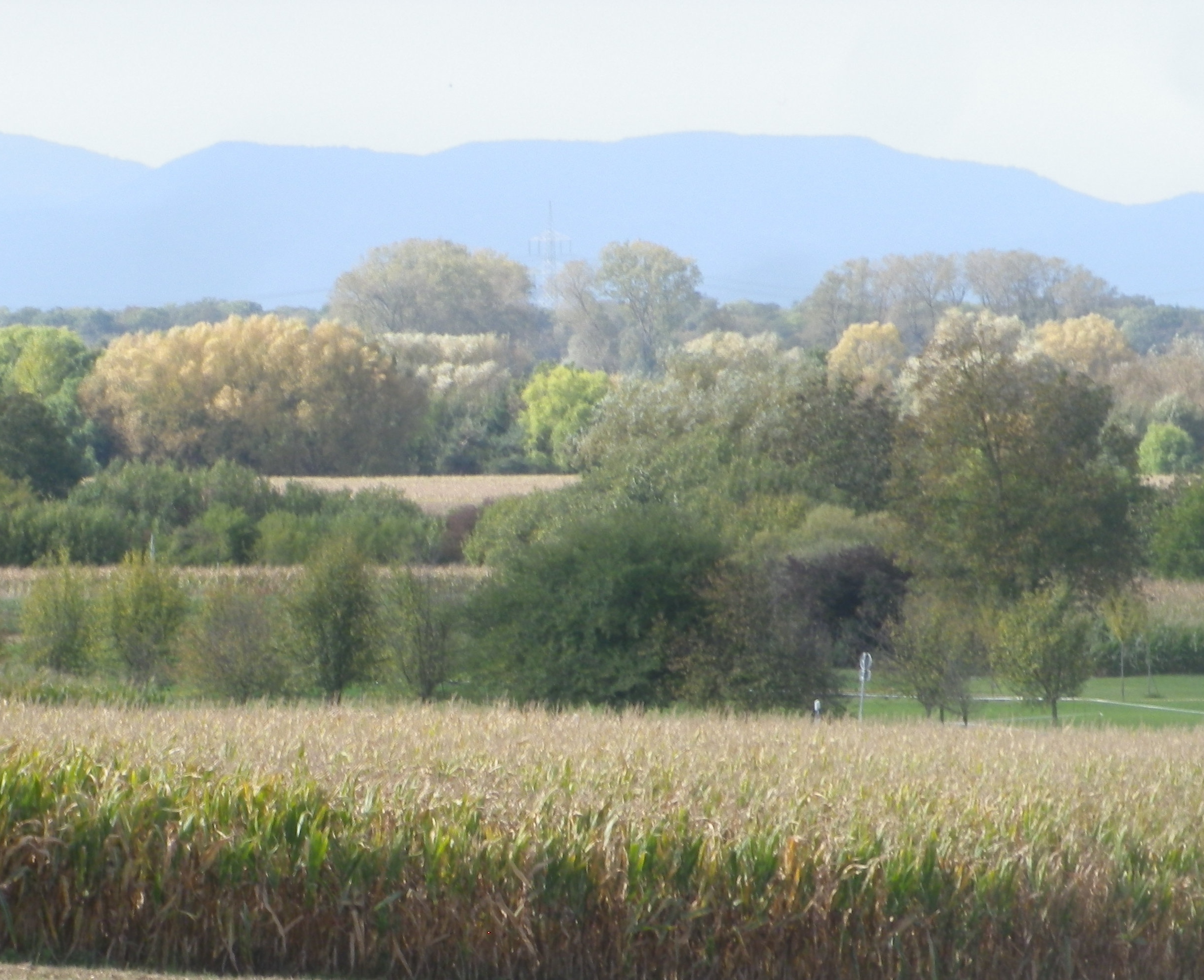
During the first part of the hike, the views were to the west, toward the Vosges and rapidly sinking sun. In the distance lay the Alsatian town of Selestat, and vineyards, a thin yellowish line, at the foot of the Vosges, somewhere between Dambach la Ville and Scherwiller.
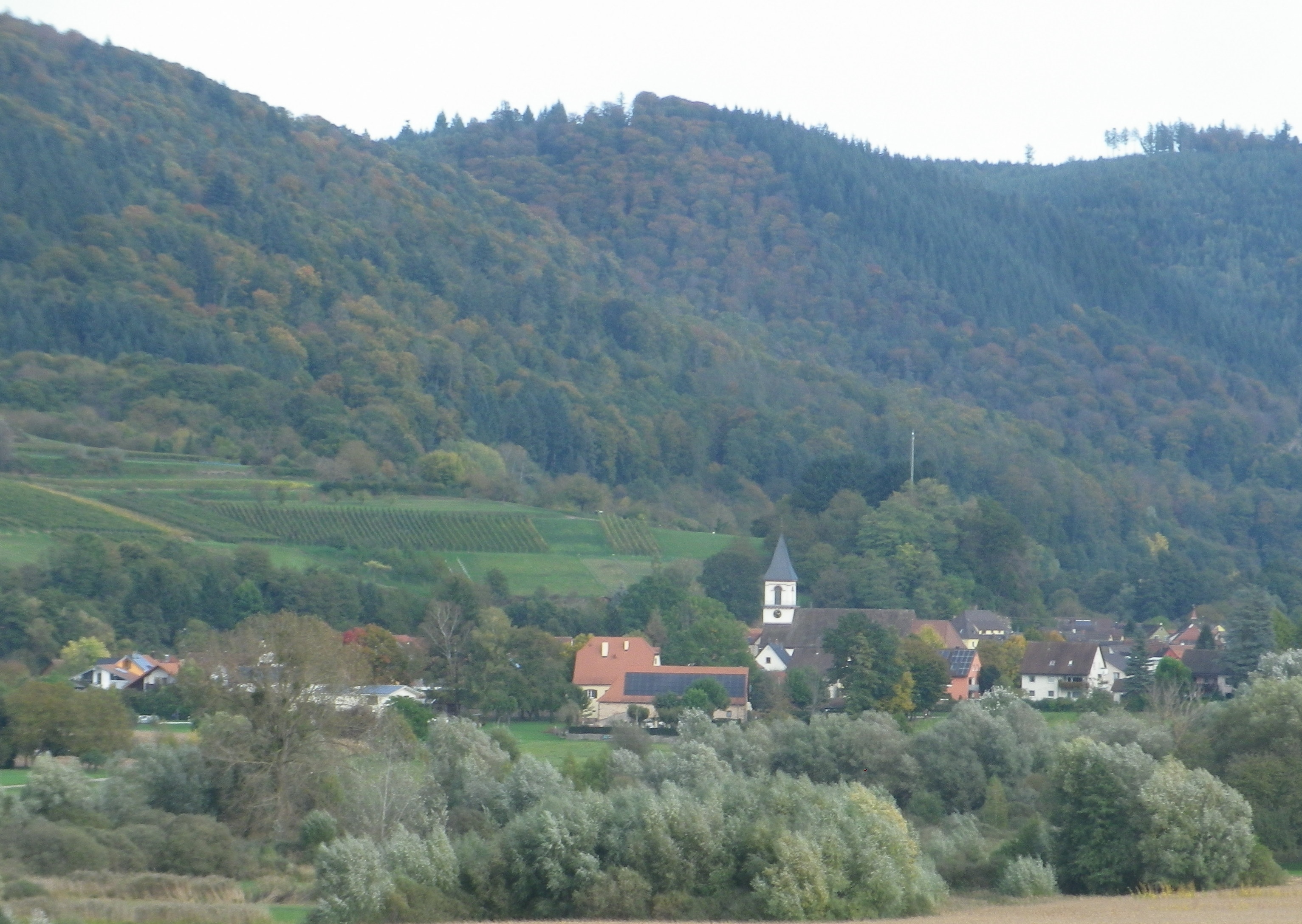
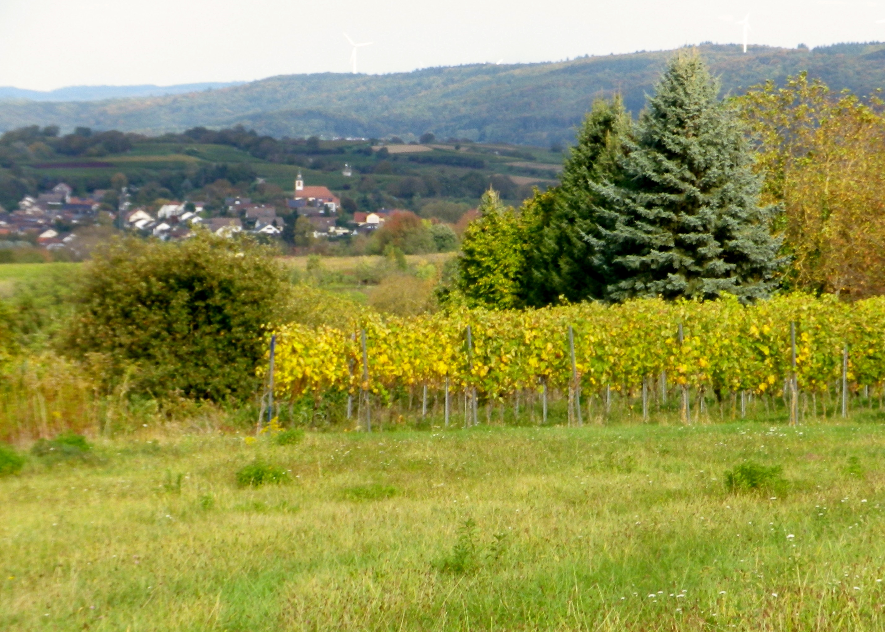
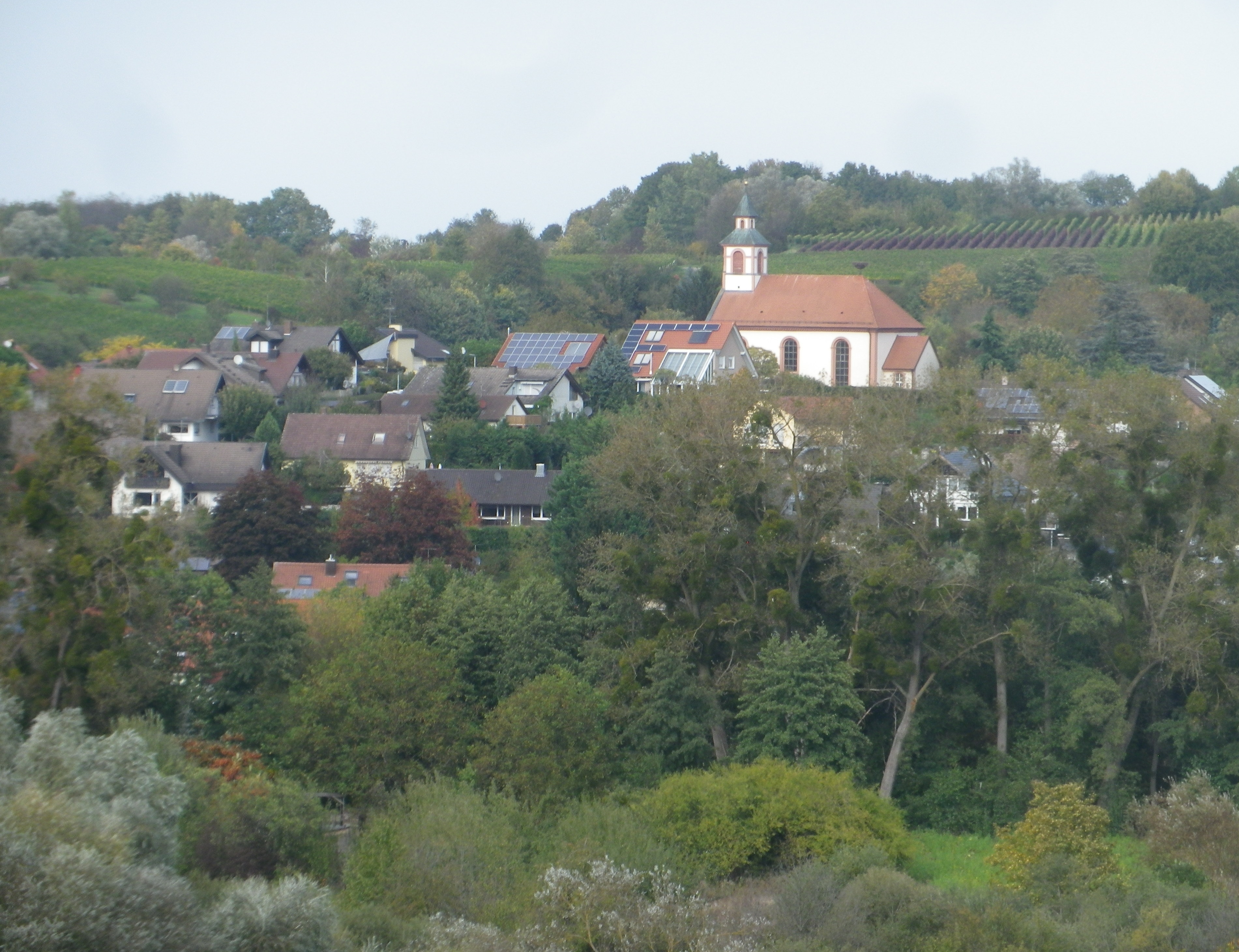
As the trail rounded its southern most extent, and headed north, the first views of the nearby Black Forest came into sight. Bleichheim and its solitary church steeple hove into view, but put into perspective by the massive foothills of the Black Forest behind. Tutschfelden and its distinctive steeple appeared.
Heading back toward the village, I passed a couple of wineries, (the Schaudt and the Ringwald), and more vintner huts. All nestled comfortably into the folds of this rolling terrain, and blended in effortlessly. Then just like that, from vineyard to village, I was back in Wagenstadt.
No, mankind did not outdo nature here, but came in a close second. The true merit of mankind’s efforts was housing the implements, wineries and the taverns where nature’s fruit of the vine could be harvested, produced and enjoyed with friends and neighbors.
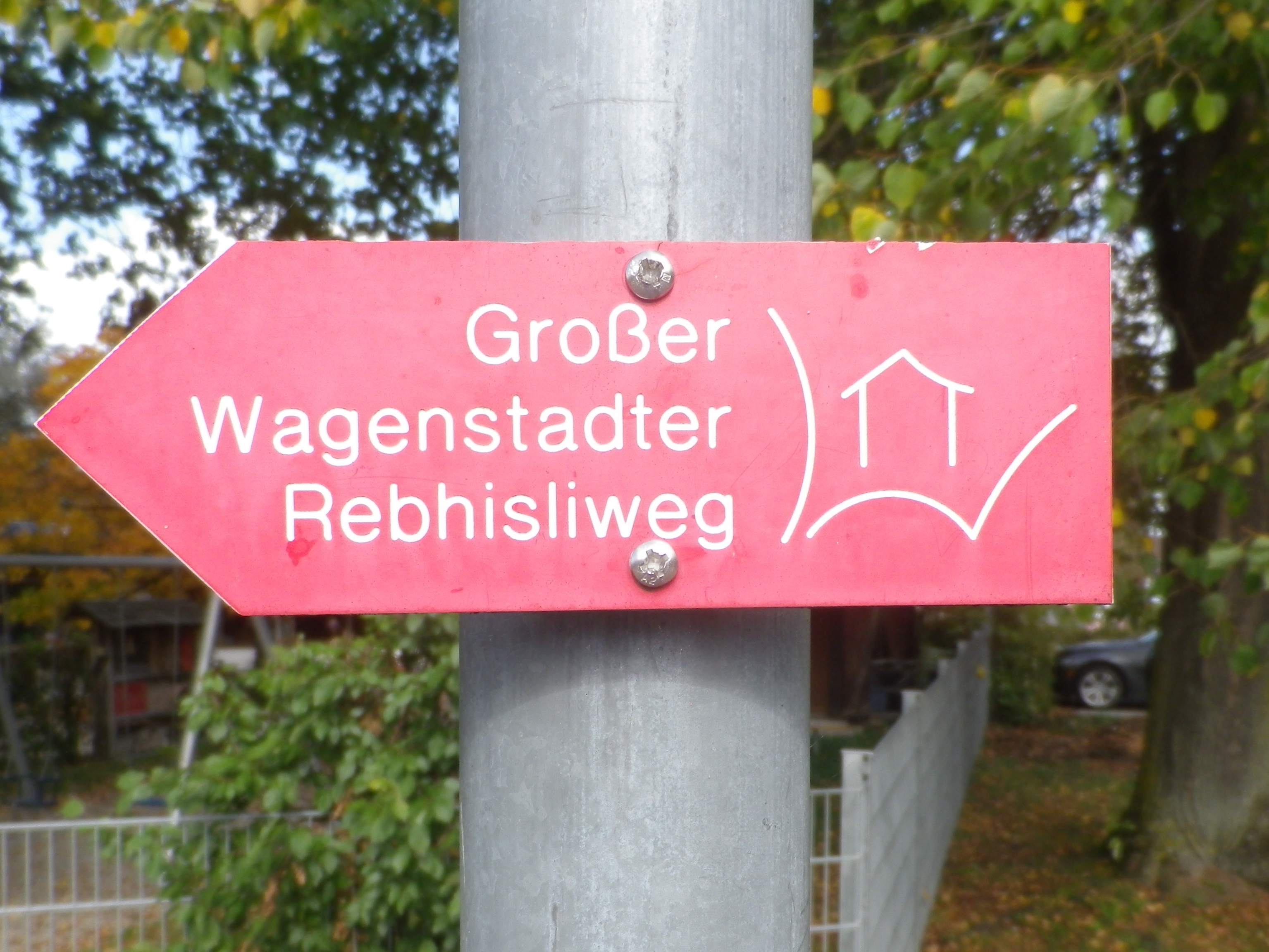
Trail Name: Grosse Rebhisliweg
Trail Type: A short distance circuit; well-maintained and mostly hard-packed or paved with some grassy surface; marking on the trail fairly good, but a map could be useful.
Length:
Total – 7.4 kilometers/5.2 miles
Convenient to: Freiburg, Germany
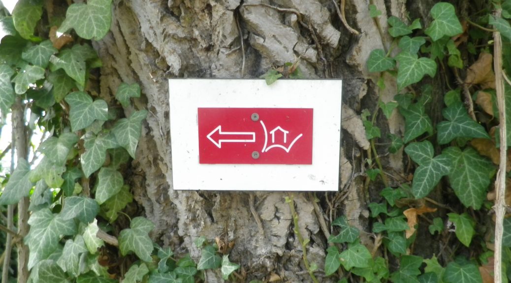
Marking: A rectangular red background with a stylized white letter W, with a stylized white hut inside it
Trail Description: A gentle hike over modest inclines with well-maintained trail surfaces through vineyards and fields with the vintner huts throughout. Great views in all directions, but especially toward the Black Forest.
Trailhead:
Herbolzheim-Wagenstadt, August Ziegler Weg, by the Evangelical church
Parking:
Herbolzheim-Wagenstadt, Im Erb or Im Weiherle
Public Transportation Options:
Rail and Bus: Herbolzheim, and nearby Kenzingen, are two of the many stations on the main north-south train route through the Rhine River Valley. DeutscheBahn (DB) has many trains serving this area, and operates buses which serve the nearby villages like Wagenstadt.
Suggested Stages: Not applicable
Trail Itinerary-Reference Points: (Counterclockwise)
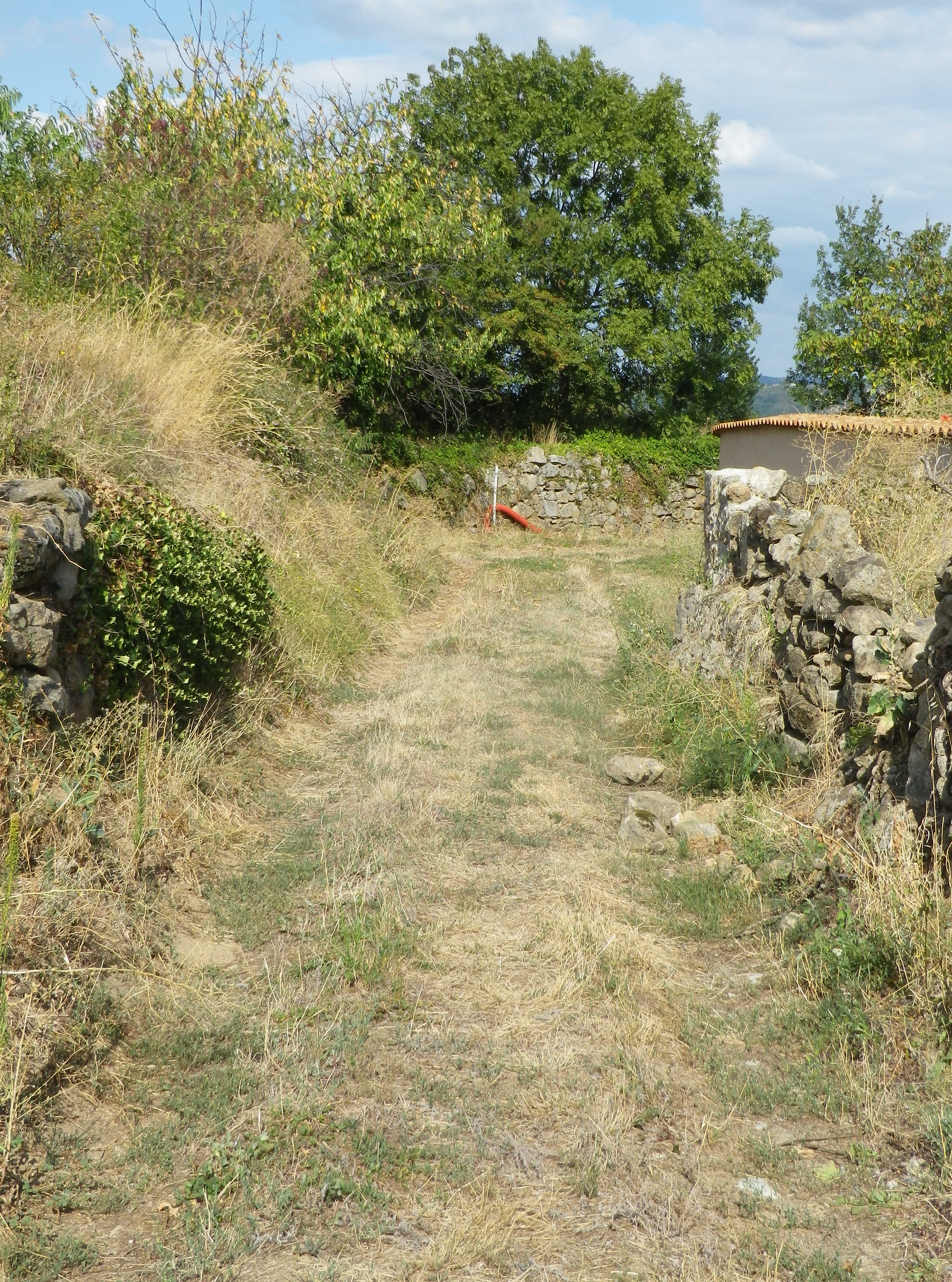
Herbolzheim-Wagenstadt: Kenzingerstr, Brechterstal, fields, vineyards, edge of forest, vineyards, Weingut Schaudt, Kenzingerstr, Ob dem Dorf, past the cemetery, vineyards, down a slope to trailhead.
Representative Trail Photos:
Restrooms:
None observed
Attractions on or near Trail:
None related to wine
Tasting along the Trail:
Three wineries are on the trail (but note hours), plus other wineries and taverns in the nearby towns Kenzingen and Malterdingen
Alternative Options:
Hiking: Nearby Ettenheim has the Weinwanderung Kaiserberg, a circuit similar in distance and landscape. See the Nutshell here.
Car: The Badische Weinstrasse, a car route of over 500 kilometers on mostly secondary roads, covers not only Wagenstadt, Bleicheim and Tutschfelden, but most of the wine villages and towns from Laudenbach, north of Heidelberg, to Weil am Rhein by Basel, Switzerland.
Additional Information:
Regional: https://www.schwarzwald-tourismus.info/schwarzwald/regionen/region-europa-park
Trail specific: https://www.alltrails.com/explore/map/rebhisliweg-wagenstadt
Comments:
Two trails actually, with a tiny bit of overlap, the Grosse, or long trail has red signage, and the shorter one (about 4.1 kilometers) has blue and yellow signage.
A pleasant trail, and I could recommend it for families with children of about six or seven and up.
The one grass covered surface section might not be mowed, which could be an issue in mid-summer. However, there are easily identifiable detours all around.
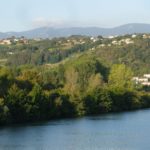
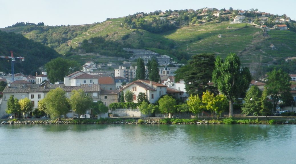
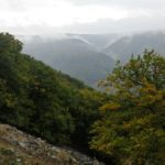
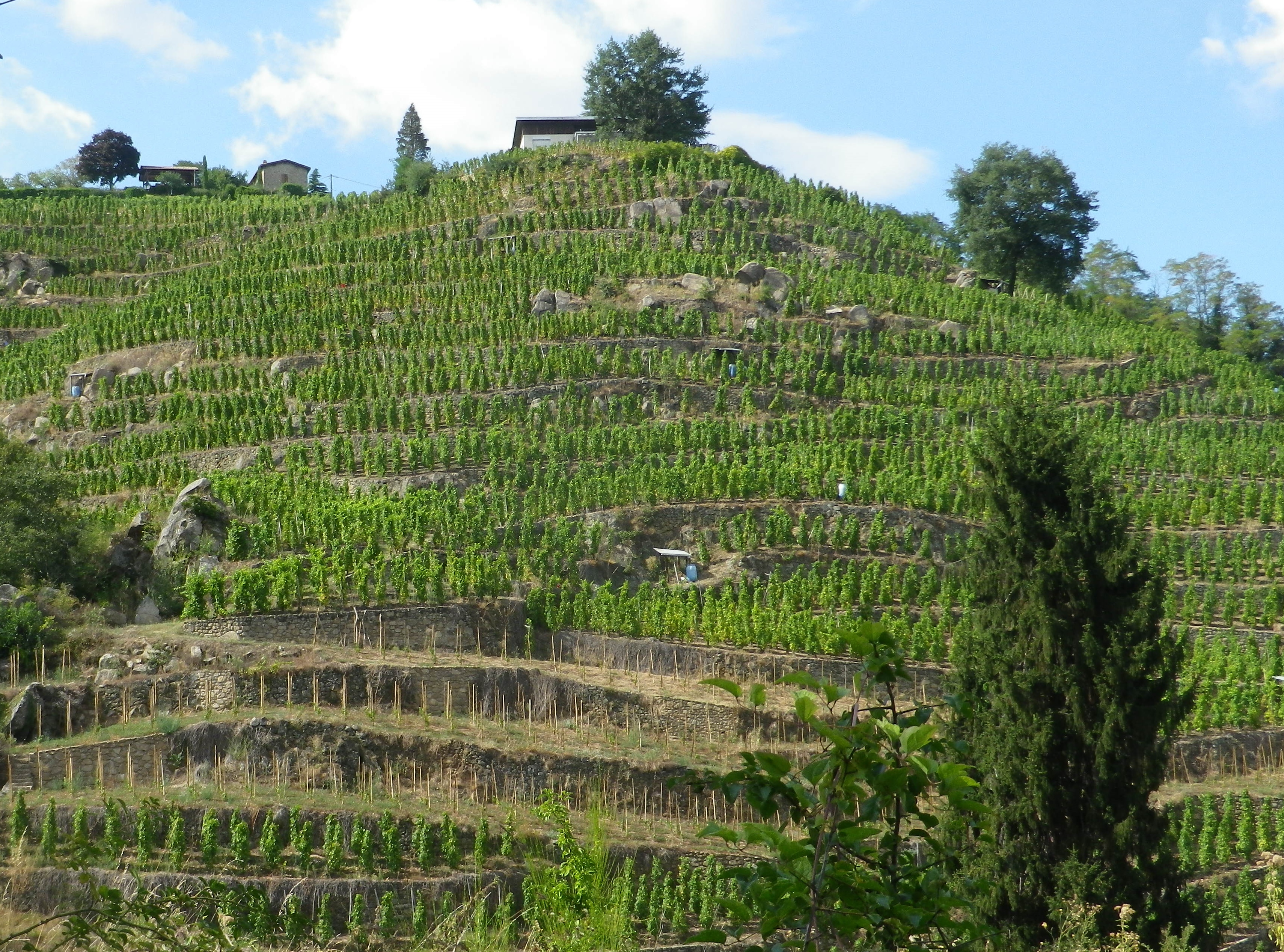
Condrieu, the cradle of Viognier, is a small town, as well as the name of an appellation devoted to Viognier. While the appellation stretches about 8 miles/12.5 kilometers south of Condrieu, I found a wine-themed hike through the villages of Verin and Saint Michel sur Rhone, circling Chateau Grillet, one of France’s smallest appellations (a bit over 8.5 acres), likewise devoted exclusively to Viognier.
Like these two appellations, the one nested completely within the other, the hike itself was small. (One map said six, another said seven kilometers.) Still, I considered myself fortunate to have found it, and to have hiked it, as Viognier is one of my favorite wines, and the opportunity to see the homeland of this varietal, to hike the hills where it is still grown after all these centuries, was fantastic.
In fact, I was in such a hurry to begin, that I parked along the Rue Nationale in Verin, and began there, as opposed to starting at the official start point in St Michel sur Rhone. I hurried north upriver to enter the old village center. Verin, like Saint Michel sur Rhone, is a small village. No industry apparently, just lots of vineyards. Still the old center is charming, a couple of narrow lanes, set along a stream that feeds into the nearby Rhone. Being able to hike again in the northern Rhone region along the river was another reason to be ecstatic about the hike.
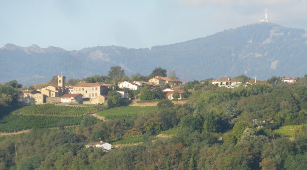
Once leaving the village, the trail begins a steady climb up a rather steep slope. The steepness of the slopes here, combined with their southerly exposition, is part of the reason the Viognier grape does so well here. This part of the trail was thankfully through woods. Occasionally, a tantalizing hint of the Chateau Grillet vineyards appeared, making my mouth water.
Completing the last push uphill to the hamlet of l’Ollagniere, the views began to open up. It was a peaceful spot high above the river, with more open fields, and fewer vineyards.
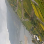
The first descent went through a small wood, and followed along a quiet lane into the village of St Michel sur Rhone. The stone church caught my eye, as did the large parking lot and restrooms. I saw one small inn with a restaurant, but not a soul in sight anywhere in this amble through the village. Leaving the center of the village via the cemetery, I reflected that at least there had been inhabitants in the village.
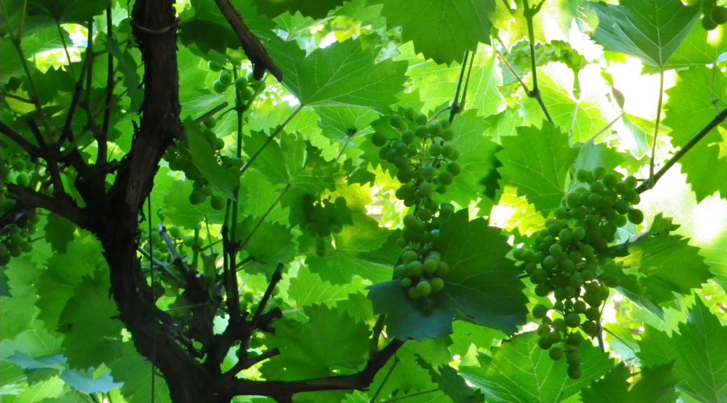
The second descent was certainly more punishing than the first, but rewarding for its passage through the acres of vines all growing Viognier! The loose granitic soil, and the well-worn rock surface it lay on only added to the challenge. But once the trail reached another wood, the going was easier. Meanwhile, the south and east facing views of the Rhone were amazing.
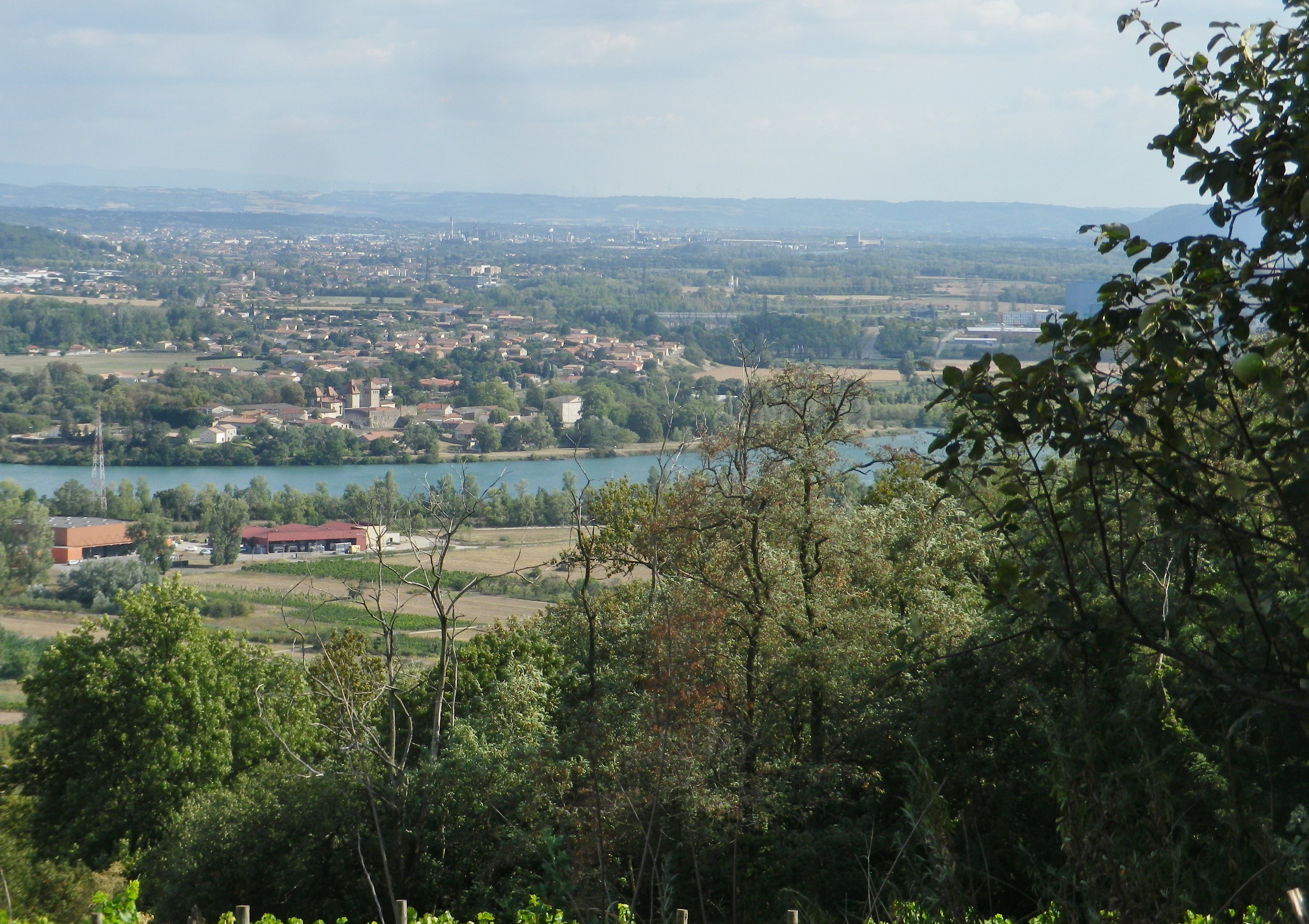
The trail along the river’s flood plain was easy. While not necessarily scenic, it was quiet, and flat, which is rare in this area. And from that perspective, it demonstrated how, in this section of the Rhone, the cliffs literally rise up suddenly. Heading north, the trail turned west, and within a quarter of a kilometer, I was hiking along the base of steep slopes. It was my last section of the trail, that ended following along the final vineyards on this hike. While they would be the last vineyards I saw while hiking, they certainly won’t be the last vineyards I savor from this hike!