Trail Name: Chemin du Vignoble
Trail Type: Long distance, two-stage bike trail from Martigny to Leuk (aka Loeche), in the Valais Canton in Switzerland; well-maintained and almost exclusively paved, but marking on the trail can be problematic in places.
Length:
Total – 83 kilometers/ 51.5miles
Stage One – 36 kilometers/22.4 miles
Stage Two – 47 kilometers/29 miles
Convenient to: Martigny, Montreux, or Sion, Switzerland
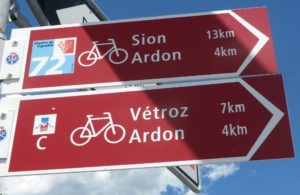
Marking: Red stylized grapes with 72 in white, on a blue square, on a red arrow.

Trail Description: A trail with a fair number of ascents and descents, some fairly steep, the route takes in tidy Swiss villages and towns and vineyards, along with dramatic Alpine scenery. While there are some dedicated bike paths, some of the trail follows town roads or agricultural paths. It is a bit challenging for those with biking experience, and in reasonably good shape; others should avoid and choose an alternative trail. See the possibilities identified below.
Trailhead:
Stage One – Avenue de la Gare, Martigny (train station)
Stage Two – Avenue de la Gare, Sion (train station)
Parking:
Plenty of paid garages or spots in Sion and Martigny. Free parking places are more difficult to come by, even is some villages. (Some spots are free on Sundays.) Caution: Some garages (at least in Sion) close during the evening and on Sunday, reopening in the morning or Monday. So check for hours!
Public Transportation Options:
Rail: Trains go down river hourly, from Leuk to Martigny (and even further to Lausanne and Geneva). The trains going up river from Martigny also depart hourly, and go to Leuk (the end of Stage Two), then Brig. Some train service for the municipalities along the route are on the other side of the river, in Charrat, Saxon, and Riddes. Check for hours at https://www.sbb.ch/de/fahrplan.html.
Bus: Not applicable
Suggested Stages:
Stage One – Martigny to Sion
Stage Two – Sion to Leuk
Trail Itinerary-Reference Points:
(Stage One Only, In Reverse, Sion to Martigny)
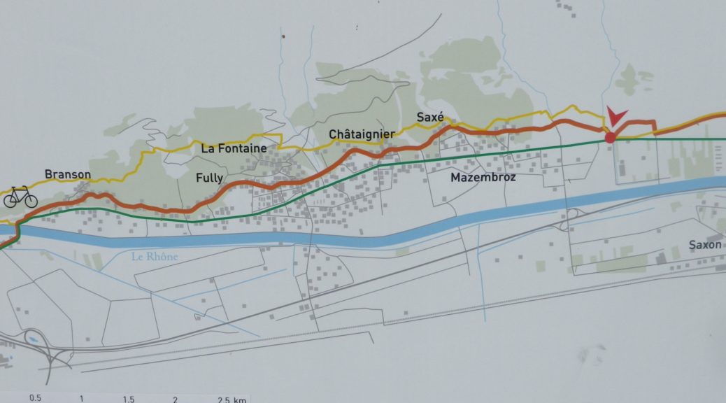
Sion: Rue (R) des Creusets-R des Erables, Chemin du Vieux Canal, R des Plantanes, R des Collines, Chemin des Amandiers, R de Gravelone, Chemin de l’Agasse, Route (Rte) du Sanetsch-Rte du Coteau, (At this point, on the actual trail, in the hamlet of Muraz); Muraz: Chemin des Romains, Route de la Muraz, Route de la Tournalette, Cross Route des Ballettes; Vuisse: Rte de Vuisse; Conthey: R (R) Centrale-Route (Rte) des Bailles-Rte du Bourg; Vetroz: R. des Vignerons, R de l’Eglise,Rte Cantonale/9; Avenue de la Gare (through circle), Rte de la Meuniere, Rte d’Ardon (start vineyards); Ardon: Avenue de la Gare, R du Nayat-R des Retsons, Avenue du Pont de la Roua, R des Euchettes-R du Bletsard, onto unnamed vineyard trail heading SW; vineyards; St Pierre de Clages: Rte de Merdesson, cross highway interchange; R de l’Eglise (Visit), R de la Portettaz, straight onto vineyard trail, R de Ravanay; vineyards, onto trail paralleling Rte Cantonale/9, under highway to River and Autoroute du Rhone, vineyards (a giant u); Leytron: Rte de Riddes, Rte de Praz de Feur, Rte du Stade (past stadium), Chemin du Levant OR Chemin du Proz de Mars, Rive de Salentse Est, Promenade des Berges (along river); Saillon: R des Marais Neufs, Avenue des Comtes de Savoie/Chemin des Ecoliers, dogleg right to Chemin des Amandiers, Rte de Gru; Chemin de Chenil OR go straight at the vintner hut)!, right onto unnamed road-Rte de Mazembre; Fully: Rte de Mazembre-Rte de Saxe-Rte de Chataignier, Rte du Chavalard-winds-R de l’Eglise-Rte de la Foret-Rte du Carre-slight right-R de la Colombiere-slight left-Rte de Branson, major traffic circle/bridge over river, right at sign for Martigny on unnamed road, under Autoroute du Rhone, to (not across), then along creek/canal; Martigny: R du Follaterres, R Marc Morand, Ave de la Gare (by a McDonalds)
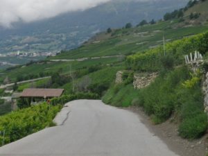
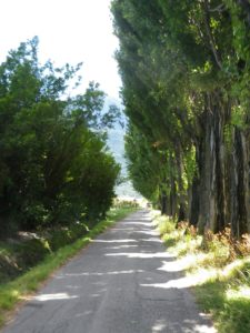
Representative Trail Photos:


Restrooms:
Sion – Avenue de la Gare x Rue de Lausanne (Note: None seen at the train station!)
Attractions on or near Trail:
Martigny/Plan Cerisier: Mazot-Musee, Switzerland’s smallest museum, housed in a mazot, a small, temporary dwelling for the vintners and their families while in the fields tending their grapes, with exhibits on viticulture in the region.
Fully: Musee du Savoir Faire Alpin (Museum of Alpine Know-How), with implements for vintners, as well as many other farming implements, and tools used in daily life in the Alps.
Tasting along the Trail:
Many vintners along the trail, especially in Fully and Vuisse to Conthey; There are a couple of wine bars in Sion, and a tavern or two in Martigny, should the wineries be closed (as they often have very limited hours in Switzerland).
Alternative Options:
Hiking:
A hiking route runs parallel to, and sometimes on, the same path as the Chemin du Vignoble biking trail. Also called Chemin du Vignoble/Stages One and Two (Trail #36) follow much of Stage One of the biking trail. It runs for 16 kilometers from Martigny to Saillon, and then 21 kilometers from Saillon to Sion. Note: Stage One is classified as medium, and Stage Two is classified as difficult.
Other, shorter hikes include: Martigny -Chemin des Vignes en Terrasses/Chemin du Vignoble de Martigny; Fully – Chemin des Vignes et des Guerites; Conthey – Parcours Viticole de Conthey;
Biking: Route du Rhone, Stage Four, follows the Rhone River, coming close to vineyards in Conthey, Vetroz, St Pierre, Ardon, Chamoson, Fully, Martigny. (The entire Route de Rhone trail has a total length of 350 km.)
Car: Route du Vignoble covers much of the same territory.
Additional Information:
Regional: http://www.valais.ch/en/destinations ; and for information on Valais wine: http://www.lesvinsduvalais.ch/
Trail (segment) specific: http://www.cheminduvignoble.ch/fr/chemin/ or http://www.veloland.ch/fr/itineraires/etappe-01018.html
Comments:
This corner of Switzerland is relatively easy to reach from the north and west. Once in the Valais, two other nearby wine regions await discovery: the Vaud region, and the Terrasses de Lavaux, described here.
Most of the trail is in full sun, when there is sun. In the early mornings, clouds or mists can hover just above the trail, obscuring views, but making for a more comfortable summer ride.
