All posts by admin

Climbing the Moselle Terraces


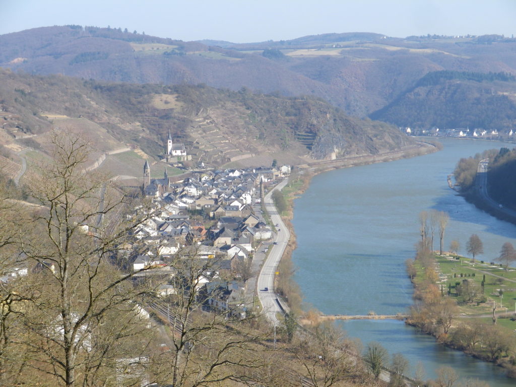
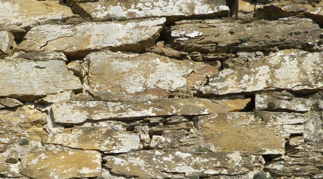
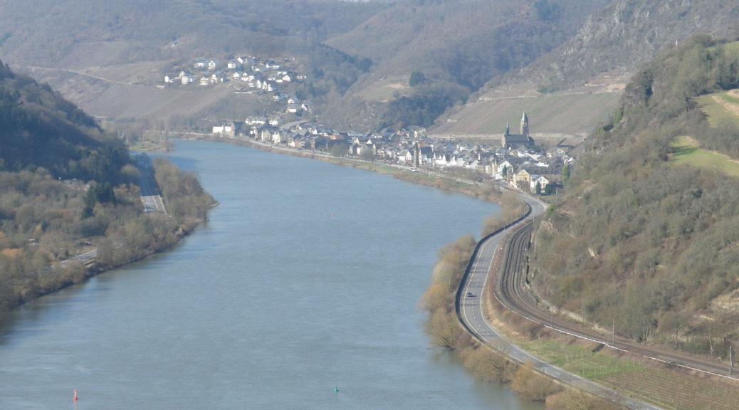
The Weinwetterweg circuit, if nothing else, promotes a new appreciation for viticultural workers on the Moselle. The “Terraced Moselle” is the name of wine district where the lower length of the Moselle starts, and serious terraces begin. This end of the Moselle twists and turns through the slate cliffs and outcroppings that line its sides. As it approaches the junction with the Rhine at Coblenz, the seemingly impossible-to-sustain vineyards appear between narrow river frontage, and high rocky promontories. This is the most spectacular part of the Moselle, and is well worth both a visit and a hike.

Hatzenport and the Rabenlay

Continue reading Climbing the Moselle Terraces

Wine Notes: Lower Moselle/Terrassenmosel


 What I Learned:

Germany’s important (and oldest) wine-producing Moselle River region has three wine districts along it – the Upper, Middle and Lower – beginning at the French-Luxembourg border, and continuing to Koblenz downriver. This post focuses on the Lower Moselle (Untermosel), also known as the Terraced Moselle (Terrassenmosel).

This district, north of Zell (with the famous black cat emblem), past Cochem and its imposing Reichsburg Castle, to the river junction at Koblenz with the Rhine, boasts some of the steepest vineyards in the world. It is home to the Calmont in Bremm, which has almost a 65-degree incline! Hence the need for the narrow terraces which dominate the landscape in the vine-bearing cliffs and steep hillsides of this district. In the village of Hatzenport, three named vineyard areas, the Kirchberg, the Stolzenberg and the Burg Bischofstein, are among some of the steepest vineyards in the district.

Continue reading Wine Notes: Lower Moselle/Terrassenmosel

WeinWetterWeg: Trail in a Nutshell


Trail Name: Hatzenport WeinWetterWeg

Trail Type: Mid-distance circuit; well-maintained, varied trail surfaces from rock, to scree, to grass and tarmac; excellent signage along the trail.

Length:

Total – 12 kilometers/ 7.5 miles

Convenient to: Coblenz, Cochem, Germany

Marking: A white rabbit and grapes, with directional arrow diagrams

WeinWetterWeg Signage

Continue reading WeinWetterWeg: Trail in a Nutshell

Dragon’s Blood Wine


Now encircled by stout walls, in the distant past the lands of Turckheim once faced a threat from a fierce foe – a dragon. Ultimately vanquished, the dragon’s blood spilled on the side of a hill, where its warmth and power rendered that soil very fruitful. Thus, both the town and its legend nowadays serve its tourism as well as its wine industry.

Turckheim is a compact town, running along the bank of a small river. Its walls back against the very hillside that has brought it fame in the wine world: The Brand. Rugged, covered in vines and topped by pines, it is very picturesque; as is the old town center, with its walls, gate towers and half-timbered houses. Fortunately, a hike dedicated to the town’s wines from its most famous cru, is available as well.

Porte de France, Turckheim

Continue reading Dragon’s Blood Wine

Wine Notes: Alsace Haut Rhin


What I Learned

Alsace’s Haut-Rhin (upper Rhine) area is particularly favored with great terroirs. Here, as elsewhere in Alsace, the harvests are primarily white varietals. The soil here is minerally, and complex, resulting in crisp, refreshing and uniquely flavored white wines. The six main white varietals grown in Alsace are Riesling, Silvaner, Muscat, Gewürztraminer, Pinot Blanc, and Pinot Gris. The only red varietal is Pinot Noir.

Continue reading Wine Notes: Alsace Haut Rhin

Turckheim et Le Brand: Trail in a Nutshell


Trail Name: Turckheim et Le Brand

Trail Type: Short distance circuit; almost exclusively paved or hard packed surface, well maintained, but the route itself is not specifically marked for this trail.

Length: Total: @5 kilometers/ 3 miles

Convenient to: Colmar, France

Marking:

Turckheim to Niedermorschwihr: Blue X

Niedermorschwihr to Turckheim: Yellow triangle

Trail Markings in Turckheim

Continue reading Turckheim et Le Brand: Trail in a Nutshell

Winter in Sommerhausen


The “Sommer” in Sommerhausen means summer in German, but there were no signs of it the day I was there. Dark, windy and spitting rain, as is normal in the winter here, it was a good day to follow the Weinsbergweg, the town’s trail devoted to its wines, along the slopes lining the Main River, about 8 miles south of Wuerzburg.

Town Center, Sommerhausen

Continue reading Winter in Sommerhausen

Wine Notes: Franconia’s Maindreieck


What I Learned

Franconia (Franken, in German) is one of Germany’s 13 wine regions. Within this region there are three districts. Two of the three follow along the Main, a peaceful, beautifully winding river that ultimately flows into the Rhine by Frankfurt. Three consecutive bends form a huge triangle of land, and the wine district along the river in this area is known as the Maindreieck (Main Triangle).

Continue reading Wine Notes: Franconia’s Maindreieck

Weinbergsweg: Trail in a Nutshell


Trail Name:  Weinsbergweg (incorporating the shorter educational Wein-Kulturweg) Sommerhausen

Trail Type: Short distance circuit; well-maintained and almost exclusively paved, (or with very hard-packed earthen surfaces), and with excellent marking throughout the trail.

Length: Total – 6 kilometers/ 3.75 miles

Convenient to: Wuerzburg

Marking: Snail, and White grapes on a green background, or on tarmac (see trail photo below)

Sign Wein-Kultur Weg


Another Sign for Weinbergsweg

Continue reading Weinbergsweg: Trail in a Nutshell