

Rhine River Valley

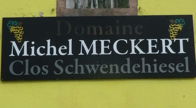
Gateway to Klevener de Heiligenstein


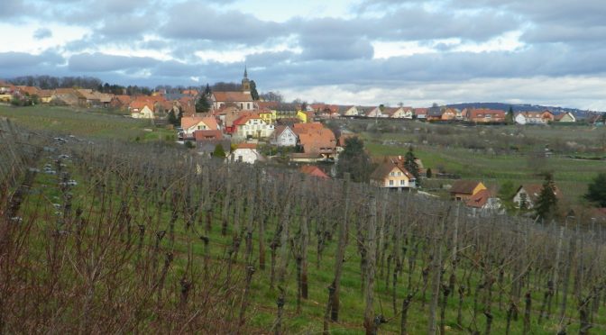
Heiligenstein Vineyards

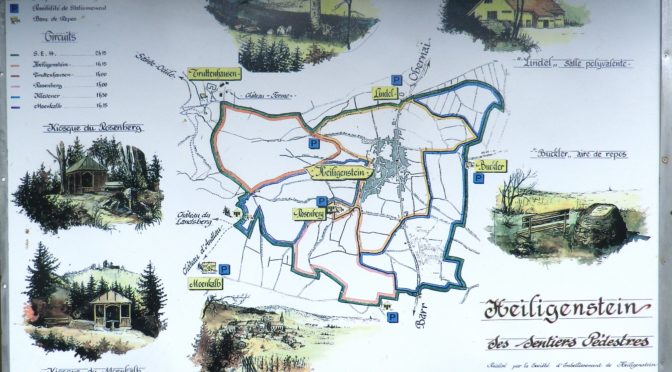
Village of Heiligenstein

Last Stop on the Trail


While not one of the more famous wine regions in Germany, the Hessische Bergstrasse region has a charm all its own. Only about 20 minutes from Heidelberg, a major tourist destination in its own right, with nearby vineyards falling within the Baden wine region, the Hessische Bergstrasse wine region is little known to visitors.
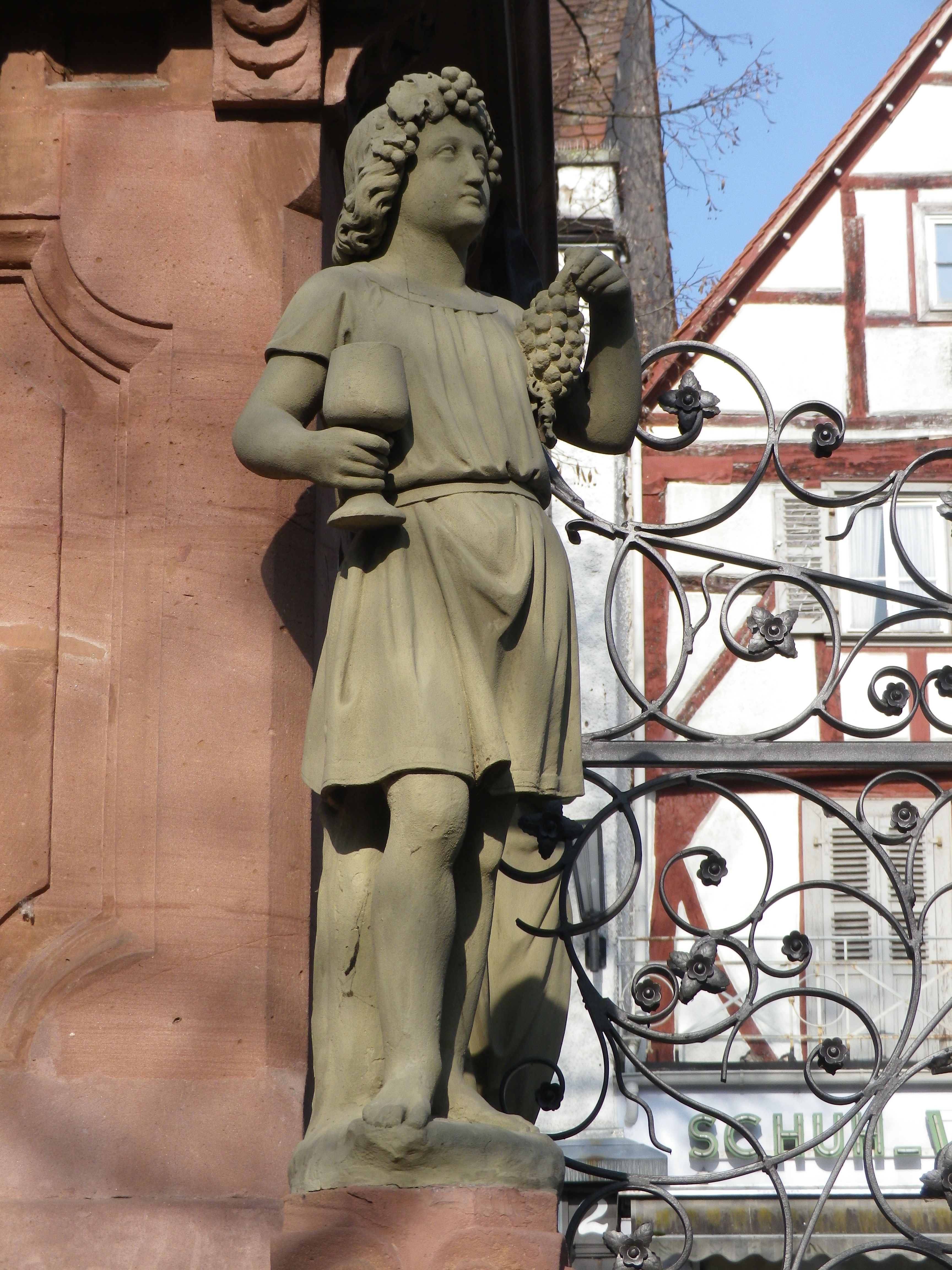
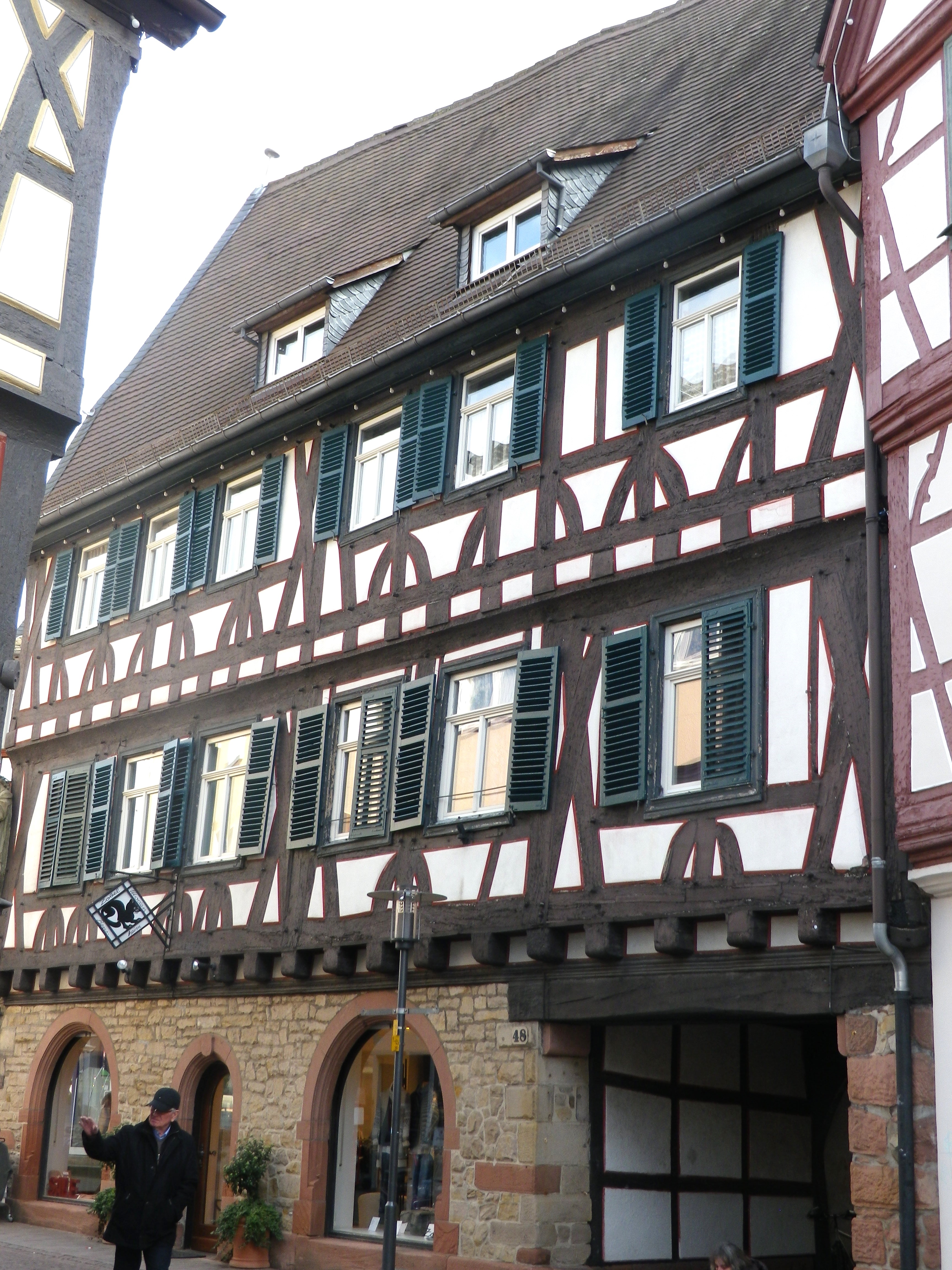
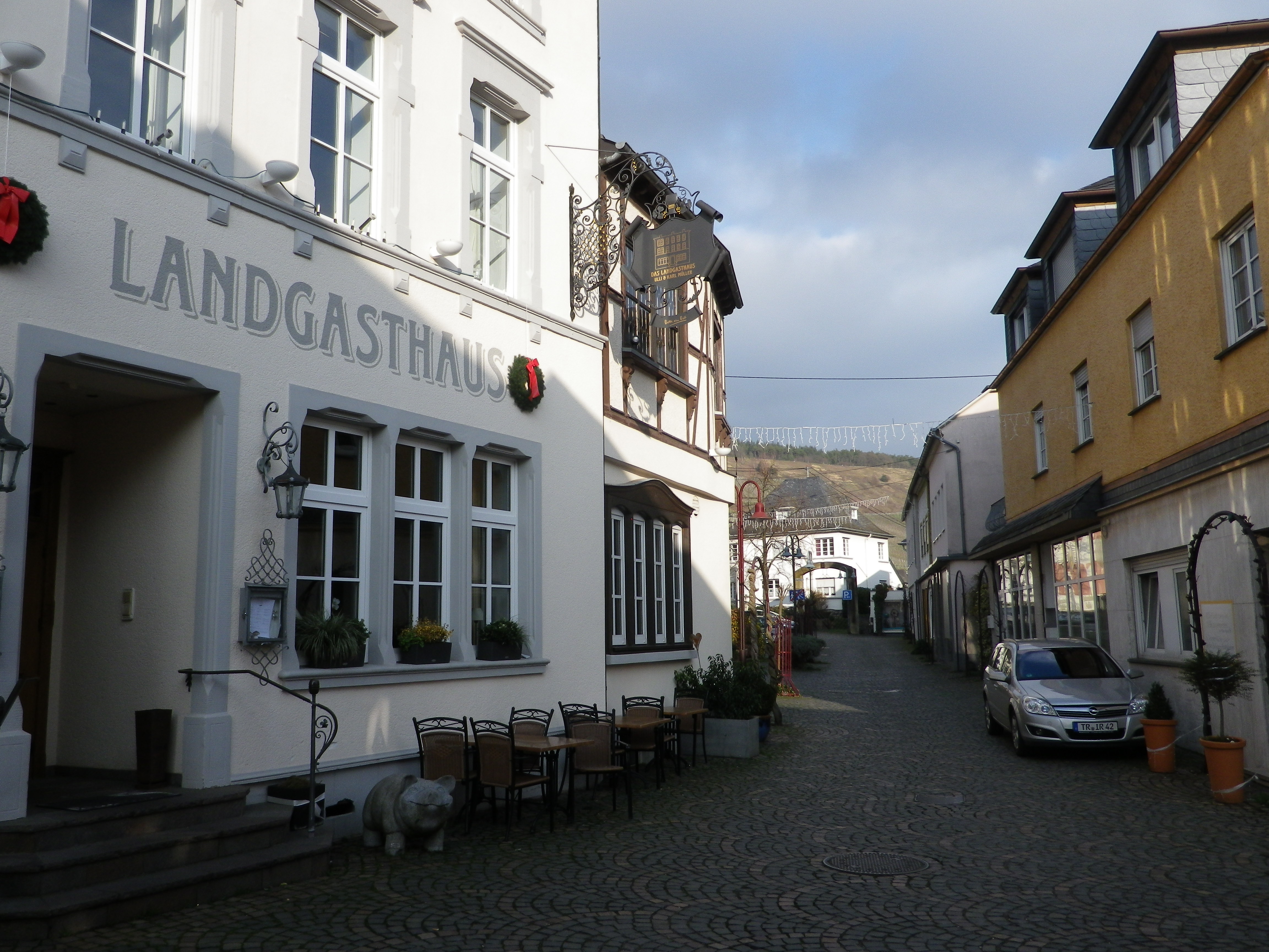
The wine town of Bensheim is but one of several small towns in this wine region, lined up like pearls in a necklace along the tourist road Bergstrasse. (So-called because it runs north to south along the western edge of the hills of the Odenwald forest.) Bensheim is also approximately the center of the Starkenburg wine district of this wine region. My trailhead for this hike was in the charming historic center of town. Filled with colorful half-timbered houses, and lots of architectural detail, it was a delightfully different way to begin hiking.
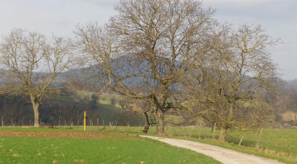
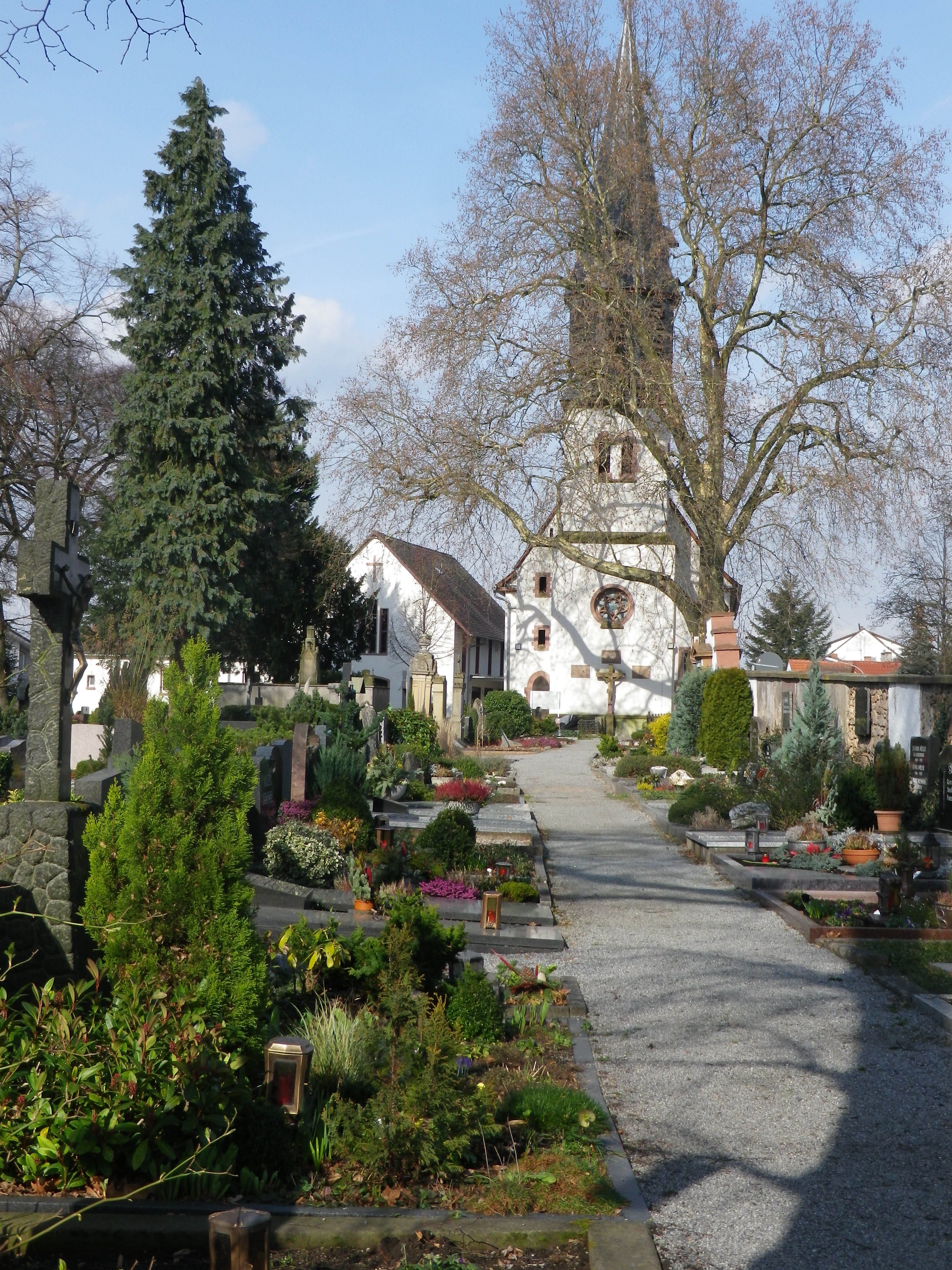
On reaching the outskirts of town, a church with a large cemetery appeared. A quick perusal of the area disclosed tidy, well-kept grave sites, each with distinctive stones. German cemeteries are interesting places to see at least once. Like Roman towns, gravesites were often found on the edge of town. (In fact, many German towns have a Waldfriedhof (a forest cemetery) in the town woods that form part of the township lands.) Now though, there are a couple of residential developments beyond it, but fortunately, the trail avoided those as led up the Hemsberg hill. Thus, the flat terrain of the town abruptly ends.
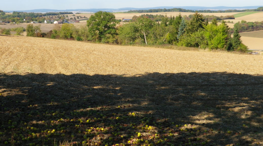
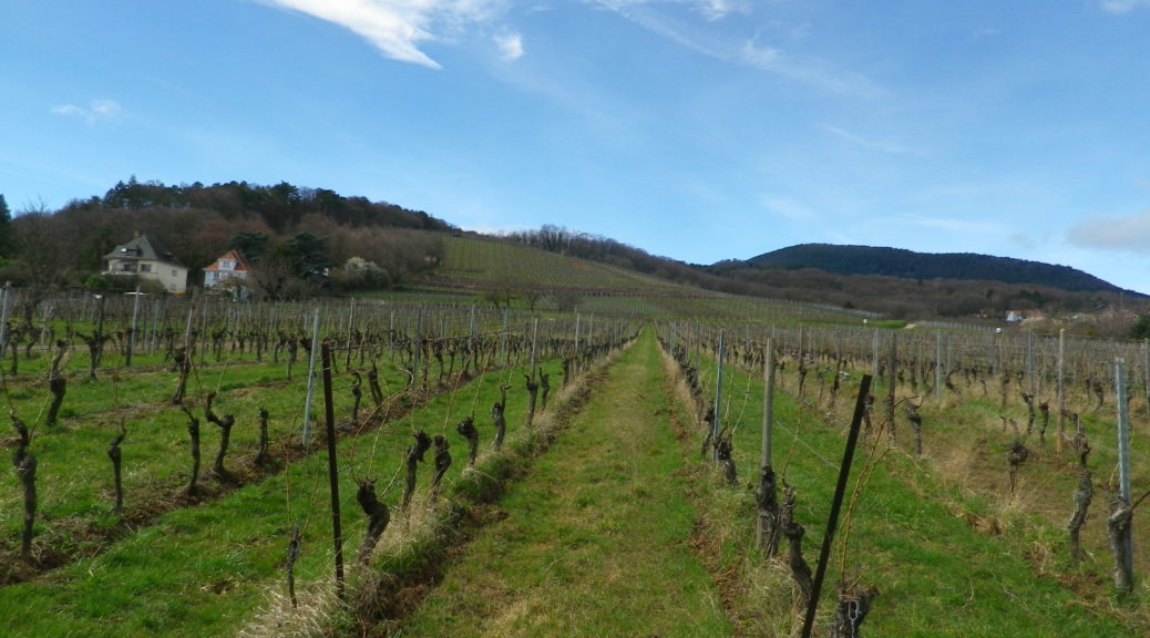
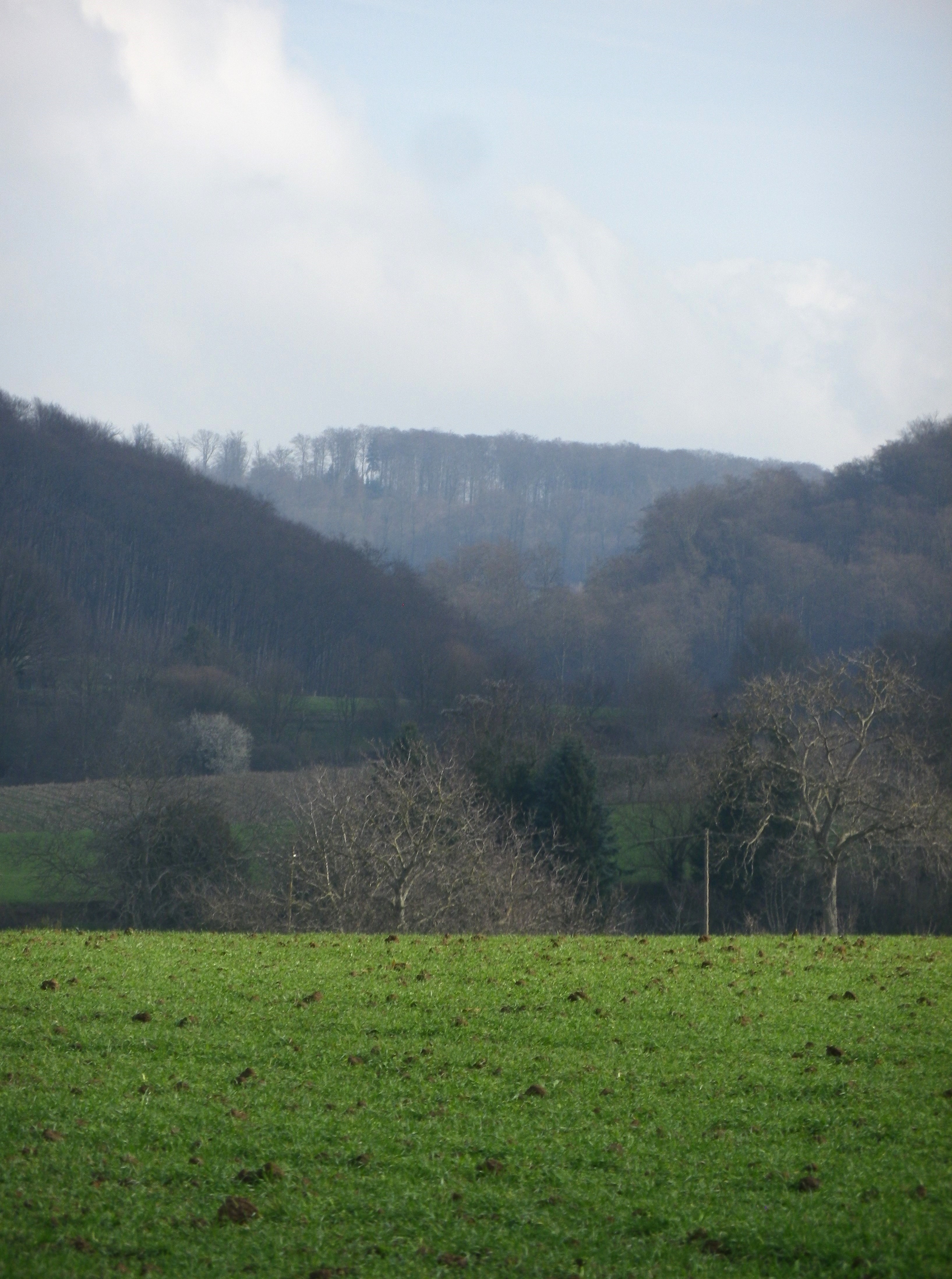
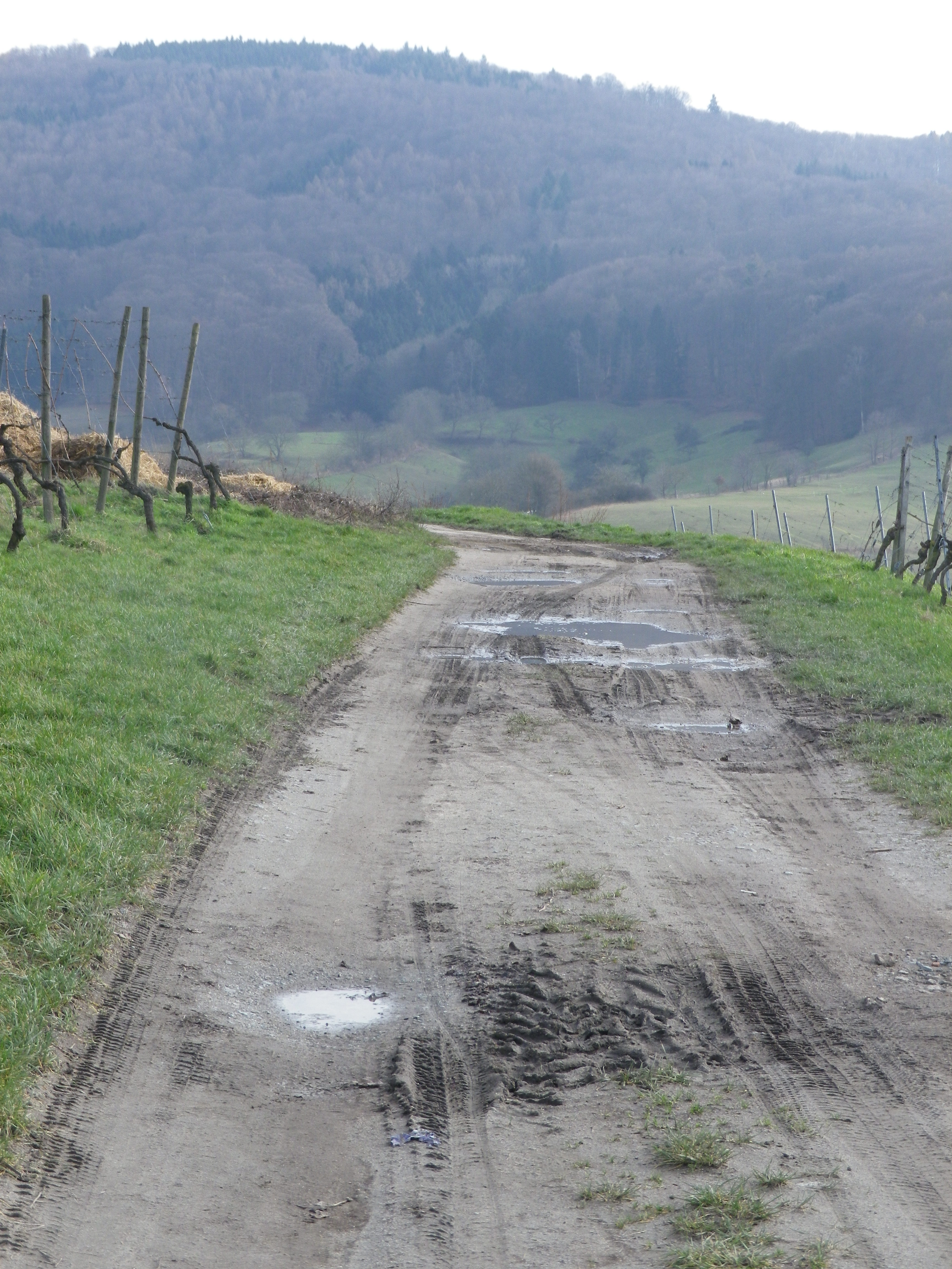
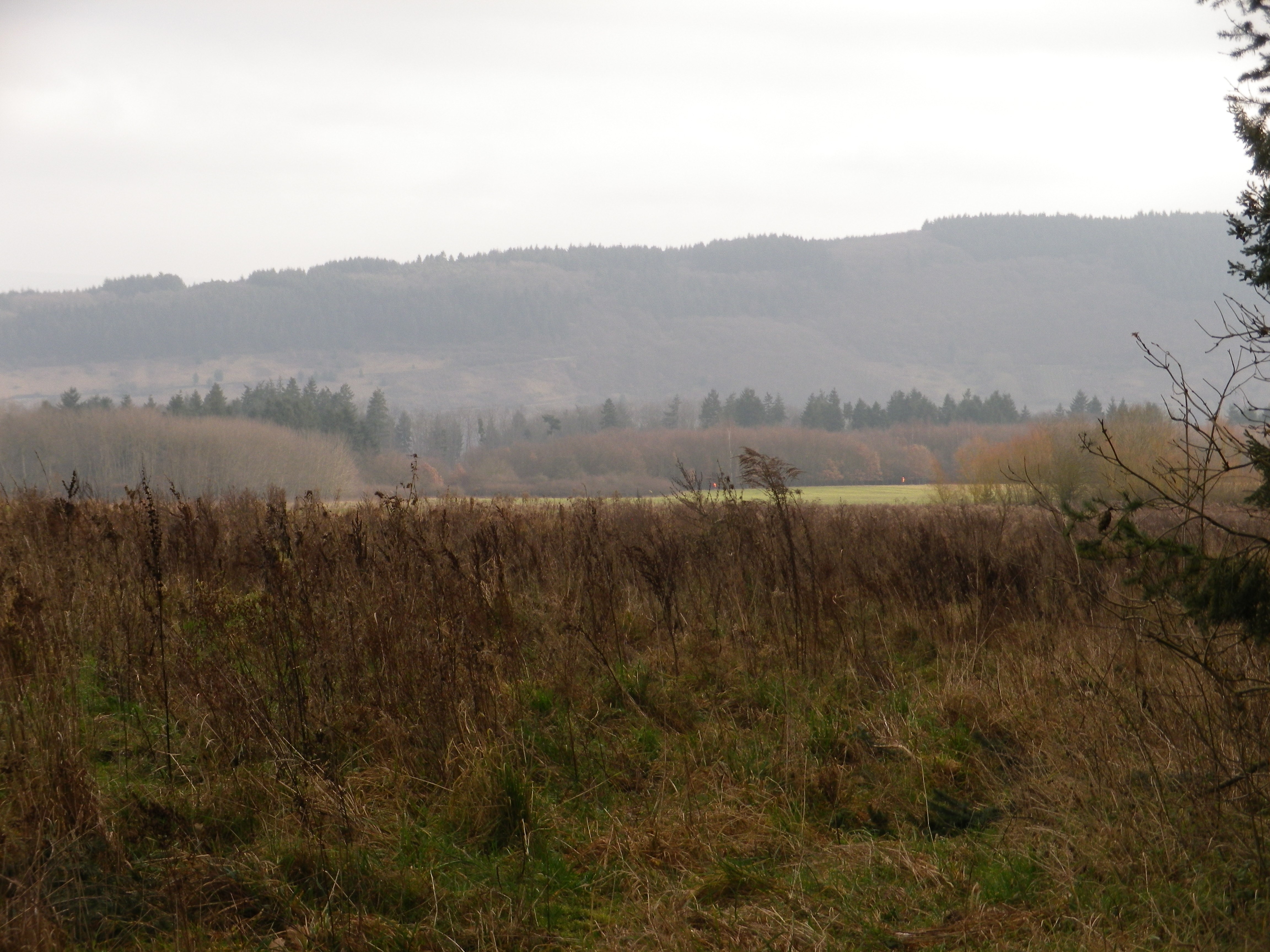
On the Hemsberg, the first of many vineyards began. While upon first entering the vineyard, the views over the Rhine Valley were impressive, once around the Hemsberg hill, the other hills stood out in dramatic relief. Looking east from the Rhine Valley, the hills often seem to be ridgelines. In reality, at least from the trail here, discrete peaks appear, giving the whole area a “hills and dales” character: Like a crumpled piece of tin foil upon which time and nature had intensified the effects.
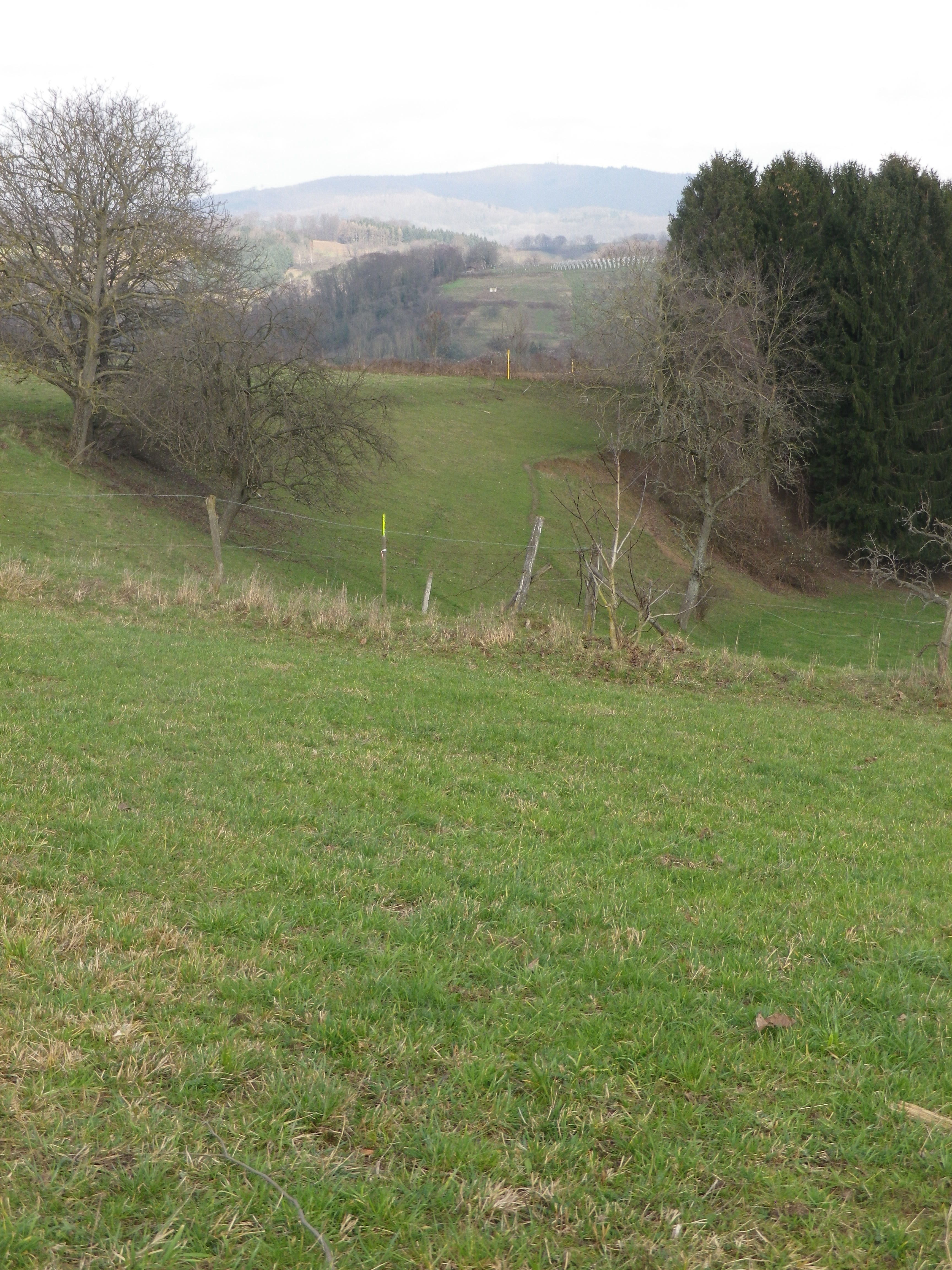
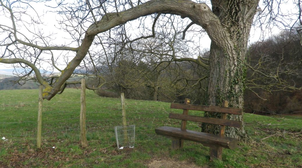
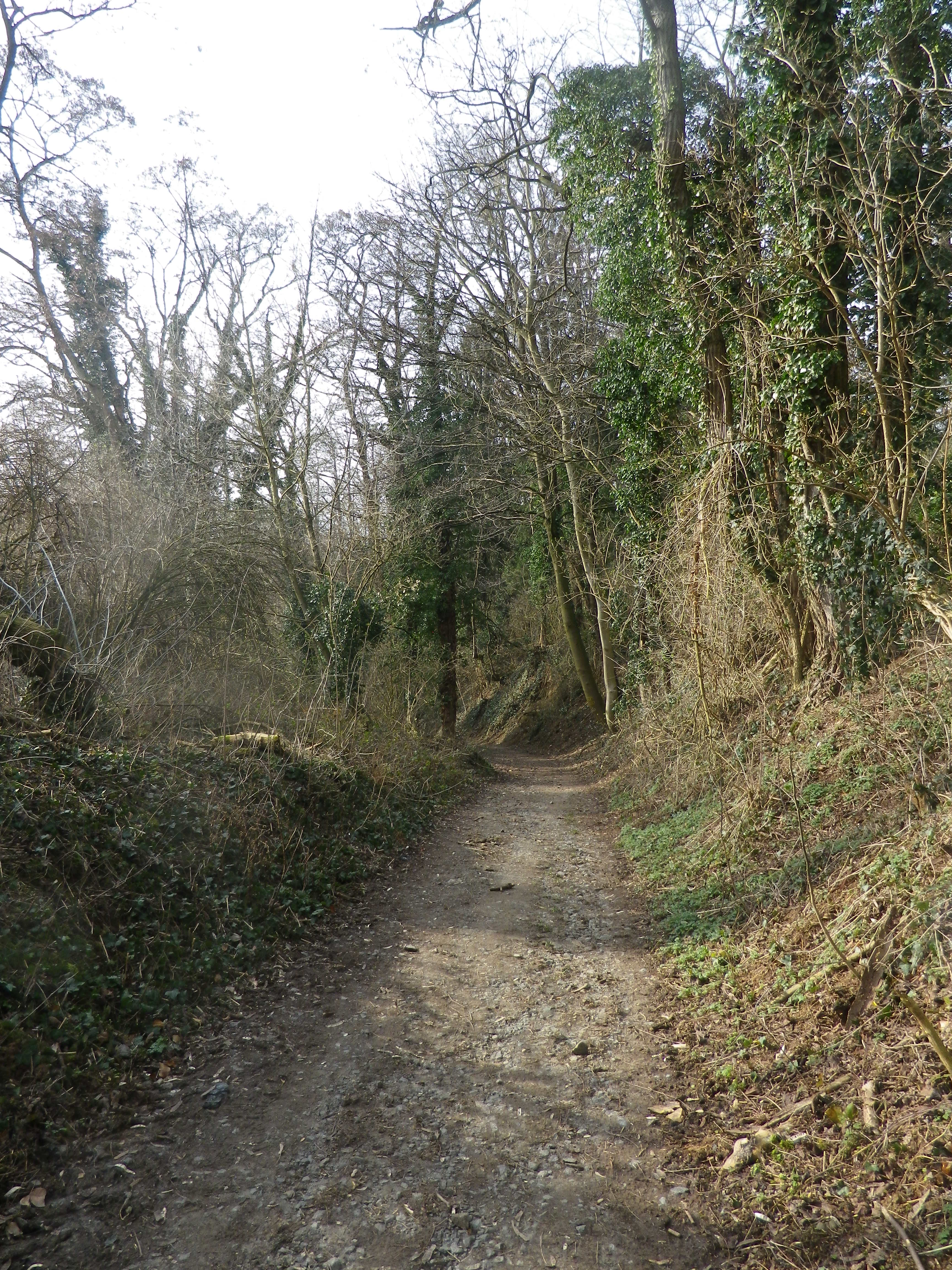
Upon leaving the vineyards, much of the rest of the hike passed through rural scenes: Fallow fields of undulating green, small copses scattered about, strips of brown furrows where the first plowing of the season had begun. Molehills rose before mountains which were tree-covered. Rivulets appeared, and disappeared into streams, the noisy music of water tinkling everywhere. Old trees, some sporting crowns of mistletoe stood as solitary sentries in backwater meadows.
Rounding the trail through Gronau, the trail headed back toward Bensheim. I entered a large woodland, filled with setting sunlight casting long shadows. It was another quiet interlude through nature that ended on a path following the Lauter stream. As trees lined both sides of the stream, it wasn’t until almost back into the heart of Bensheim, that I realized the nature-filled idyll had ended, and the charming town-scape had reappeared. Quiet and lively, idyllic and charming, up and down, the trail itinerary offered a lot to experience, to see, and to taste in this tiny section of the Hessische Bergstrasse.
What I Learned
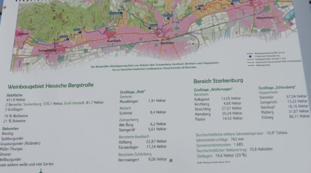
The Hessische Bergstrasse wine region is not very well known outside of Germany, in spite of the fact that it begins only about 25 kilometers/16 miles north of the well-visited city of Heidelberg. It is the smallest German wine region, and has only two tiny districts. The Starkenburg district falls between the towns of Zwingenberg, to the north, and Heppenheim on the southern end. The town of Bensheim lies about midway between the two. Bensheim itself is home to a well-known Grosslage, the Wolfsmagen. The Streichling, Hemsberg, Stemmler, and Paulus vineyard areas cover the hills south and east of the old town. Much of the Hemsberg and Paulus have nice exposure to the sun as it sinks behind the Haardt mountains in the Pfalz, on the western side of the Rhine River valley. The Kirchberg and Kalkgasse lie separately, on the northern side of the old town center. Thus, the Wolfsmagen Grosslage can claim almost as much as acreage as the total acreage in the Umstadt district, the other, northern, district within the Hessische Bergstrasse wine region.
The principal grape varietals grown here are Riesling, Grauburgunder, Weissburgunder, and Silvaner. Spaetburgunder is the only red varietal grown here in significant quantities, although, some Dornfelder may be found and used in wine blends.
What I Tasted
2015 Riesling, Bensheimer Wolfsmagen, Hessische Bergstrasse, Trocken, Qualitaetswein, Weingut Goetzinger: A dry white wine with light plus gold color, green apple and fresh cut grass nose, with green apple and fresh cut grass flavors, with a hint of smoke, tart finish with medium plus acidity.
2014 Riesling, Bensheimer Hemsberg, Trocken, Qualitaetswein, Bergstraesser Winzer: A dry white wine with medium-light gold color; talc and slightly floral nose; citrus flavors, some hints of vanilla, mild acidity.
Rotsekt, Cuvee, Halbtrocken, Weinkellerei Josef Mohr (Bensheim): A semi-dry sparkling red wine (mostly Dornfelder) with dark cranberry red color and fine bubbles; nose of spices, predominantly cloves, and red berry and spice flavors.
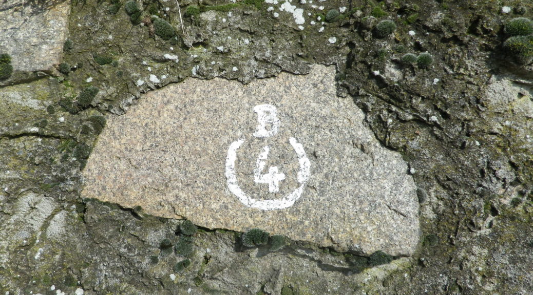
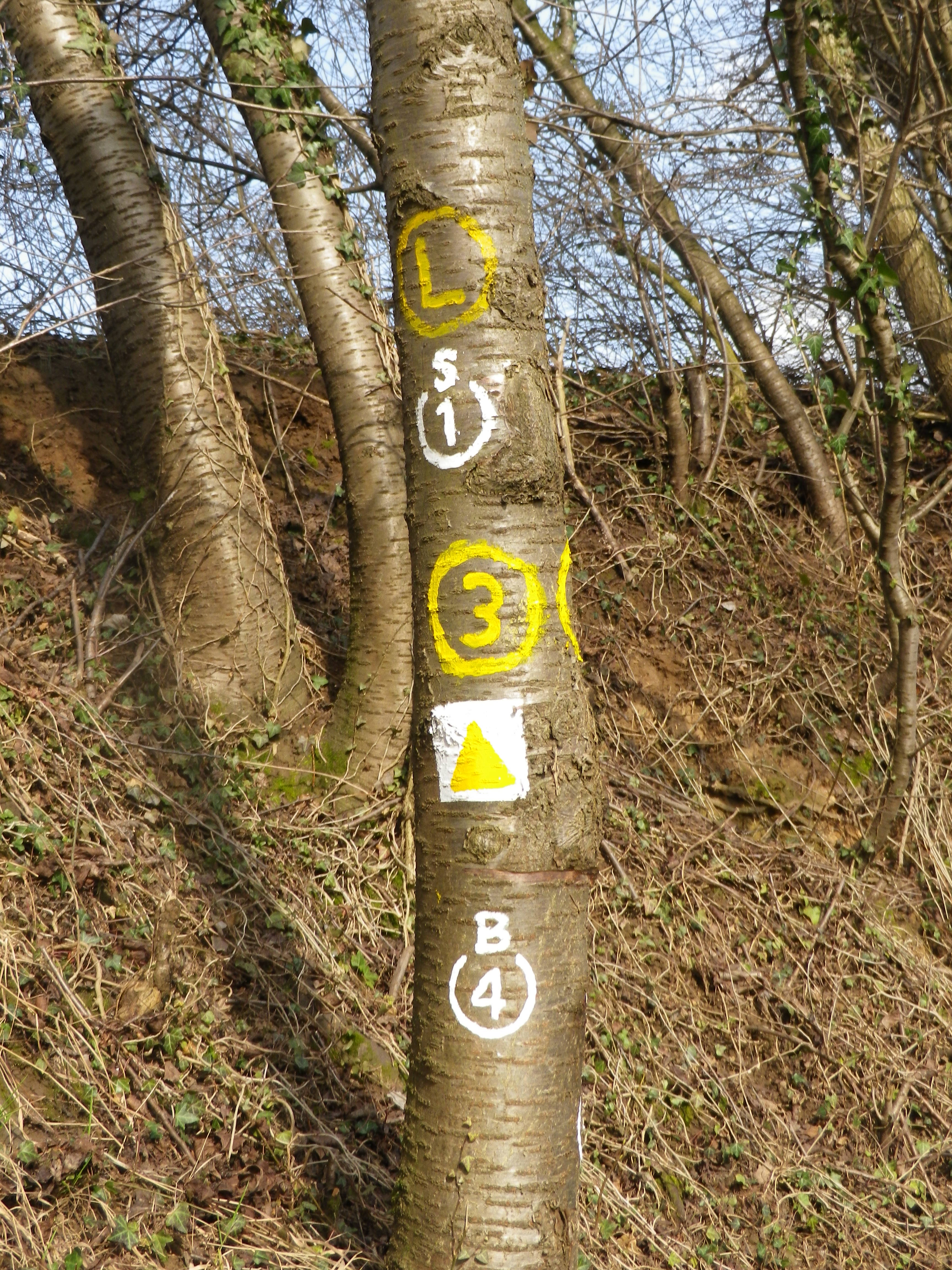
Trail Name: Lichte Hoehe, Weinberge und Waelder (AKA: (Benheim’s) B4, and Gronau Weg)
Trail Type: Mid-distance circuit trail; partly paved, otherwise hard-packed earthen surfaces, well maintained, route well marked in most places.
Length:
Total: 13 km/8 miles
Marking: B4, written in white letters on a number of surfaces. See the photos below and above.
Trail Description: A real rambler’s ideal: such a variety of landscape, vegetation, and views can be difficult to find along other short trails. Mostly easy, with a couple of mildly challenging ascents, this trail, proceeding from urban to fields and forests, and back, seemed miles from Heidelberg and the busy Rhine River Valley cities, but was quite accessible from them.
Trailhead:
Bensheim: B47 (Nibelungenstr) x Bassmannweg
Parking Possibilities:
Bensheim: B47 (Nibelungenstr) x Bassmannweg
Public Transportation Options:
Rail: Frequent trains from most major cities north, south and west of this town. Check Deutsche Bahn for details.
Suggested Stages: Not applicable
Trail Itinerary-Reference Points: (clockwise)
Bensheim: Hauptstrasse x Gebergasse, Friedhofstr, past the cemetery and church, Hemsbergstr- Hemsbergweg, follow toward Hemsberg, vineyards, fields to Gronau; Gronau: Steinfoerstweg, Maerkerwaldstr; follow signs toward Schoenberger Kreuz; forest, Nibelungenstr (and path beside the Lauter creek); Bensheim: Bleichstr, Augartenstr, pass Marktplatz, Hauptstrasse.
Representative Trail Photos:
Restrooms:
Bensheim: Haus am Markt, Marktplatz//Buergerbuero: Hauptstr 39//Bahnhof, in front of it
Attractions on or near Trail:
See Tasting notes below, reference Heppenheim.
Tasting along the Trail:
Bensheim: A couple of wine-makers in the town of Bensheim, several pubs/wine bars offering local wines.
Heppenheim: Nearby town has the Bergstraesser Winzer, a wine cooperative, wine shop and wine tasting lounge, where you will find lots of information about wines and wine-making in this area.
Alternative Options:
Biking: Winzer und Weinstuben Tour, an easy 19-kilometer long bicycle route passing vineyards, wine bars and wineries. See the Nutshell here.
Car: Ferienstrasse Bergstrasse, a 28-kilometer car touring route, includes Bensheim and many more towns, many of them wine producing towns, from Darmstadt to Heidelberg.
Additional Information:
Regional: https://www.bensheim.de/tourismus/touristinformation.html
Trail specific: https://www.bensheim.de/fileadmin/media/bensheim/06-Tourismus/Wanderungen-um-Bensheim.pdf (starting p. 32); AKA: Gronau-Weg
Comments:
The trail name says it all: An easy and very relaxing experience, in a little-known wine region.


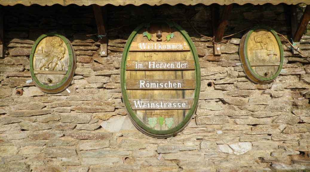
Along the Roemische Weinstrasse, that section of the Mosel where Romanitas arguably reached its maximum expression in Germany, there are many reminders of the era that once was, and what it became. For these two reasons alone, the hike along some of the best vineyards found in this stretch of the Moselle was a rewarding experience.
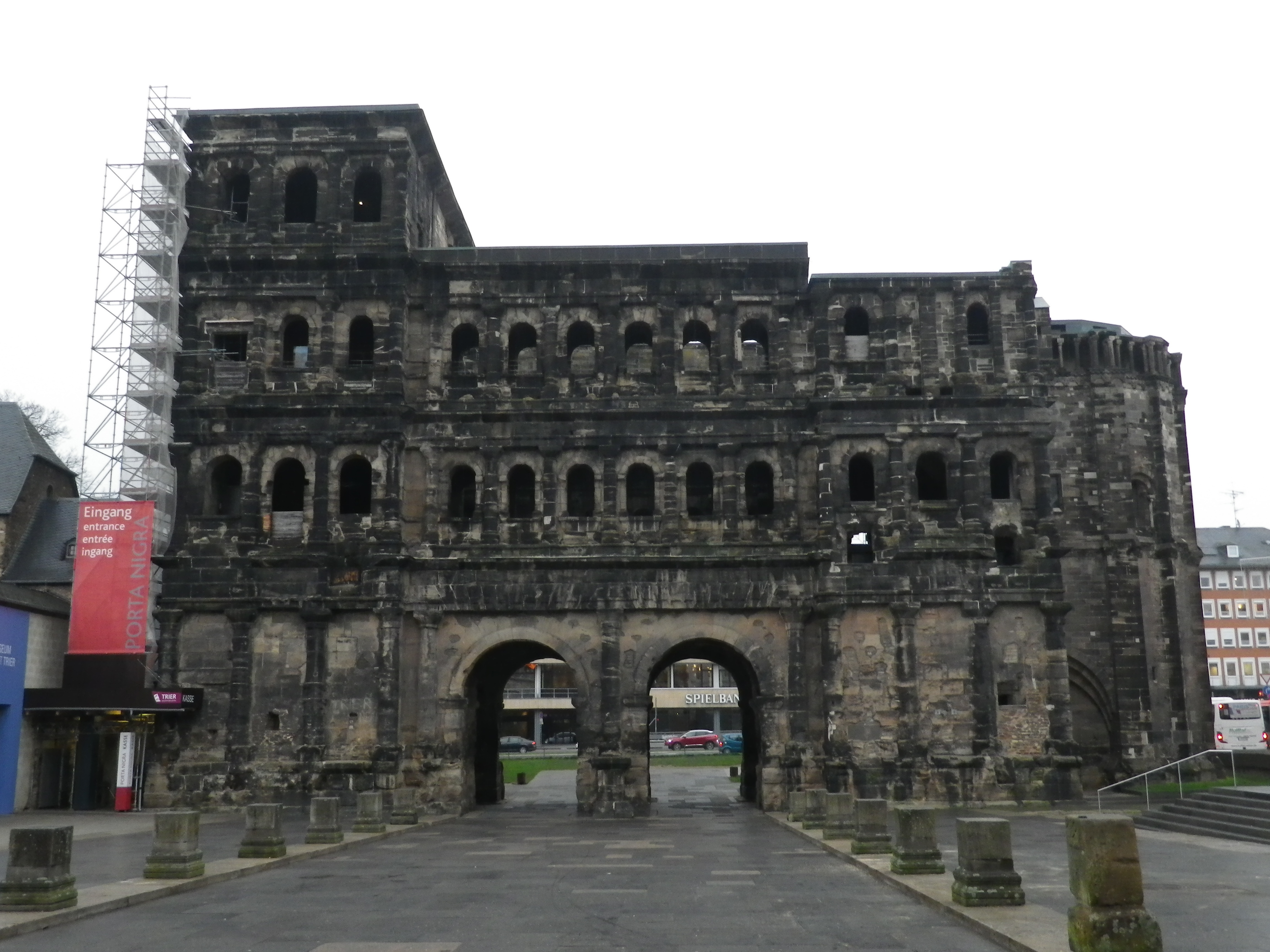
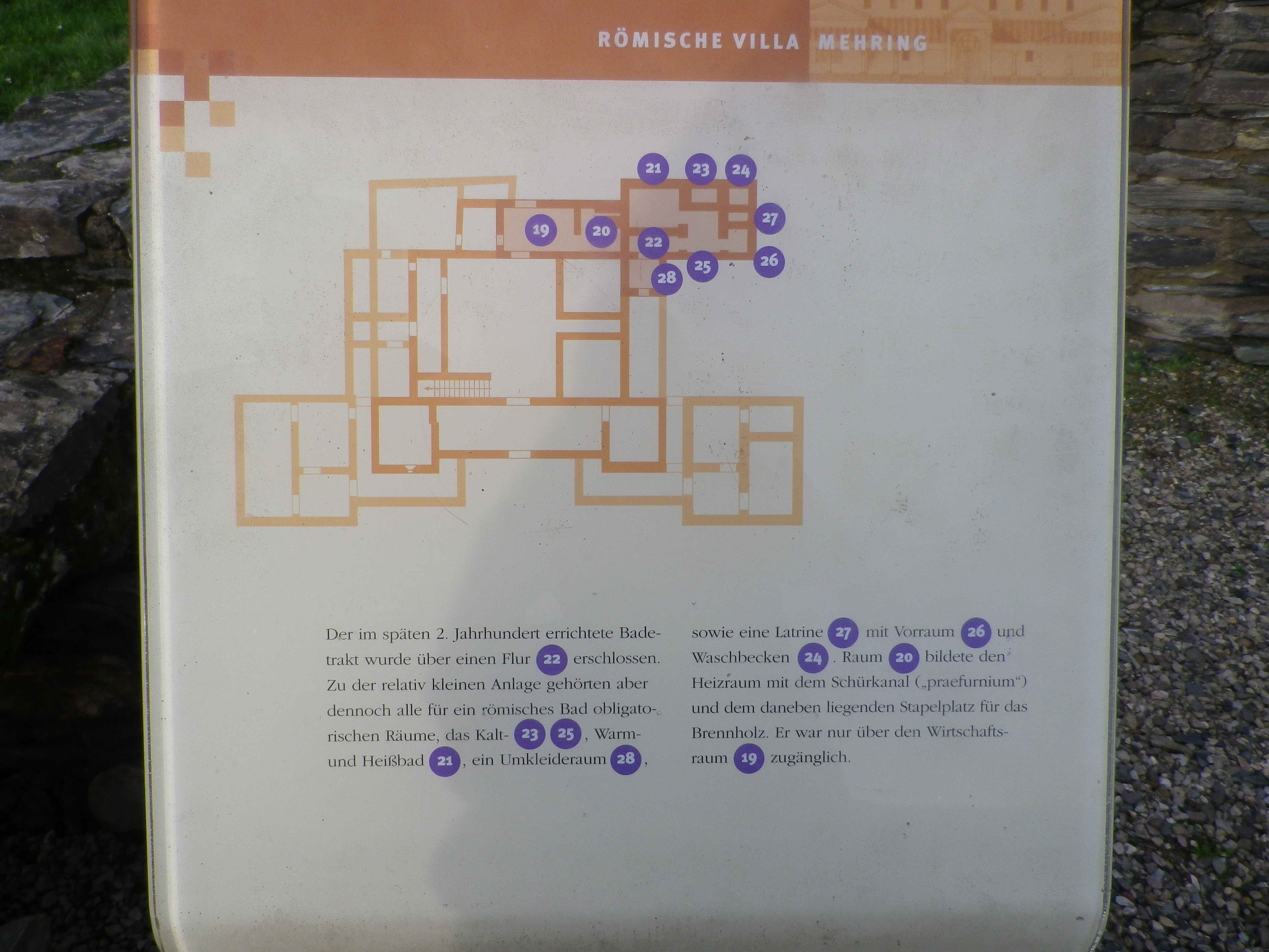
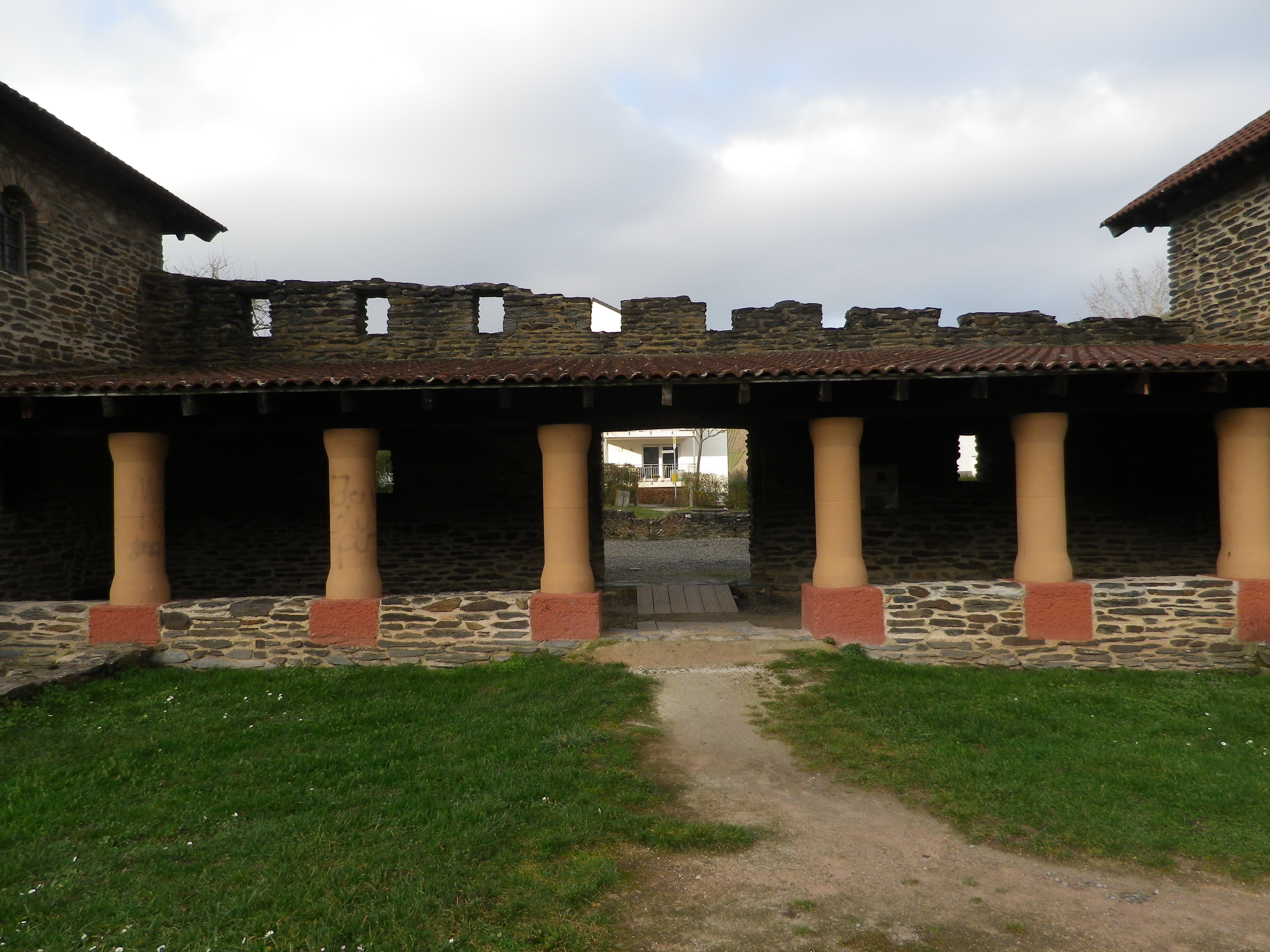
Trier, once the capital of the Roman Empire, is itself worth a hike through the city. A magnificent city gate (Porta Nigra), the basilica of Aula Palatine, an amphitheater, baths, a bridge, impressively show the former grandeur of this city. The nearby village of Mehring also boasts villa ruins dating to that era. In short, back in the day, this city and the surrounding countryside was the place to be. While neither place is as grandiose as it once was, that remains in this area is dedicated wine-making, and impressive views.
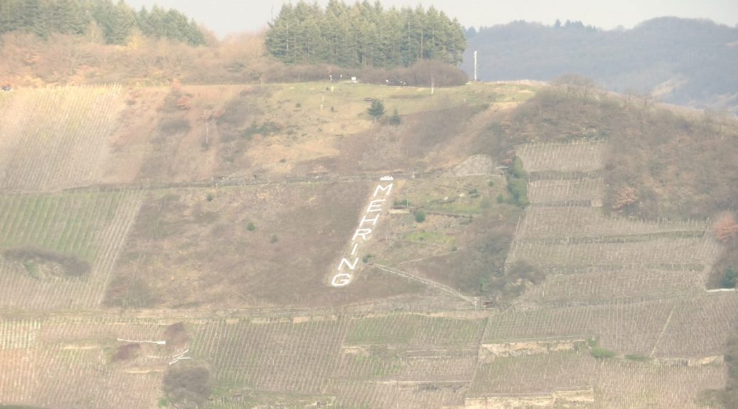
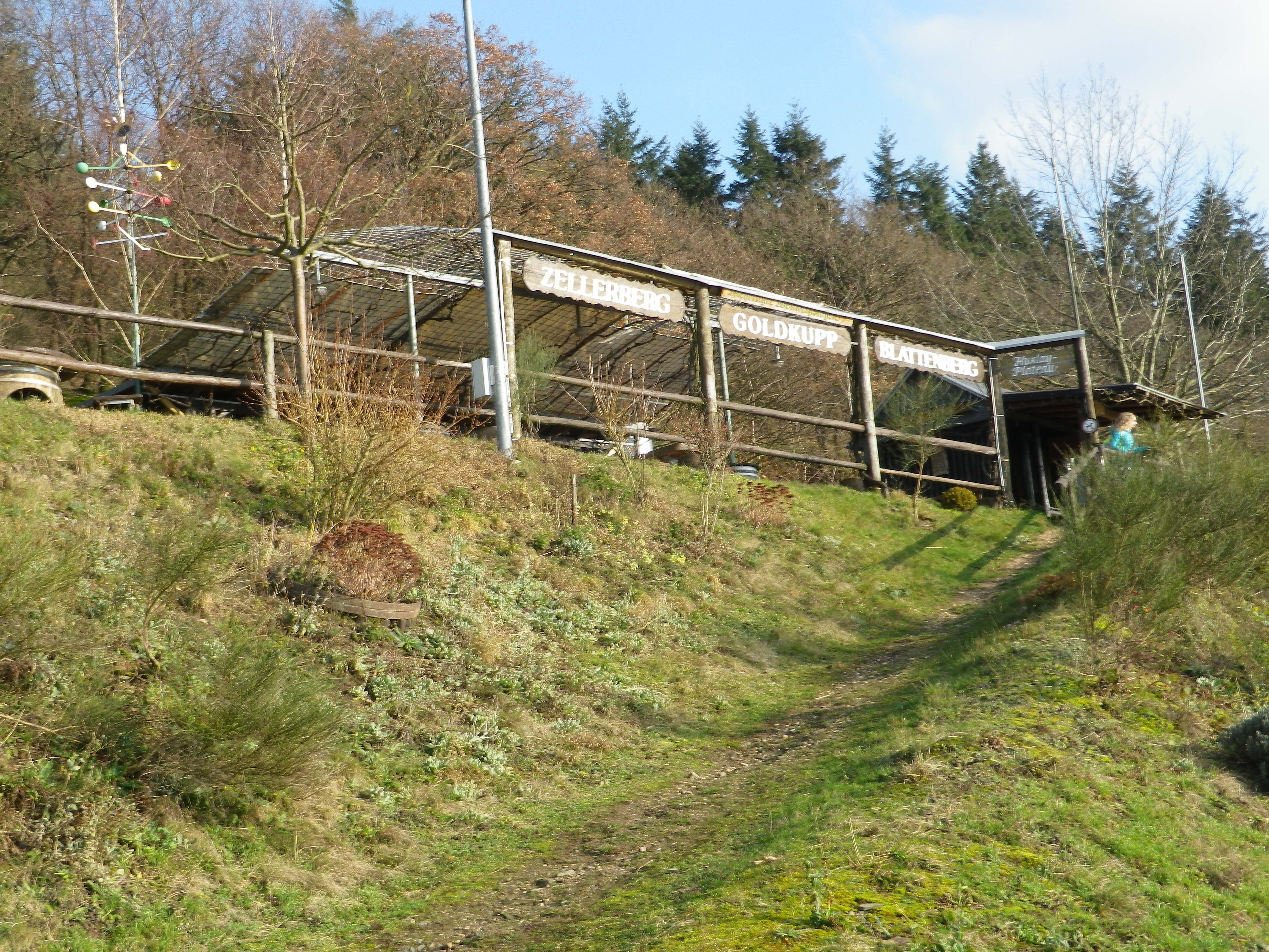
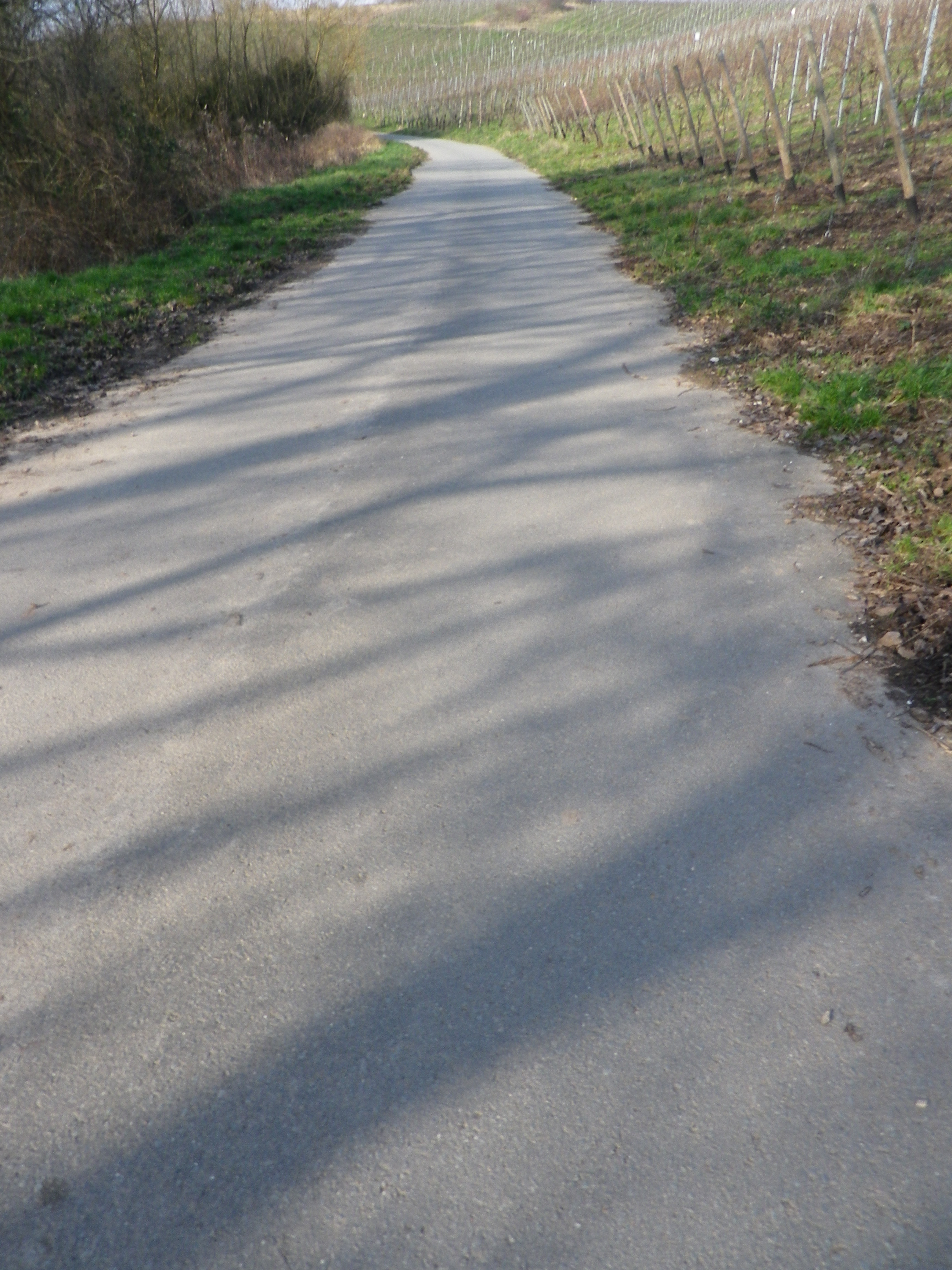
The circuit hike began in the center of Mehring, on the left bank of the Moselle, opposite the former villa. The circuit began with a climb up through the vineyards to the grill hut near the top. A great place to grill and enjoy the view, before continuing on up the hill heading beyond the Blattenberg vineyard toward the Goldkupp one. This is one of the most highly esteemed vineyards in the area, and with its steep slope, and southern exposure, it is favorably sited for vines! Undoubtedly, vines grew here during the Roman era as well.
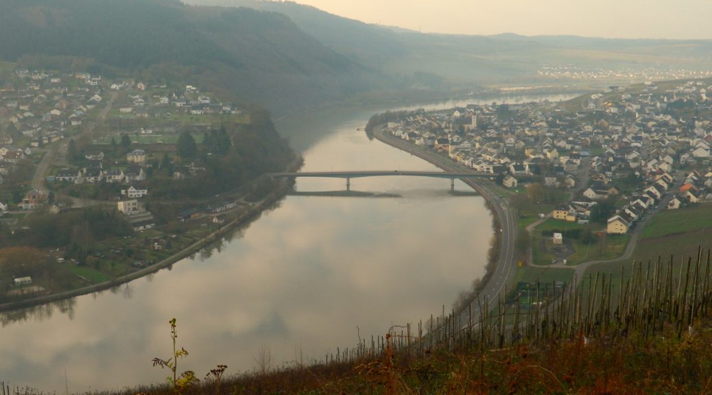
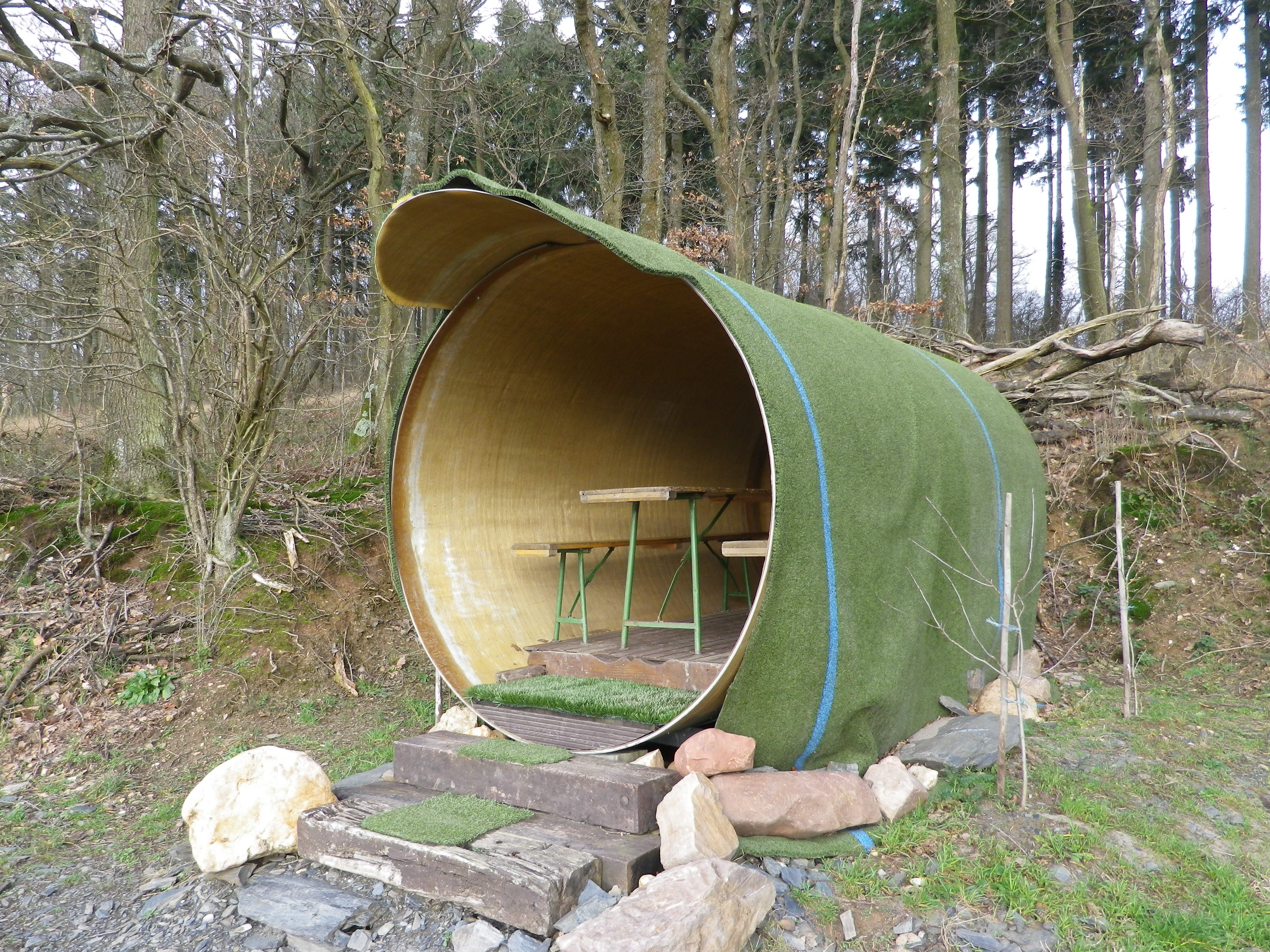
Soon I came to the 10,000 liter wine barrel. Converted into a picnic area, it offers nice views of Goldkupp. Being just above 500 meters below the Ortsberg peak, it also had great views of the river and the hills beyond. It was just possible to make out the Roman villa ruins on the other side of the river. Unfortunately, I had no wine to sip as I admired the views seated at the picnic table.
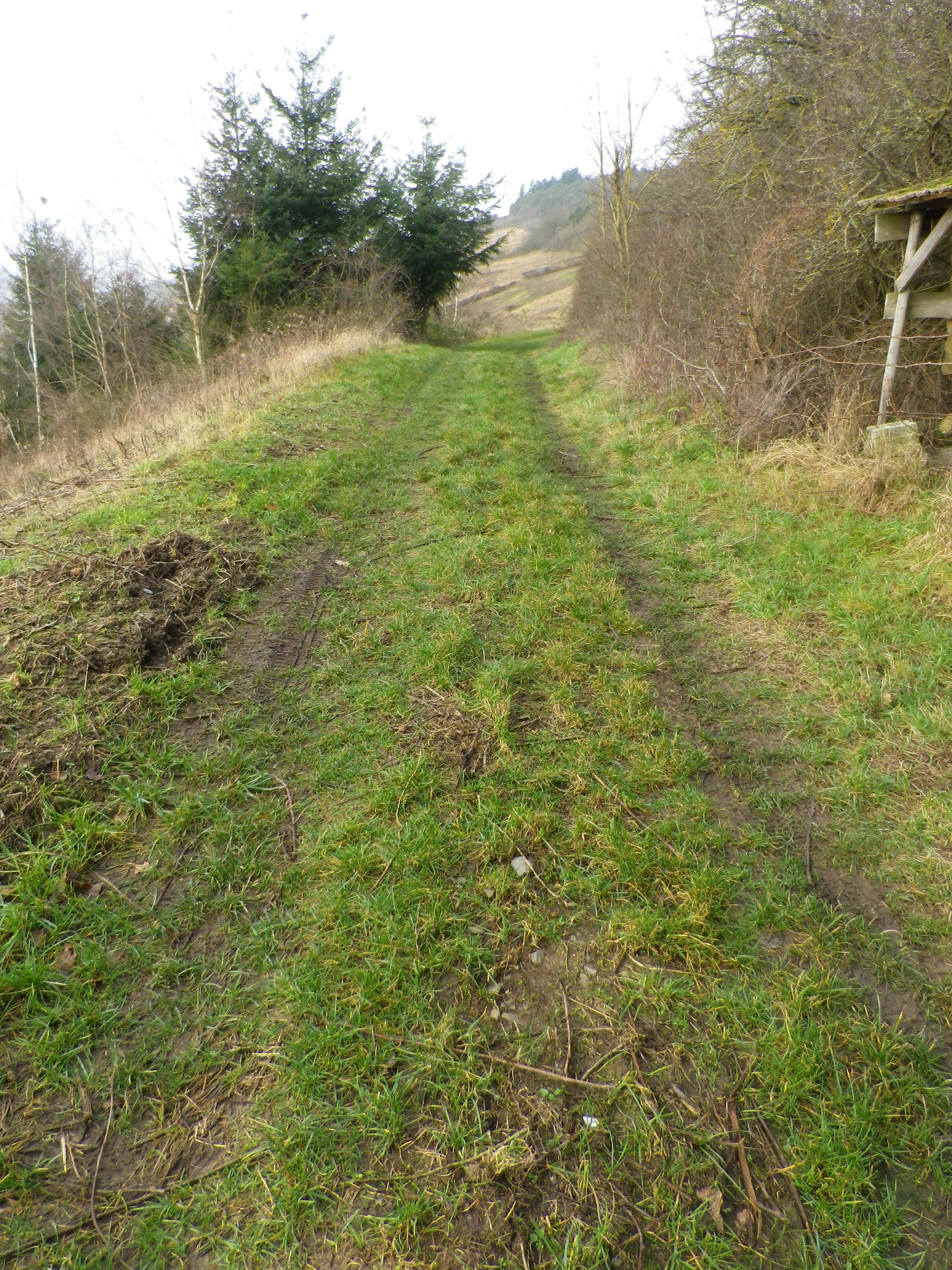
The trail then curved behind the slightly lower Hundsbuckel peak. One nice thing about this trail is that some of it passes through woods, along shady paths that in summer would be a welcome break. Between vines and woods were fields, marginal areas not suited for grapes. Vineyards appeared again on the lower reaches of the slope, just outside of the village. At that point, looking up at the vineyards served to illustrate just how much this village is devoted to wine, how the vines dominate it, as undoubtedly it has for centuries.
Passing back through the village center on the left bank, one is struck by how medieval it is. You can tell from the street layout. In the mid-eighth century, Charlemagne’s father donated the area to the Prum Abbey, and it then became their most important wine-making place, indicating that Frankish warlords, after taking control from the Roman administration, at least let things continue as they had under the previous administration. (Charlemagne himself, from his old Roman-era villa at Ingelheim, directed that grapes be planted opposite his villa, on the sunny slope, where the “winter snows first melted.”)
From the village center, taking a small detour to the river is advised. Or even more adventurous, cross the bridge to visit the villa ruins, always open, and worth a visit. From there, I admired the vineyards from afar, and contemplated the good life the owners must have had with their wines in their comfortable villa on this lovely stretch of the upper Moselle. Eons of time and generations of experience helped this lovely district evolve into what it now is, and nowadays it is certainly a place to be seen and savored!
What I Learned
The Mosel (Moselle)-Saar Ruwer Wine Region is a large one. The focus here is the wine growths directly along the Moselle River valley, which is classified into three sections: The Southern (Upper) Moselle area, the Bernkastel (Middle) Moselle area, and the Terraced (Lower) Moselle.
The Upper Moselle (in Germany) begins at the French border, at Perl, opposite the Luxembourg town of Schengen. It follows the river downstream. The soil here is characterized by shell limestone, marl and sediment. The slopes here are fairly gentle, and the Saar River joins into the Moselle at the edge of this zone. This area ends where it abuts against the Bernkastel (Middle) Moselle zone, around the city of Trier. The Ruwer district joins the Moselle above Trier, then the Bernkastel zone begins again by Kenn, and continues uninterrupted almost reaching Zell (Mosel). Most visitors begin their Moselle visits at Bernkastel-Kues, and follow downriver to Zell and Cochem, even to Koblenz on the Rhine, thus missing this southern Bernkastel area completely. In this middle district, I mostly focused on wines from Mehring, and its well-known Goldkupp and Zellerberg vineyards. The area around Trier (famous for Karl Marx and the Romans), produced some interesting wines as well. This is where Roman history and great wine terroir combine to create a compelling experience for wine tourists.
What I Tasted
2017 Riesling Spaetlese, Mehringer Goldkupp, Trocken, Praedikatswein, Weingut Sebastiani (Mehring): A dry white wine with medium minus gold color; floral, mineral nose, with spice mustard, slight turpentine, and fruit flavors, medium plus acidity, with a tart finish.
2017 Riesling, Mehringer Zellerberg, Hochgewaechs, Halb-Trocken, Deutscher Qualitaetswein, Weingut Sebastiani: An off-dry white wine with pale plus gold color; a slightly mineral nose, with green apples, and green gooseberry flavors.
2017 Riesling Auslese, Mehringer Goldkupp, Trocken, Praedikatswein, Weingut Sebastiani: A sweet white wine with medium minus gold color; a ripe, fruity nose, with ripe peach and apricot flavors; mild acidity, and well-balanced overall.
2017 Weissburgunder, Mehringer Zellerberg, Trocken, Deutscher Qualitaetswein, Weingut Sebastiani: A dry white wine with pale gold color; a slight nose of fruit, and green apple flavor, with a hint of minerality; Medium acidity.
2016 Dornfelder, Auf Schock, Trocken, QbA, Weingut Jutta Fassian (Mehring): A dry red wine with dark garnet color; cherry nose with a hint of tobacco, cherry, pipe tobacco and oak flavors; soft, mild tannins, smooth finish, with a velvety mouthfeel.
2016 Riesling, Trierer Sankt Mattheiser, Hochgewaechs, Feinherb, Qualitaetswein, Weingut H. Wahlen (Trier): An off-dry white wine with light gold color, fruity and mineral nose, with floral and ripe peach flavors; medium acidity, smooth, sweet finish.
2015 Spaetburgunder Rose, Halb-Trocken, QbA, Weingut Longen-Schloeder (Longen-Longuich): An off-dry rose with a light cranberry color; slight red berry and floral nose, with red berry and vanilla flavors, hint of stone-mineral; smooth finish.
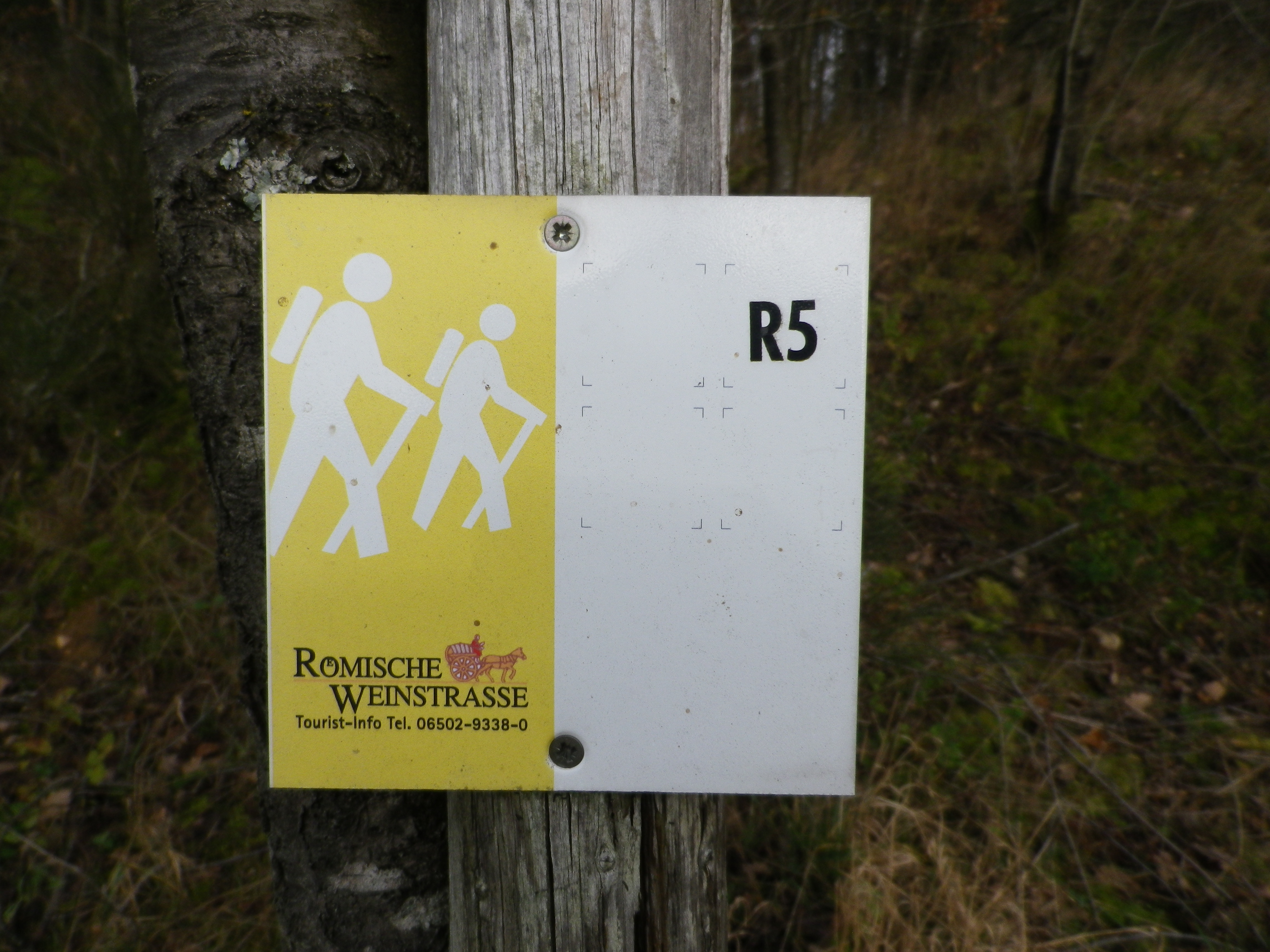
Trail Name: Roemische Weinstrasse Mehring R5
Trail Type: Short distance circuit; well-maintained and almost exclusively paved, marking on the trail mostly good
Length:
Total – 9.8 kilometers/ 6.08 miles
Convenient to: Trier, Germany
Marking:
White and yellow metal square with lettering R5 in black, stylized hikers; and/or directional arrows with trail number on posts
Trail Description: An easy circuit, suitable for most families, that traverses vineyards, pastures, and copses, and passing through Mehring’s village center. While there are plentiful rest spots, snack/bar establishments, and hiking huts to picnic in along the trail, you will want to spend your time admiring the bird’s eye views of the Moselle, and the surrounding hills.
Trailhead:
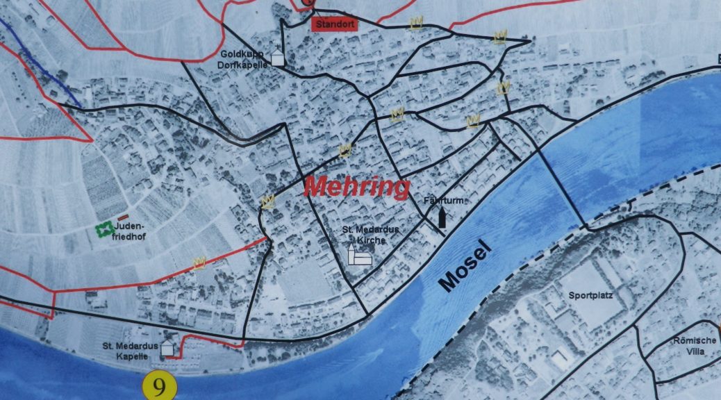
Mehring: Deierbachstrasse x Schulstr
Parking:
Mehring: a small lot (about 20 cars) at Lintnerstrasse x Deierbachstrasse
Mehring: a small lot downhill from the one above on Deierbachstrasse
Public Transportation Options:
Rail: No train service, per se
Bus: The Moselbahn bus has frequent daytime service from Trier to Mehring, stopping at several villages along the way.
Suggested Stages:
Not applicable
Trail Itinerary-Reference Points: (Counterclockwise)
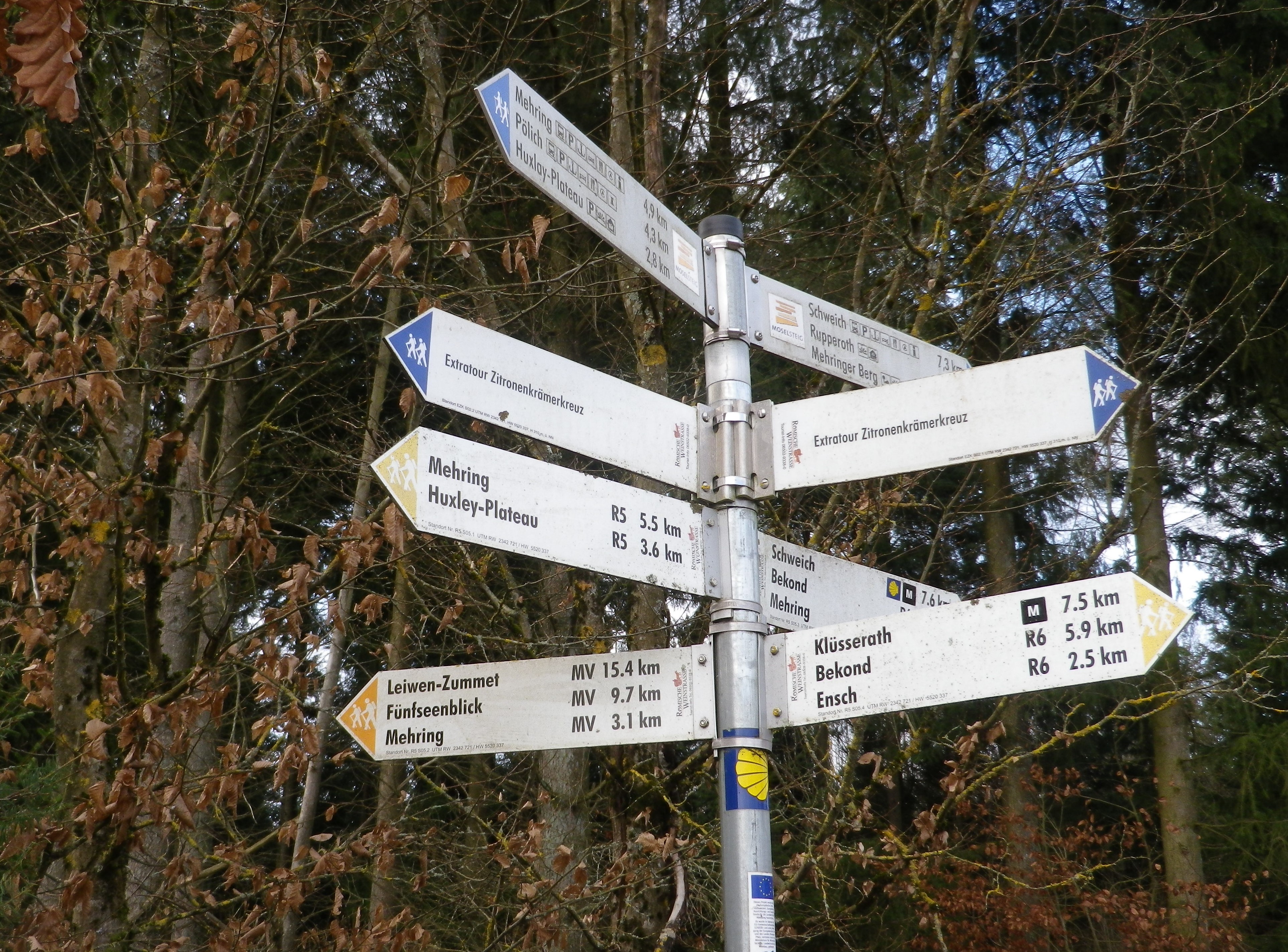
Mehring: from parking lot at follow Deierbachstr uphill, right onto Schulstr, and stay left on Schulstr uphill to Roemerstr-Goldkuppstr-Bornstr, crossing Am Rebenhang into vineyards; follow the long uphill lane to Huxlay Hutte; follow signs for the Kapelle; then along vineyards to the 10,000 Liter Fass (big wine barrel); follow the tree line, enter the woods, continue to follow the trail leading towards (but not necessarily to): Zitronenkraemerkreuz, Aulkreuz, and Hundsbuckel; heading downhill, the woods end and vineyards begin again; following the Muehlenbach creek past a small pond; past the Dreitaeler Weinkommission, right onto Steinkaul downhill, and right back onto Deierbachstr.
Representative Trail Photos:
Restrooms:
Mehring (exterior door attached to the town hall/tourist/ Wein u. Heimat Museum building open Apr-Oct (as of Nov 2023))
Attractions on or near Trail:
The Wein and Heimat Museum from April to October; otherwise just lots of scenery and good wine
Tasting along the Trail:
About 20 wine-makers have cellars in Mehring, and at various times, they are open for tastings. In addition to these, and restaurants in the village, there are three wine bars.
Alternative Options:
Hiking: Hiking enthusiasts will find a diverse (circuit, long-distance, family, challenging or easy…) selection of trails, to include wine themed hiking trails, all along the Mosel. Especially popular, albeit not exclusively wine-themed, is the Moselsteig.
Biking: The 248 kilometer Mosel-Radweg (Mosel Bike Trail) begins in Trier passes through Mehring, thence all the way to Koblenz. This beloved bike itinerary, mostly on paved surfaces, and much of it on dedicated bike trail, while not exclusively wine-themed, is a must-do (at-least-once-in-a-lifetime) experience for young and old wine enthusiasts. See the Nutshell here.
Additional Information:
Trail specific: https://www.bergfex.com/sommer/rheinland-pfalz/touren/wanderung/162982,rundwanderweg-mehring–hundsbuckel–huxlay-plateau–mehring-r5/
Comments:
An easily achievable hiking opportunity (and with lots of other options) for almost all visitors to the Moselle valley, to experience a beautiful setting in a world-class wine region, without the crowds.